Good Monday, everyone. Tropical rain producing showers and storms continue to push across the region today and this will continue until what’s left of Fred moves past the region by the middle of the week. After that, we have more rounds of showers and storms threatening to dump heavy rain from the end of the week into the coming weekend.
Some thoughts:
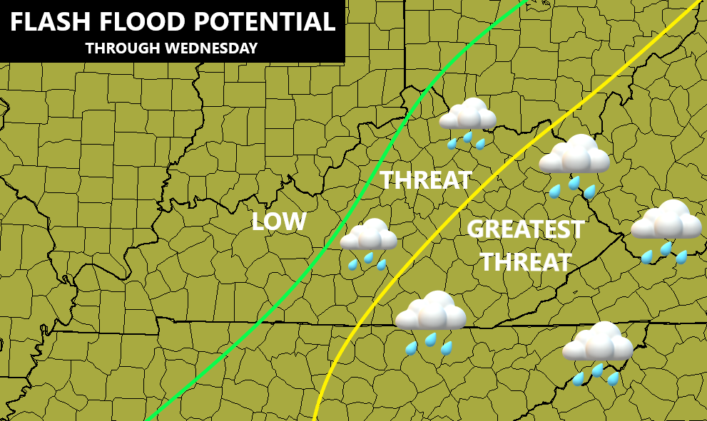
- Central and eastern Kentucky have had quite a bit of rain over the past week, so this is the target area for flash flooding.
- Rounds of showers and storms are out there today, feeding on tropical moisture streaming well out ahead of Fred. Torrential rains may cause local flooding issues to develop.
- This same setup is with us again as we move into Tuesday.
- Fred makes landfall along the Gulf Coast on Friday and works to the north/northeast. The center of what’s left of Fred is likely to pass across eastern Kentucky late Wednesday.
- This will bring an increasing area of showers and storms to the eastern part of the state, leading to a heightened flash flood threat. A few strong/severe storms may also be noted just east of the center of the low.
- These are NOT all day rains and not everyone gets a lot of rain from this.
Here’s a look at the areas I’m highlighting for the greatest potential for flash flooding through Wednesday…
As far as Fred is concerned, this storm is coming together as it nears the Florida Panhandle…

Here’s the latest info and track forecast from the National Hurricane Center…

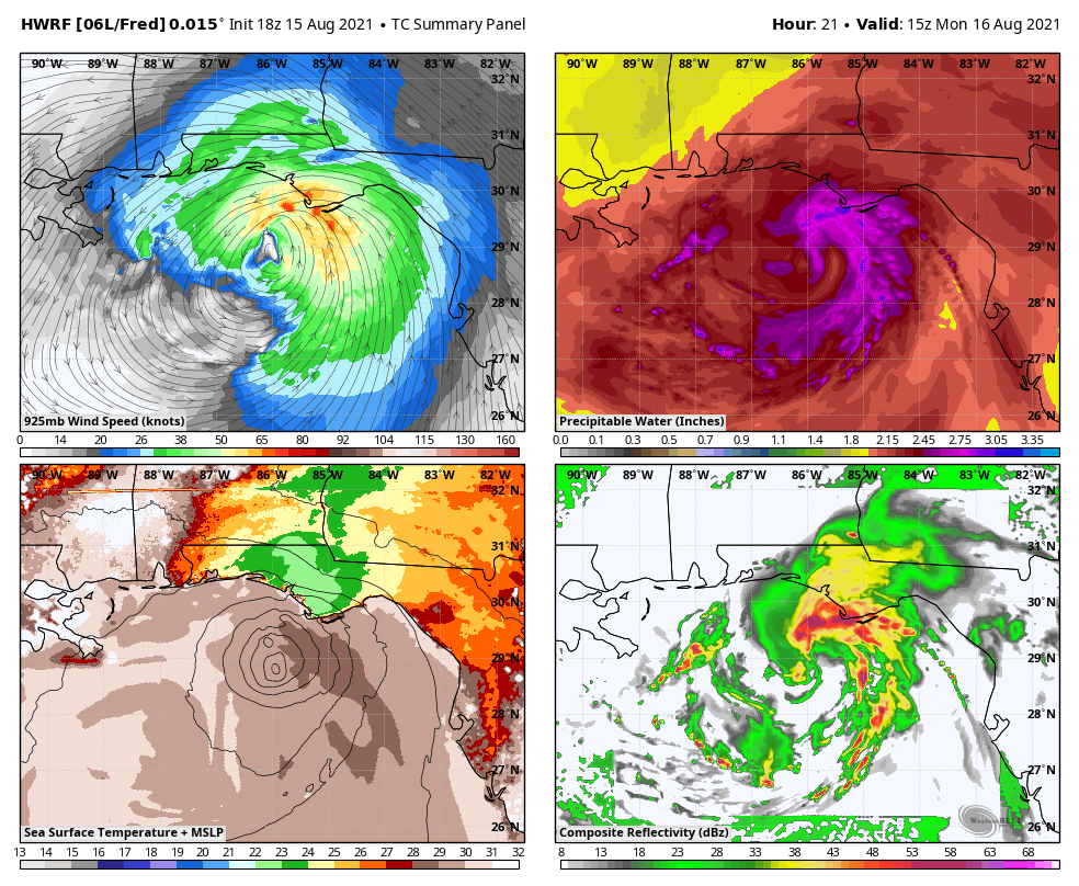
The HWRF shows how this storm works toward eastern Kentucky over the next few days…
At the same time, Grace is working through the Caribbean and hitting a lot of land, limiting the storm. The track should take this well west into the Gulf later this week…

And there’s another system spinning well off the southeastern seaboard that may get a name…

Back here in Kentucky, rounds of showers and storms will continue to be likely even after Fred moves well to the northeast of us. A lot of tropical moisture is left behind and this will lead to additional heavy rain makers through the coming weekend…
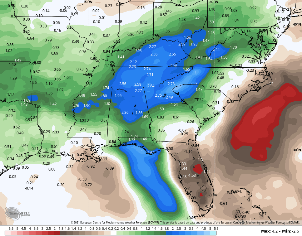
The EURO Ensembles continue to point toward a much above normal rainfall two week period…
Don’t forget to take out exclusive interactive radar for a trip down to the Gulf Coast to follow Fred as it comes ashore. Of course, you can also use it to track the rain and storms in our region today…

Have a great Monday and take care.

We finally broke our dry spell, and as usual it was via a gullywasher. I recorded 1.27″ of rain in a 40 minute period. At one point during the storm. the rain rate was 3.5″ per hour. Chances for more rain here in the Bowling Green area over the next 7, days look pretty slim.
Yell, Fred decided to track more to the East.
Looks like west of I-65 will be looking in again.
Cloud cover from the storm should help keep temps. down.
We had 0.25 inches of rain in the last 48 hours. Casey county to my southeast recorded 3.54 inches of rain yesterday. We are not hurting for more rain here in central Kentucky, as the soil moisture is adequate for this time of the year.
Tropical Storm Fred is expected to make a direct hit on Panama City, Florida tomorrow morning at 1:00 AM. Lets all hope this storm does not cause too much damage to any areas of the country.