Good Tuesday to one and all. Tropical rains continue to push across the region in waves and this is just ahead of what’s left of Fred. The remnant low is likely to pass over eastern Kentucky Wednesday, bringing the potential for additional high water issues for some.
Let’s start things out by getting an update on where Fred is today…

Areas of eastern Kentucky have the best chance of picking up on enough rain to cause flooding issues, with more scattered high water issues farther west. You can see this well with the future radar from the Hi-Res NAM…

As you can see, it may be another day of local high water issues across areas of central and eastern Kentucky.
Tropical moisture will be left behind the departing Fred on Wednesday as a few showers and storms flare back up. It looks like an increase in showers and storms will be with us by Thursday…

The threat for showers and storms will be with us Friday into the weekend as a front drops in from the northwest…

The setup next week may feature a return of toasty temps for a bit as a ridge builds into the region. But, the EURO Ensembles show this ridge retrograding back to the west fairly quickly…
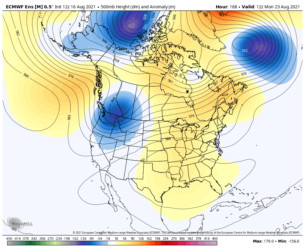
That’s really cool to watch that ridge go back to the west and a trough dig into the southeast.
Grace is still churning through the Caribbean and, as expected, the track continues to shift much farther west…

I leave you with your Tuesday shower and storms tracking toys…

Make it a terrific Tuesday and take care.

Hit and miss rain for the majority of the state.
Typical August weather except for the eastern part of the state.
Yep – a stormy pattern with no storms except for eastern part of state. I will say this year we’ve had way more thunder than previous years. Plenty of rain too. I’m really glad this year hasn’t been super hot. This is coming from someone who thinks anything about 80 is hot. LOL
Yesterday afternoon we had a localized “cloud burst” that dumped more than 2.00 inches of rain in less that 15 minutes ! Fortunately I live in a very well drained area or my always dry basement would have been flooded.
Fred has a very interesting tract record. First it was more to the west, then east and now more east into the Appalachian Mountains. This goes to show that storm tracts are still unpredictable.
Let the West have the troughs. Those folks out there need it much more than we do here in the East. Let the warm, dry weather dry things up a bit here in the east.
Looking at the radar I am grateful that Fred went east.