Good afternoon, folks. Hurricane Ida continues to strengthen as it heads toward a late Sunday landfall in Louisiana. What’s left of this storm is likely to spin into Kentucky by late Tuesday and Wednesday, bringing heavy rain and a flood threat.
Ida continues to head toward monster status and the sat shot of this storm is a bit scary…

Ida is going to give us the classic major hurricane look and that’s not a good thing. The NHC continues to take this to a Category 4 storm upon landfall…

I think this can flirt with becoming a Cat 5. Notice the inland track from the NHC continues to focus farther north into Kentucky and I expect this trend to continue.
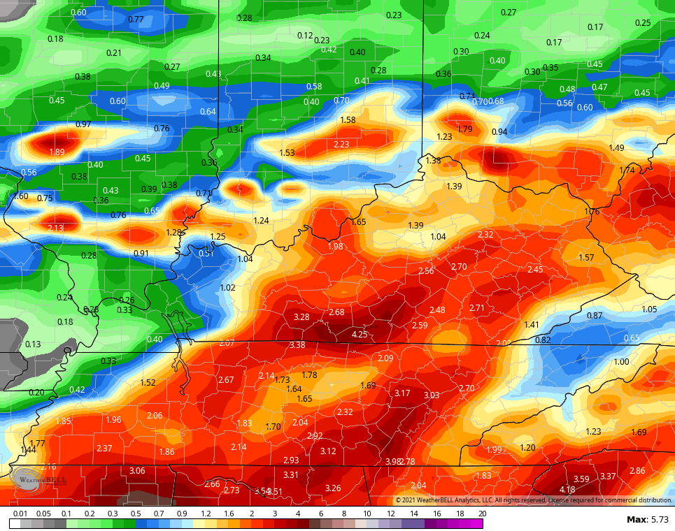
I made this map yesterday and it shows my initial thoughts on where the heaviest rains could fall…
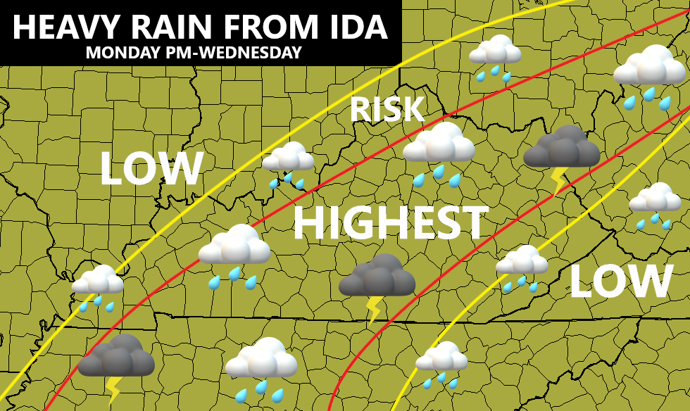
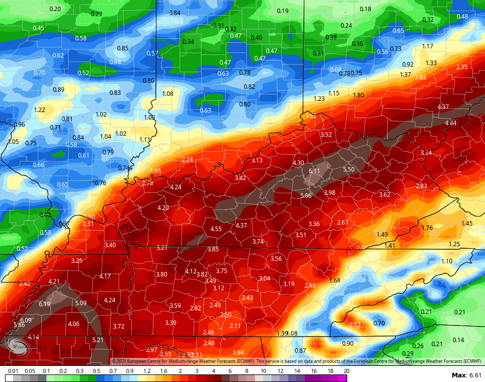
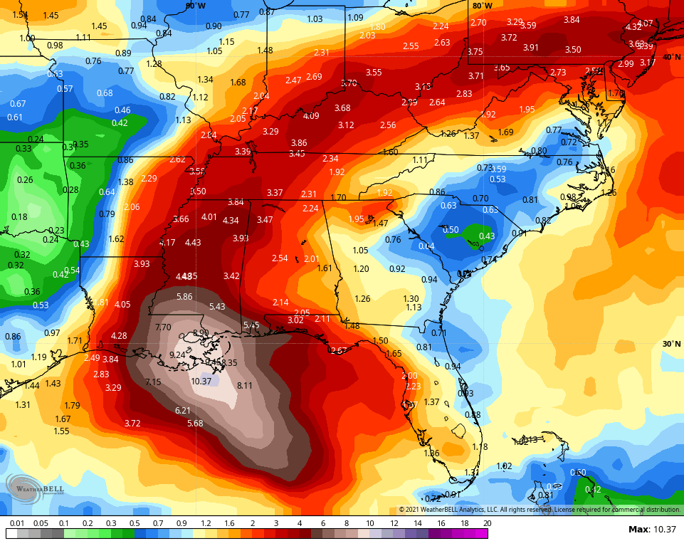
I will update that later tonight and will likely open up the highest risk area to include more of the region. Still, the rain numbers from models are backing up my thoughts with the EURO having a very troublesome look to it…
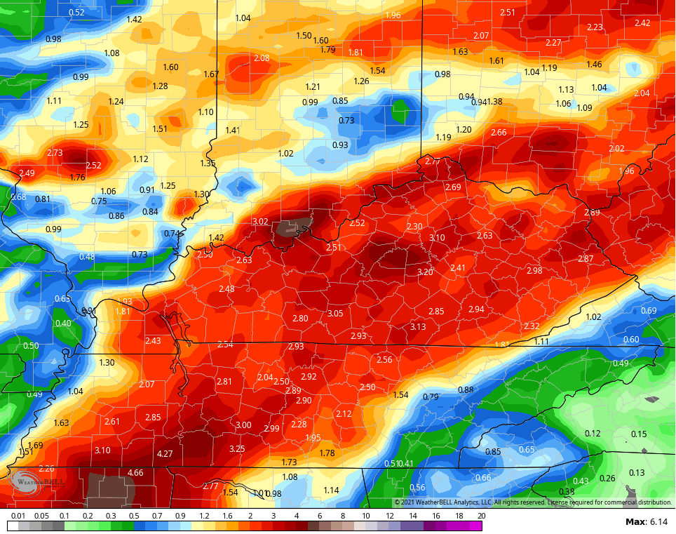
The GFS totals aren’t as high, but still plenty high enough…
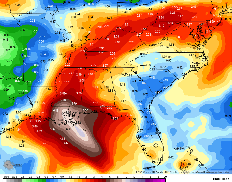
The average rainfall from 21 members of the GFS Ensembles…
The Canadian Model has shown the most deviation of all models of late…
It doesn’t even match it’s own Ensembles which look like most of the other models we’ve looked at…
The ICON continues to show hefty rains…
![]()
![]()
Obviously, the majority of the rains will fall Tuesday into Wednesday and this will give us an increased risk for flooding and flash flooding.
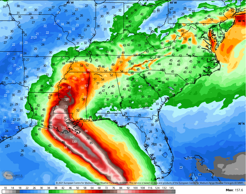
In addition to the high water threat, gusty winds may become a problem. Check out the wind gust forecast from the EURO…
I may throw you another update this evening. Until then, here are your radars to track the scattered storms we have going up out there today…

Have a good one and take care.

I’m more concerned about the residence along the Gulf Coast.
Thanks for the update!!!
A line of thunderstorms blew through the Bowling Green area around 3:30pm CDT, and my PWS recorded 0.92″ of welcome rain.
Regarding Ida, the hurricane’s strengthening doesn’t surprise me at all. Seas surface temperatures in the storm’s path are averaging 87°F to 92°F, which can fuel explosive development. I’m thankful that temperatures will be moderating over the coming week, but humidity levels will remain in the uncomfortable range, especially in areas that pick up significant rainfall from Ida.