Good Monday to one and all. It’s a very pleasant November pattern taking shape for the next several days, but we change that up in a hurry by the end of the week. That’s when another deep trough digs into the region and brings more cold weather to go along with the potential for some weekend flakes.
Temps out there today are into the mid and upper 60s for many with a 70 showing up for some. This same setup is with us for Tuesday and Wednesday, so make plans to get out there and take advantage of it.
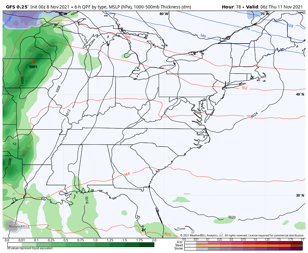
A powerful cold front will then push in here on Thursday bringing widespread rain and even the threat for some strong storms. The models are pretty bullish on some gusty winds with this setup, but differ on the flake action behind it. The GFS continues to correct itself in slowing the overall process down a bit…
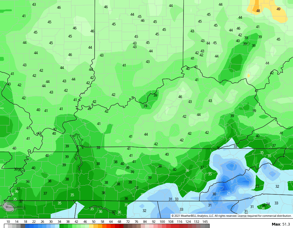
Here are the wind gusts from that line…
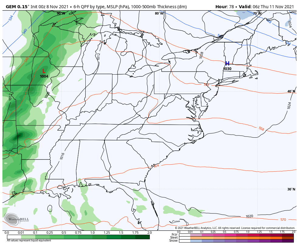
The Canadian continues to advertise the best chance for flakes behind this system…
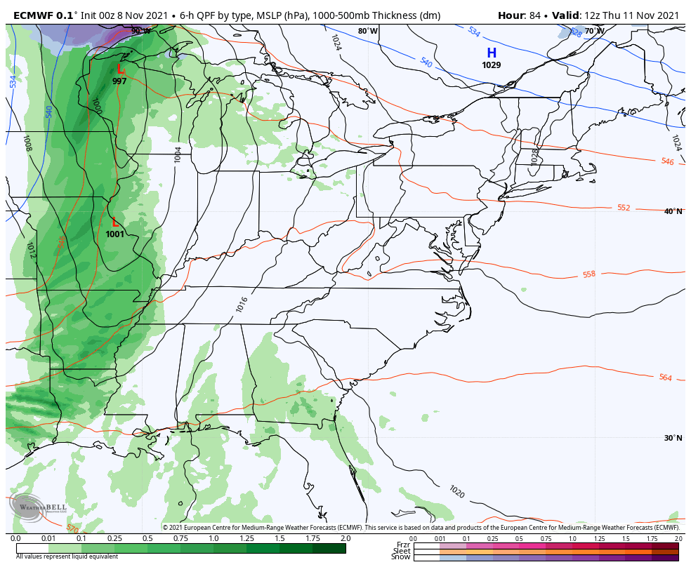
The EURO is close to some flakes here…
High temps by Saturday are likely to stay in the 30s for much of the region.
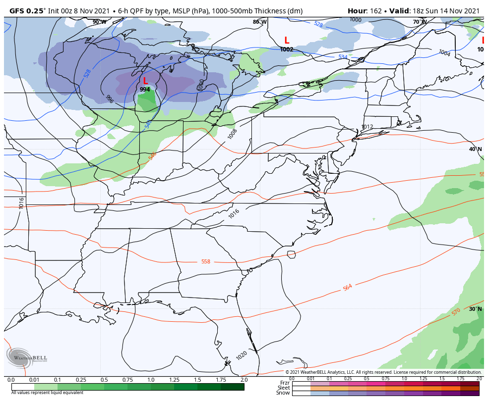
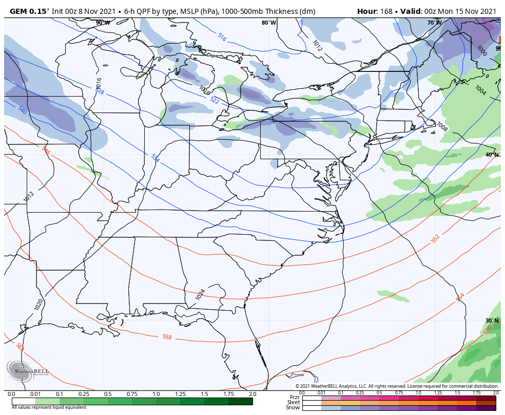
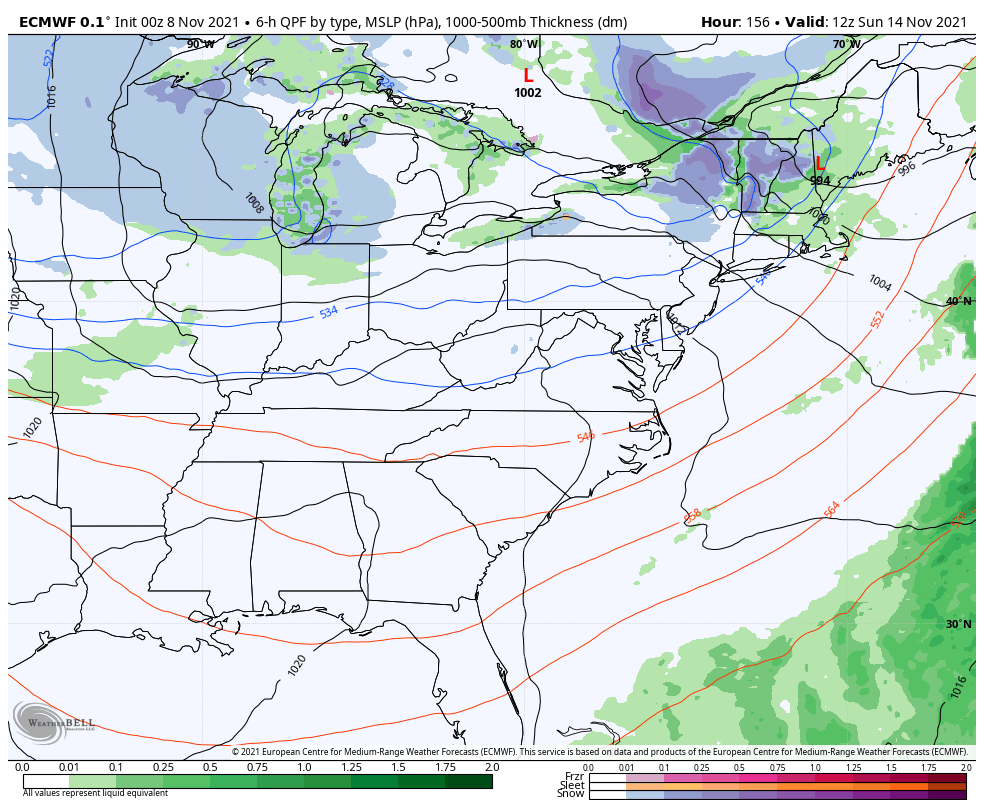
The next system quickly moves in behind this by Sunday night and Monday with the models starting to show more of a wintry look…
GFS
Canadian
EURO
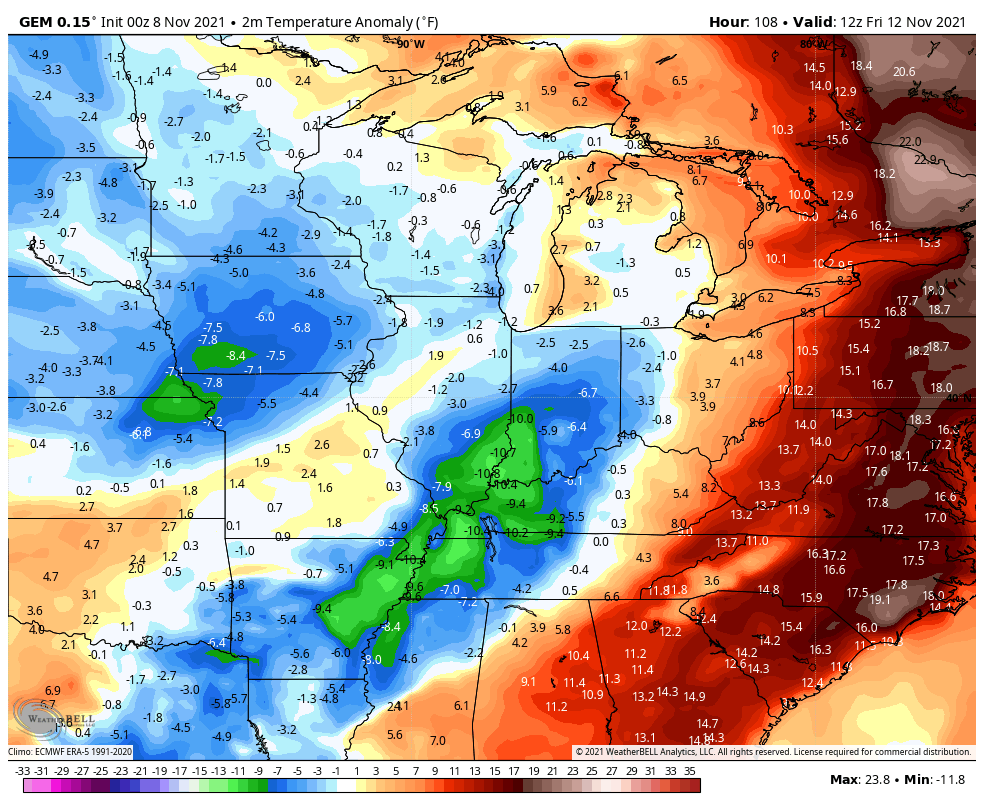
Temps continue to show up well below normal with both of those systems. The Canadian is frigid…
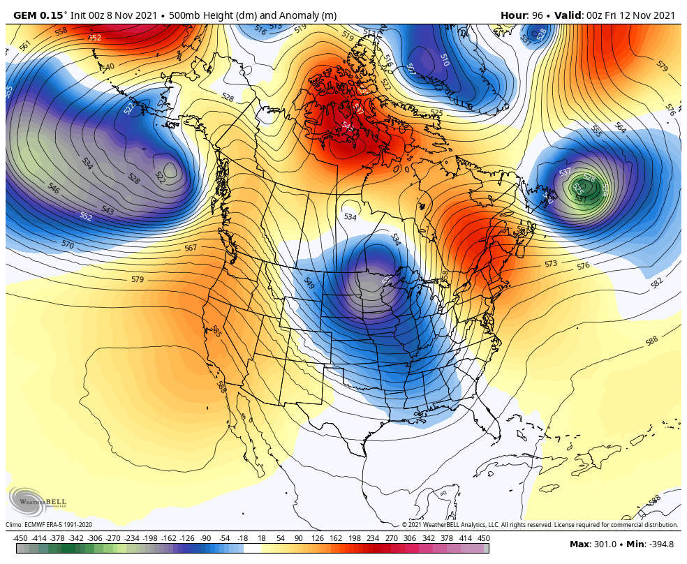
These are some deep troughs digging in here, folks…
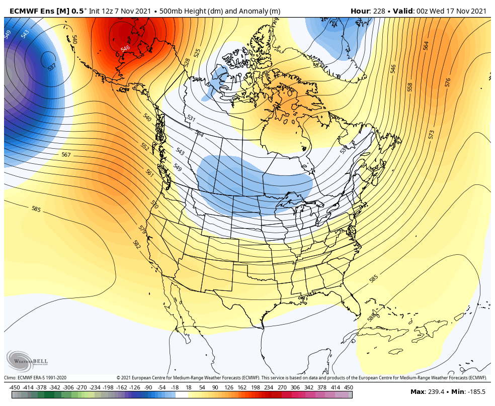
Temps should spike back up, but the stage is set for the next trough to dig back in here and get established for the week leading up to Thanksgiving. The EURO Ensembles have been locking in on this…
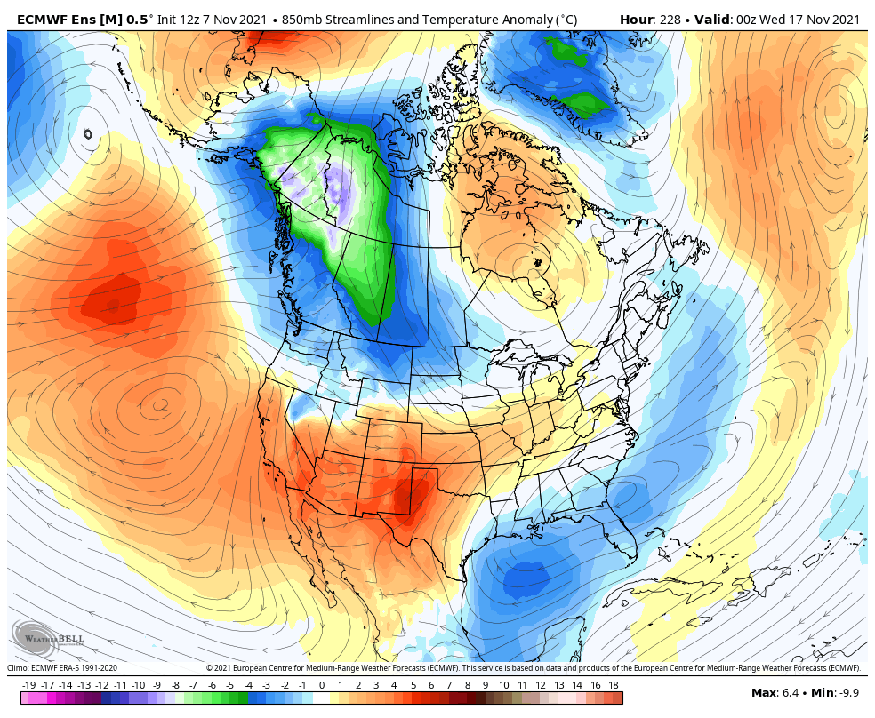
Now it’s the time of year to look at source regions of air masses diving in. The EURO is showing this air mass originating in the Arctic. Watch how this air originates in Alaska and the Yukon and slides across Canada into the US…
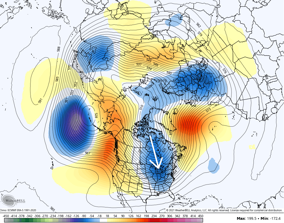
The Canadian Ensembles also show this trough having the potential to tap some really cold air…
I’ll have another update later today. Until then, have a good one and take care.
