Good Tuesday, everyone. Temps continue to run much milder than normal for the next few days, but a major change is blowing in for the end of the week and the weekend. That’s when a wintertime setup settles into the region, possibly bringing the first flakes of the season for many.
Highs today into Wednesday generally range from the upper 60s to low 70s for many. There is a system heading across the northern Ohio Valley today and it may spawn a stray shower or two across northern Kentucky. Here are your radars just in case…

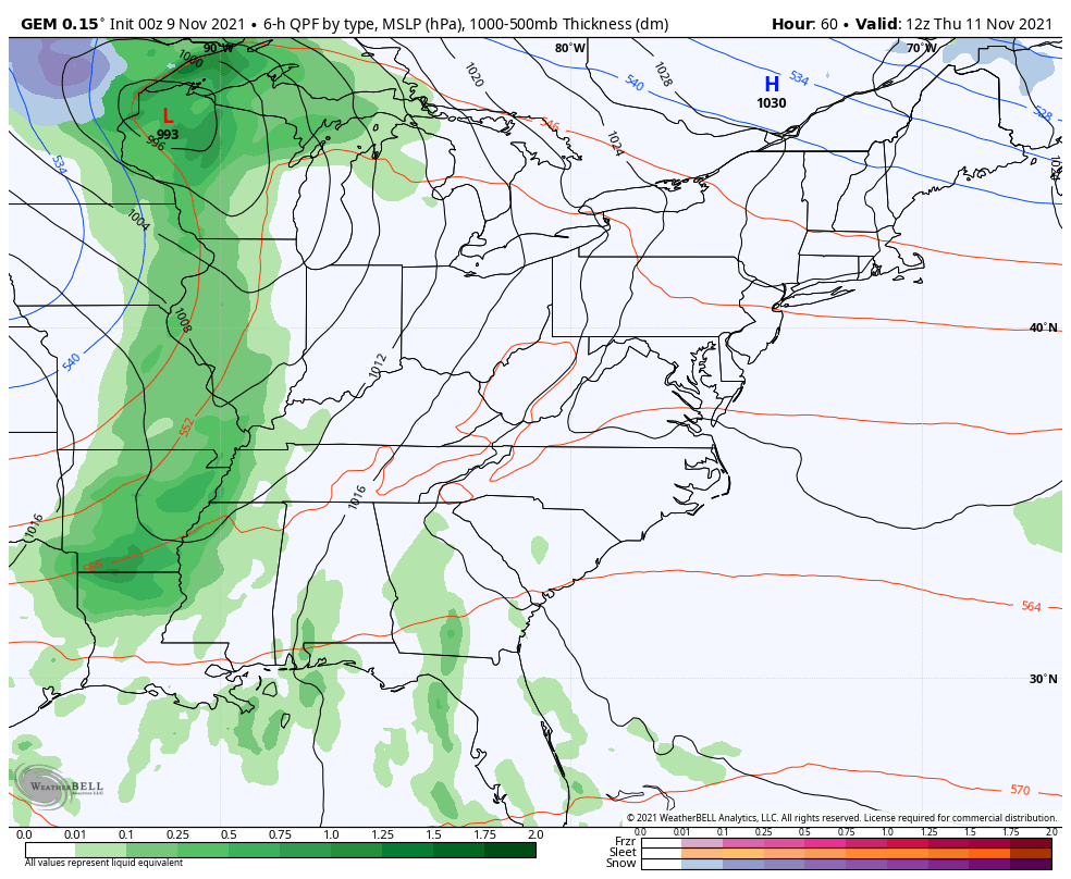
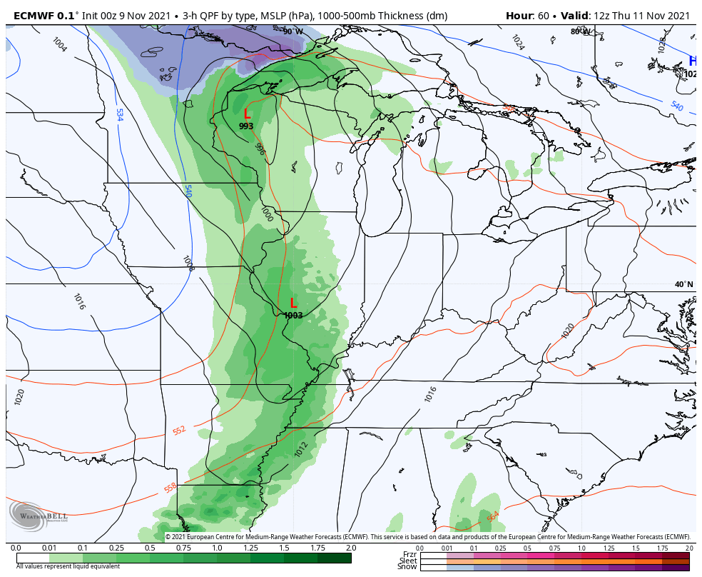
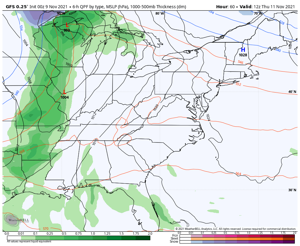
A major fall storm system then wraps up across the plains and lifts into the Great Lakes Thursday and Friday. This kicks off a wintertime setup for much of the country and that will include our region before all is said and done. Here’s a breakdown of what to expect:
- A cold front barrels in here on Thursday with a line of showers and some thunder along and ahead of it.
- Winds will be a big player and gusts may top 40mph along this front.
- Much colder air then filters in for Thursday night into early Friday with temps back in the 30s.
- A secondary push of colder air then sweeps in on Friday as winds again try to crank to between 30 and 40mph.
- A shower or two may show up later Friday into early Saturday. There’s an outside chance for a few flakes with that.
- Saturday is just windy and seasonably cold with temps in the 40-45 degree range.
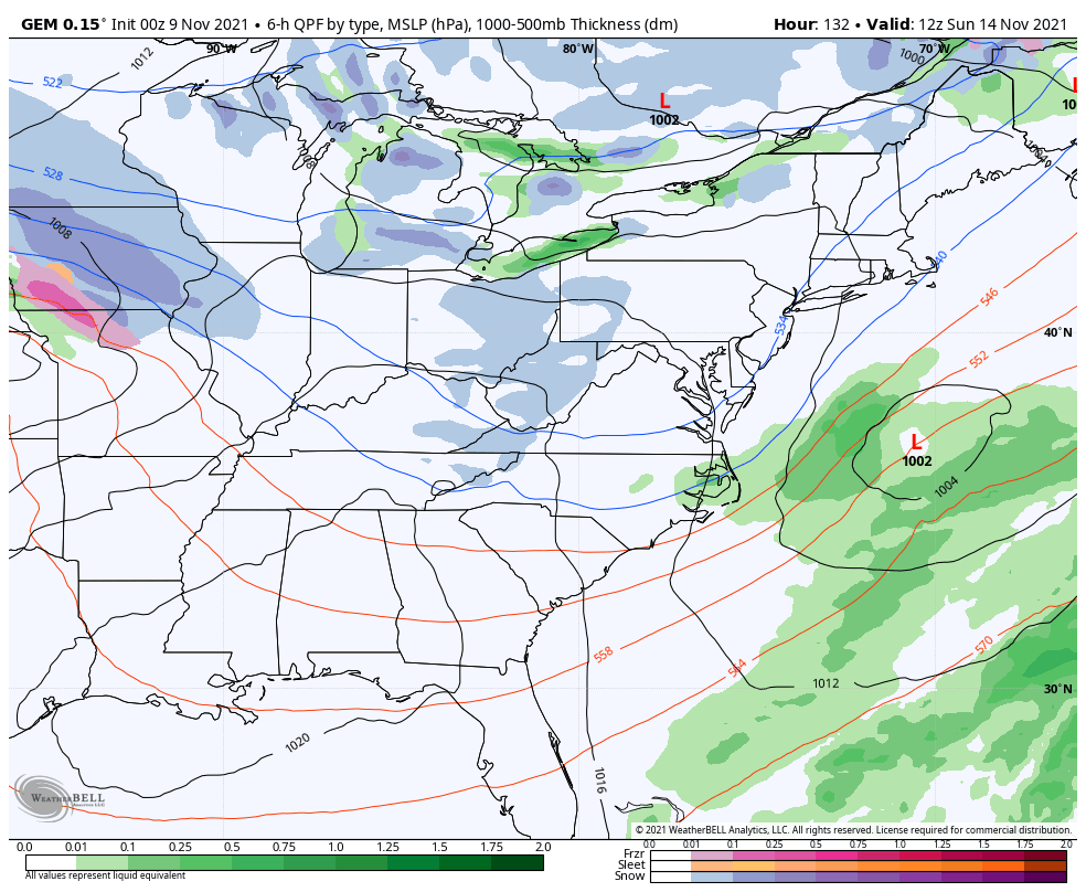
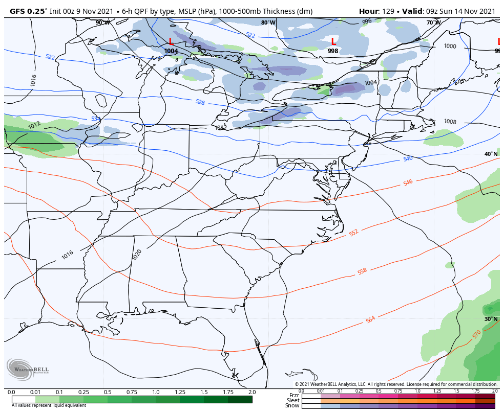
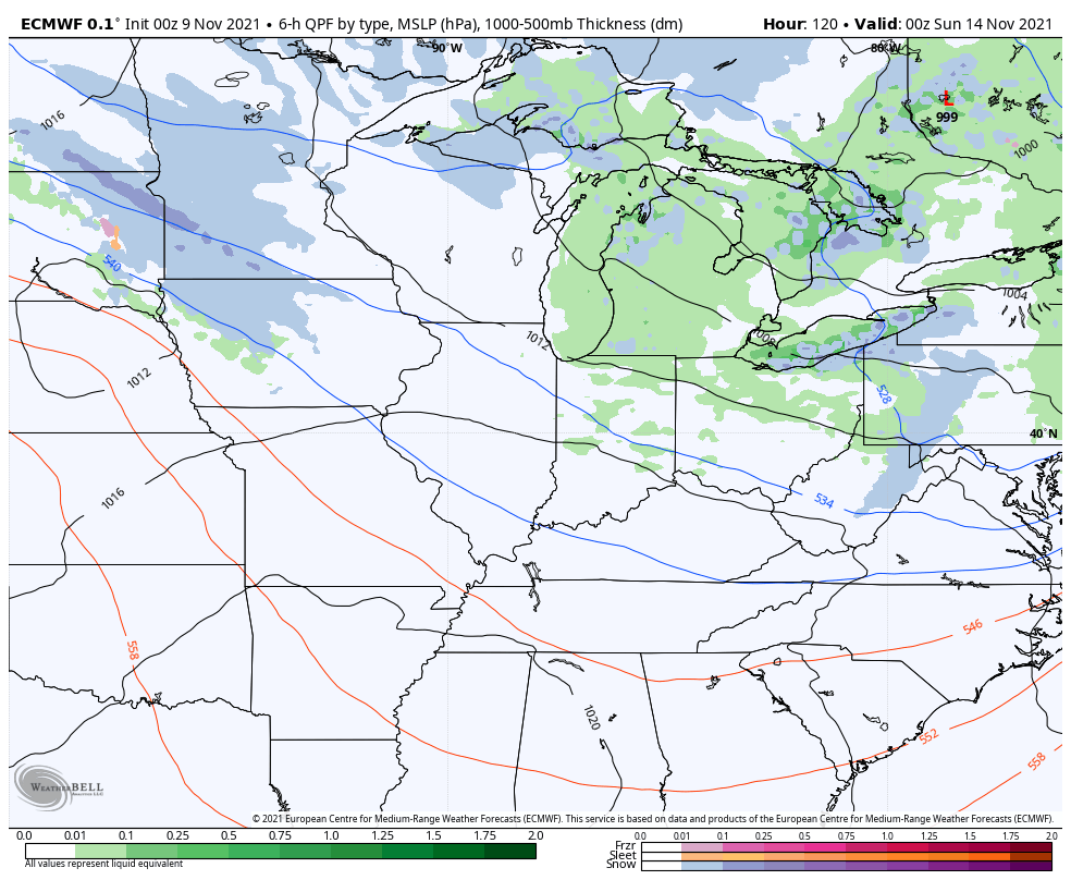
- The next system drops in late Sunday into Monday and continues to look more potent.
- This is likely to bring rain and snow to our region. A swath of accumulating snow has a chance to show up in the Ohio Valley. Can this set up in Kentucky? Odds are better north of the River.
- A cold northwest flow may create some snow showers and flurries for Monday into Monday night.
The forecast models continue to slowly come around toward a similar scenario with both systems, but still have some slight differences.
The Canadian Model has been steadfast in showing the best opportunity for some wraparound flake action behind the first system Friday night and Saturday…
The EURO is trying to do the same…
The GFS just cannot shake the progressive bias of the model, but it’s getting closer…
The second system continues to shown up stronger on the models. The Canadian shows the rain and snow swath with wraparound snow showers and flurries behind it…
Even the GFS is picking up on the rain and snow shield now…
The EURO is now showing a weaker system without much of a streak of rain or snow, but it’s showing some northwest flow flakes…
As usual, I will have another update later today. Until then, have a good one and take care.

Sounds like a raw and cold weekend coming up.