Good afternoon, folks. It’s another amazing fall afternoon in the bluegrass state and we have one more to go before the big change takes place. My thoughts on this setup haven’t changed at all, but I wanted to give an update on how the models are seeing things.
Before we get to the change, there is still the slightest chance for a shower or two going up this evening in the west and north. Chances are low, but your friendly radars are here to keep you company…

I’m not going to rehash all my thoughts from the prior posts, so y’all will have to go back and read for those. 🤓🤓😁
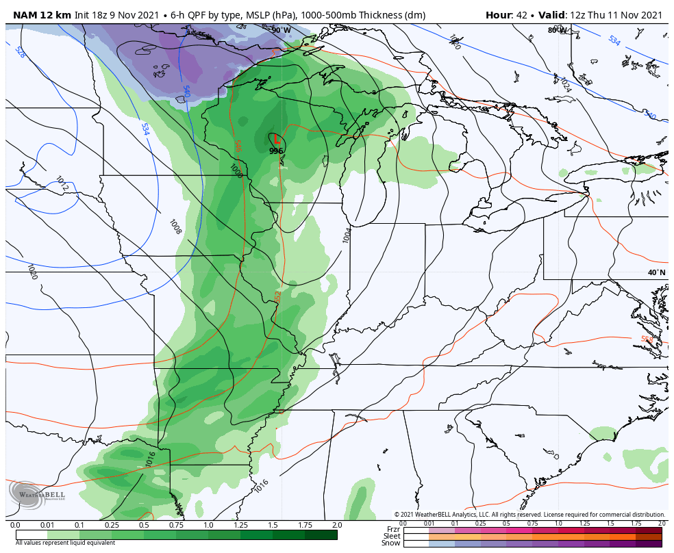
We do get two systems in here from Thursday through Monday. The first arrives in the form of a strong cold front on Thursday and the models are really straightforward on how they play it. They do differ a little backlash shower or flake action Friday night and Saturday.
The Canadian continues to show a few showers and a flake or two behind this…
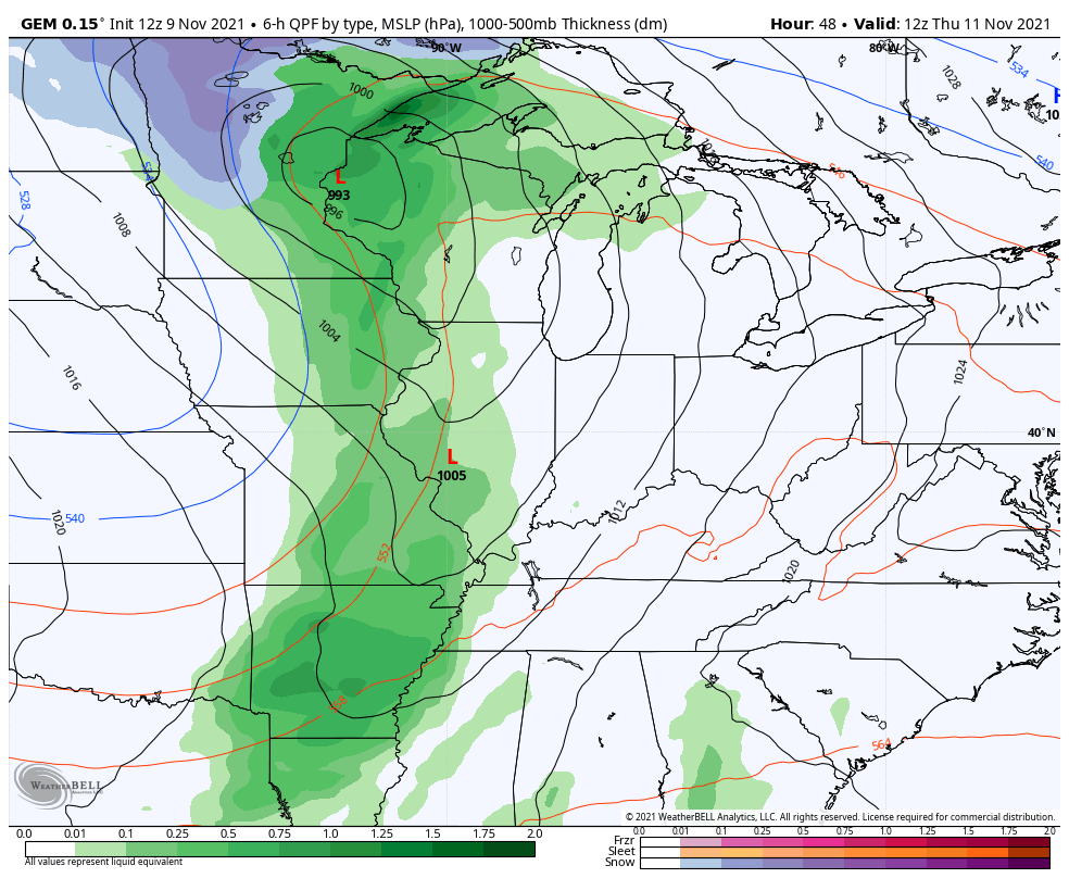
The EURO is trending that way…
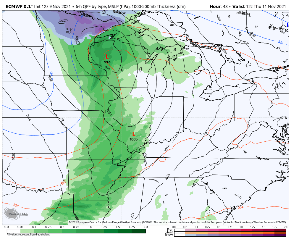
The GFS continues to be the most progressive…
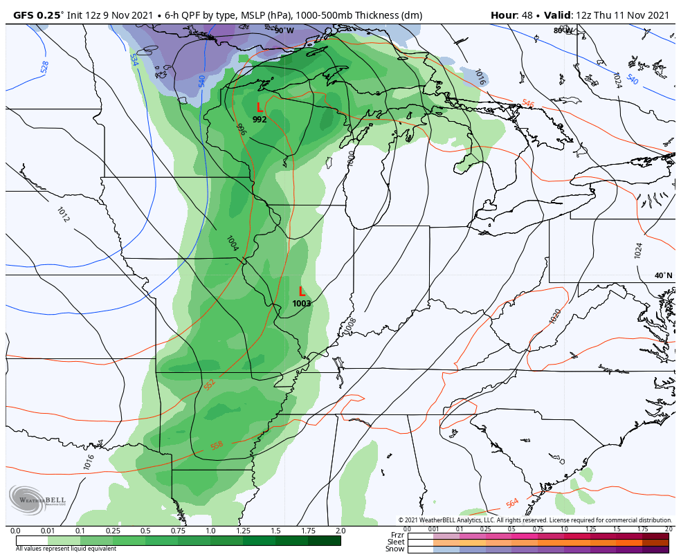
It is picking up on the gusty wind potential and shows gusts in excess of 40mph…
The NAM only goes through 1am Saturday, but you can see it starting to show a little bit of wraparound rain and snow showers in here…
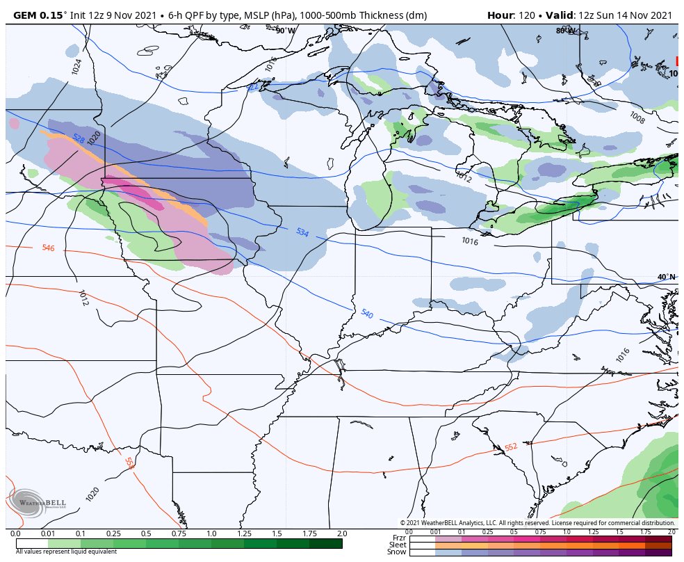
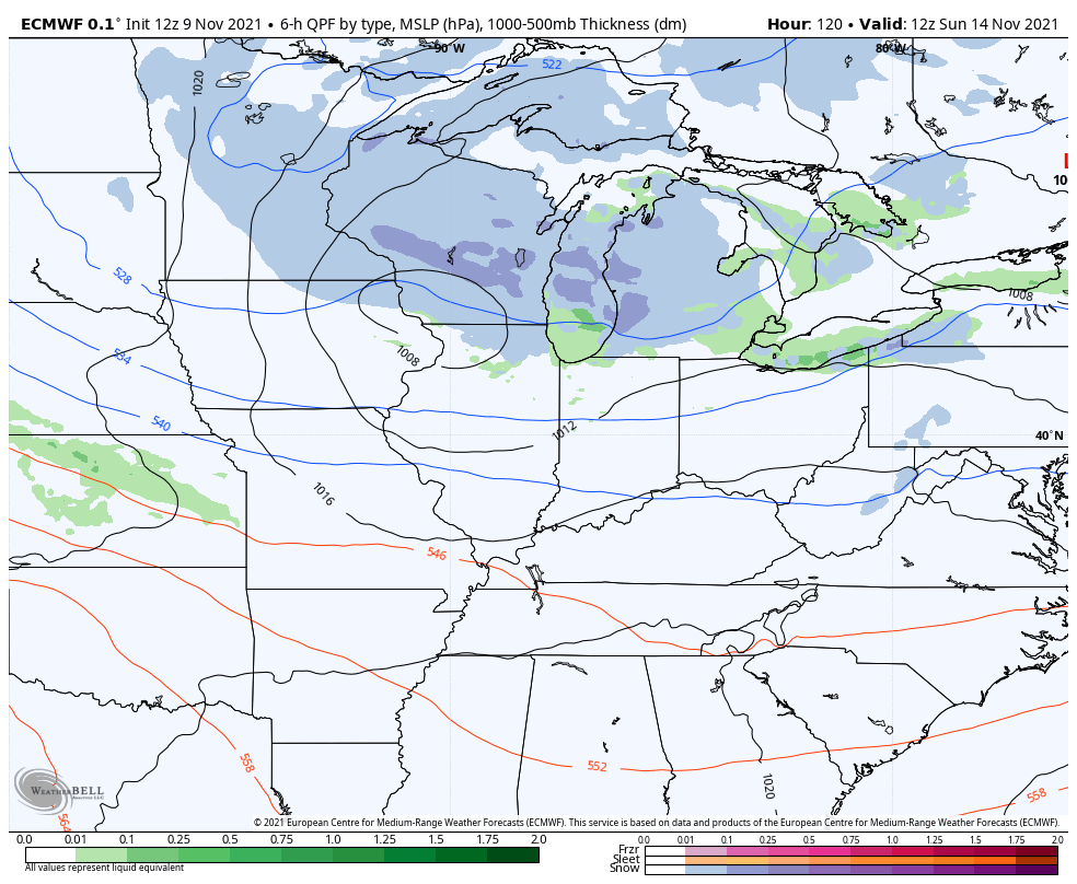
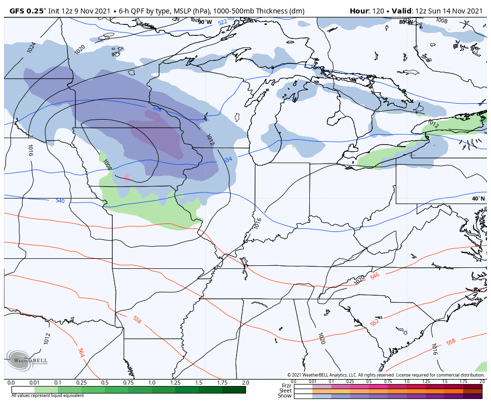
The second system looks more like a clipper diving in from the northwest Sunday and Monday. This one brings a swath of rain and snow across the Ohio Valley and Kentucky has a chance to get in on both.
The Canadian is rather aggressive with this…
The EURO is more aggressive than the last run of the model…
The GFS is a little farther north with the clipper, but it’s finally showing some snow showers behind it…
Moral of the weather story: We have two chances for some flakes this weekend. The first comes Friday night and Saturday, but the best chance comes later Sunday and Monday.
Have a great rest of your day and take care.

It has been a long time since we have seen a Clipper in these parts.