Good Wednesday to one and all. It’s the last day of our stretch of gorgeous fall weather as a big time pattern change blows in over the next few days. This will set the stage for a winter looking pattern for the weekend and early next week. The setup even threatens to bring the first light snows to our region.
Temps today are back around 70 for many as a southwest gust starts to pick up a bit. This southwest flow is ahead of the first of two big systems set to impact our weather from Thursday through Monday.
Let’s freshen up my thoughts on how this setup plays itself out…
- A cold front sweeps eastward across the state Thursday afternoon and evening. This brings a line of showers and some thunder zipping eastward.
- Winds are a big player with this setup and may reach 40mph or a touch greater at times.
- Colder winds then settle in here for Friday with upper 30s in the morning and upper 40s to low 50s for highs.
- A secondary push of cold air arrives Friday evening into Friday night. That brings the chance for some light rain and light snow showers into our region.
- A northwest flow keeps the chance for a rain or snow shower going into Saturday, especially across the east. Highs struggle into the 40-45 degree range but wind chills stay lower.
- The next system looks like a November version of a clipper and moves in Sunday and Monday. This brings a swath of rain and light snow with it but the exact path of the clipper will be the determining factor on where the stripe of light snow sets up. Odds favor north of the Ohio River, but that’s not a certainty.
- As the clipper moves east, a strong northwest flow is likely to touch off some snow showers and flurries Sunday night into Monday.
- This is a cold period overall and wind chills will be straight outta wintertime.
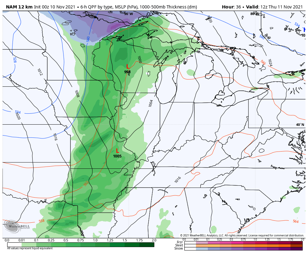
Let’s kick off the computer model party by taking a look at the NAM. This model animation only goes through 7am Saturday, but it is picking up on the rain and snow showers Friday night and early Saturday…
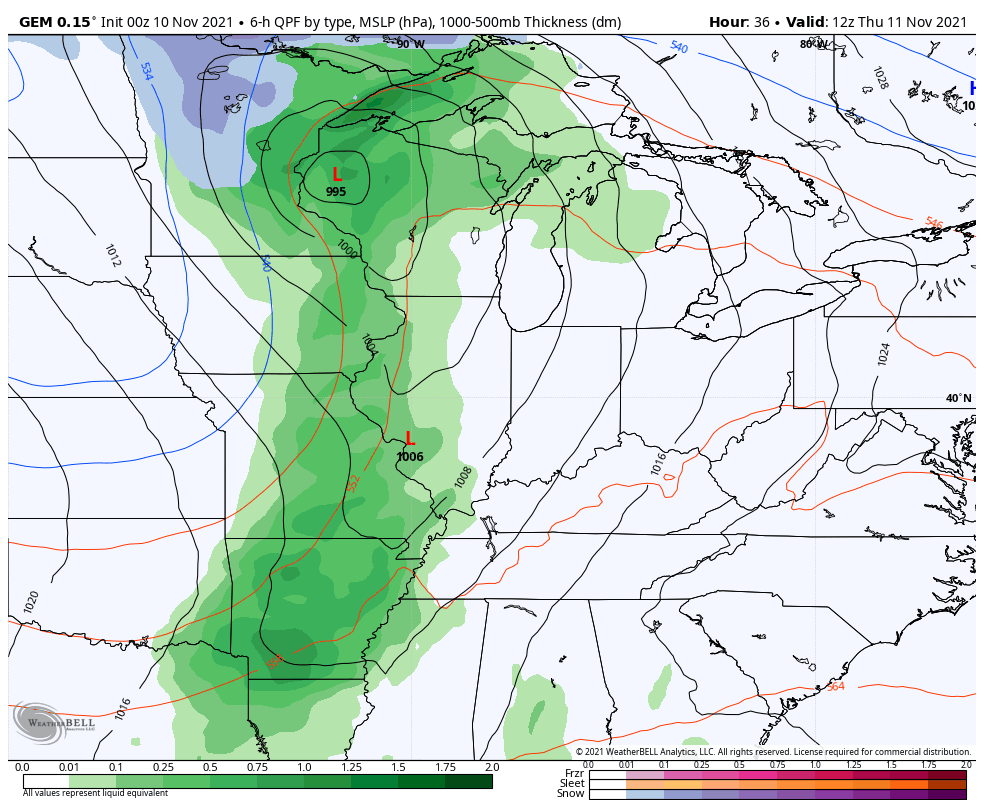
The Canadian was the first model to show the wraparound rain and snow showers and continues to do so…
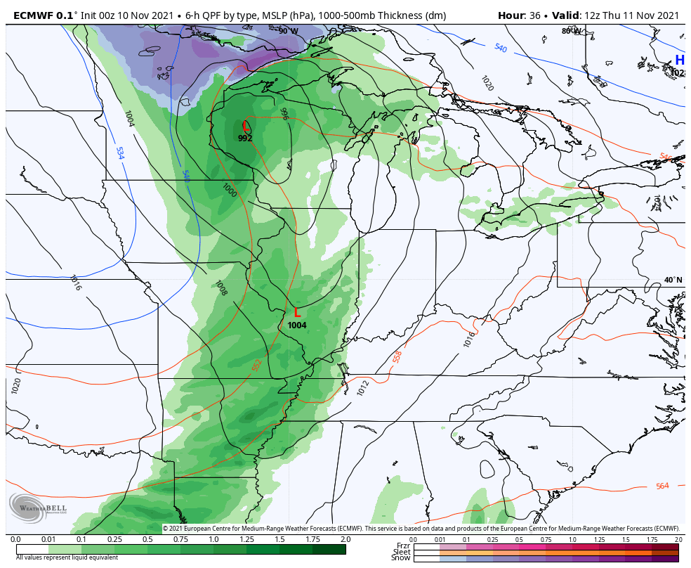
The EURO has a similar line of thinking…
The GFS continues to be too fast with everything and it apparently can’t slow down until a system is right on top of us, but it’s beginning to see some moisture finally…
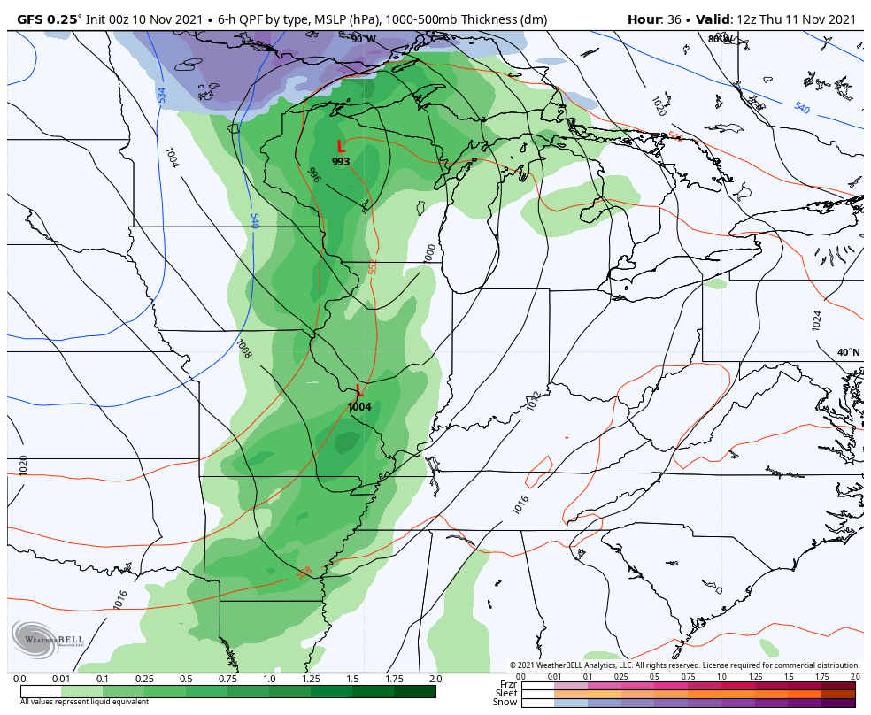
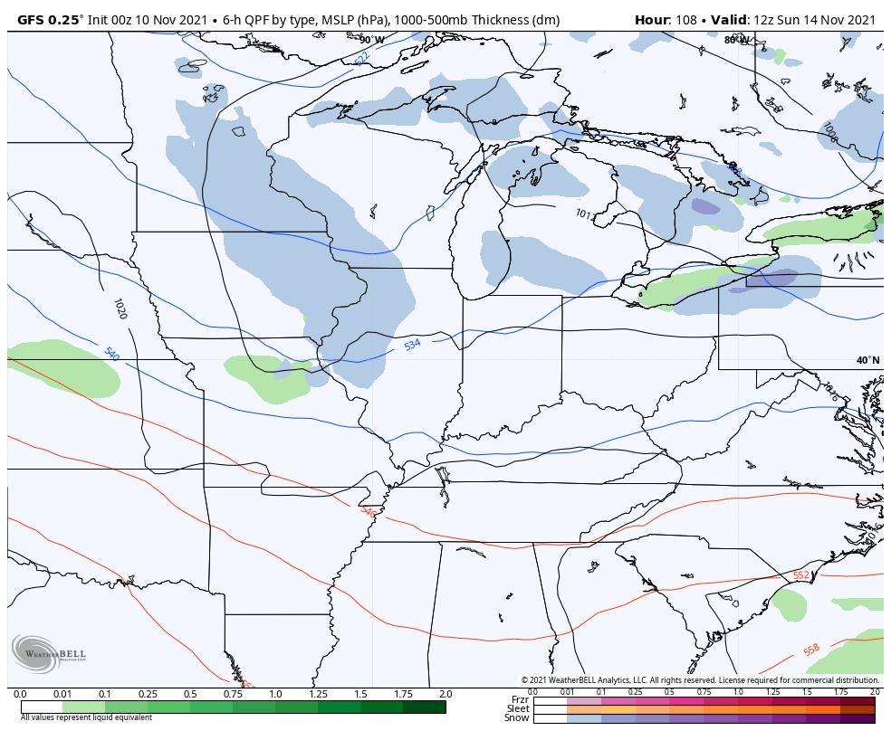
The GFS is seeing the second system a little better, but it is just way too fast with this thing…
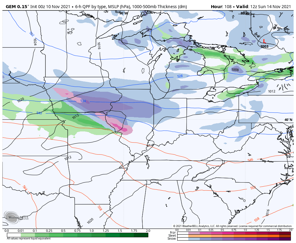
The Canadian continues to show a rain and light snow system with wraparound snow showers and flurries through Monday night…
The EURO keeps showing this as a much weaker system…
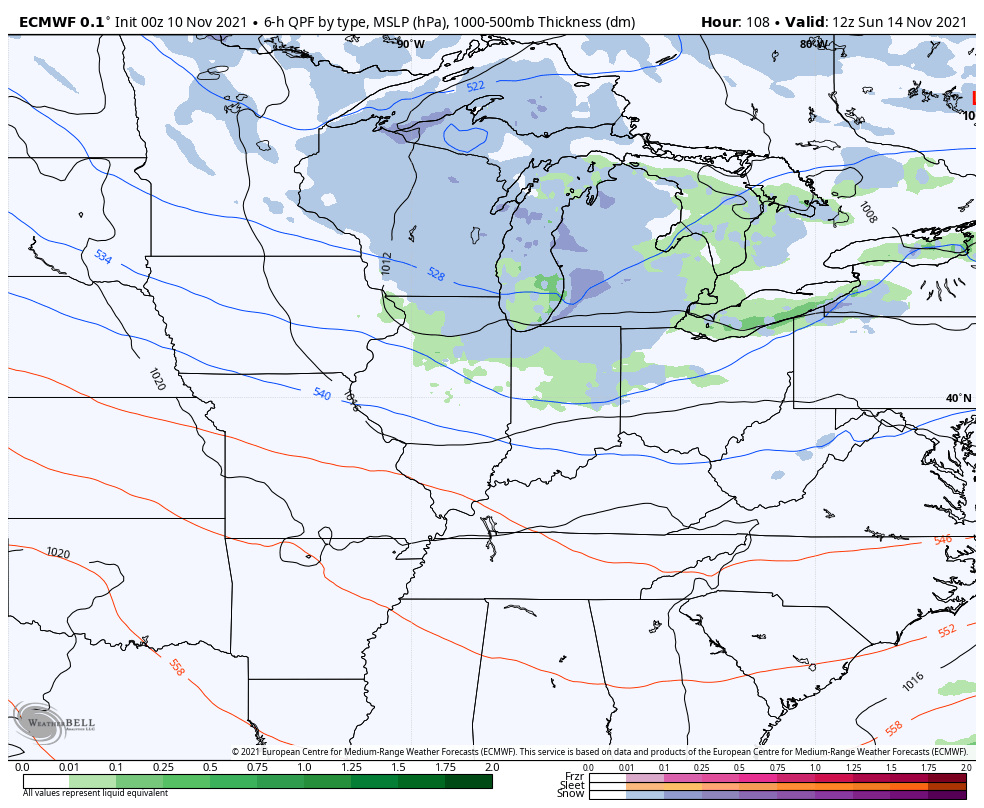
The final verdict remains the same… We have two chances to see some flakes out of this whole setup. The best chance Friday night and Saturday is across the north and east. The Sunday into Monday system has the chance to deliver flakes to much more of the region.
I will have another update or two coming later today. Until then, enjoy this fine Wednesday and take care.
