Good afternoon, everyone. Out stretch of gorgeous weather is about to come to a crashing halt as a winter pattern crashes in for the weekend and early next week. This pattern comes complete with two chances for some flakes to fly across Kentucky and surrounding areas.
This first front arrives Thursday with gusty winds and a band of showers and some thunder. This sweeps through from west to east and has a big temp drop behind it, but there’s a second push of colder air moving in behind it by Friday night. That one brings a few rain and snow showers with it into early Saturday.
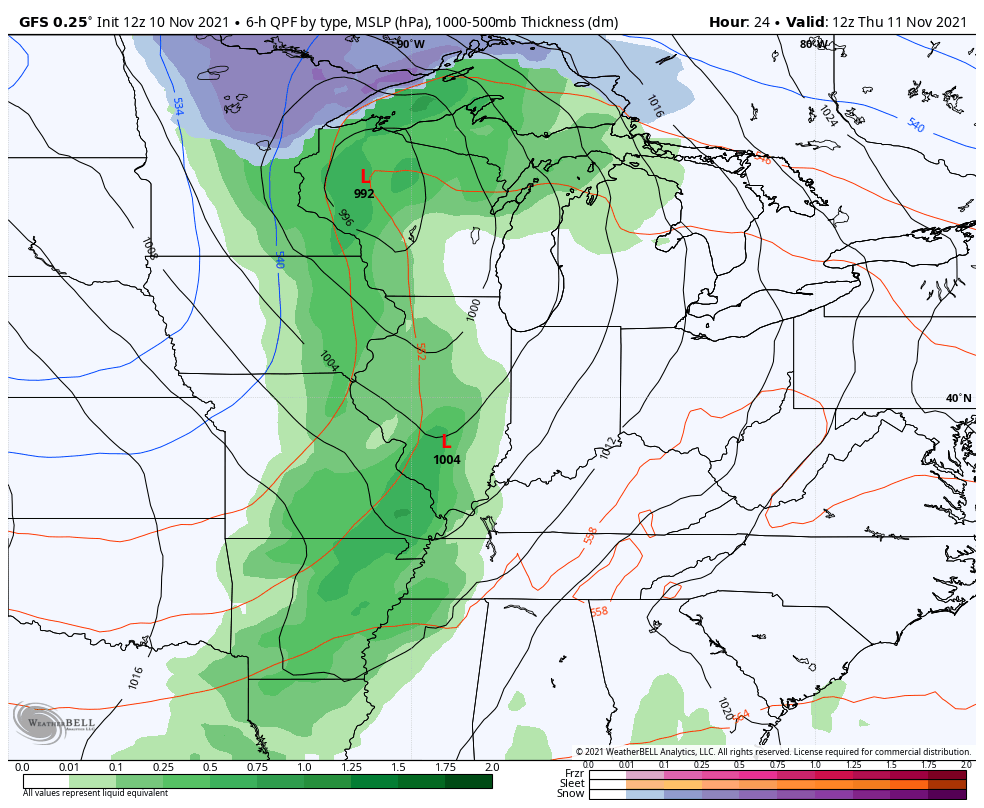
The models are coming into better agreement on a few flakes flying, especially in the north and east…
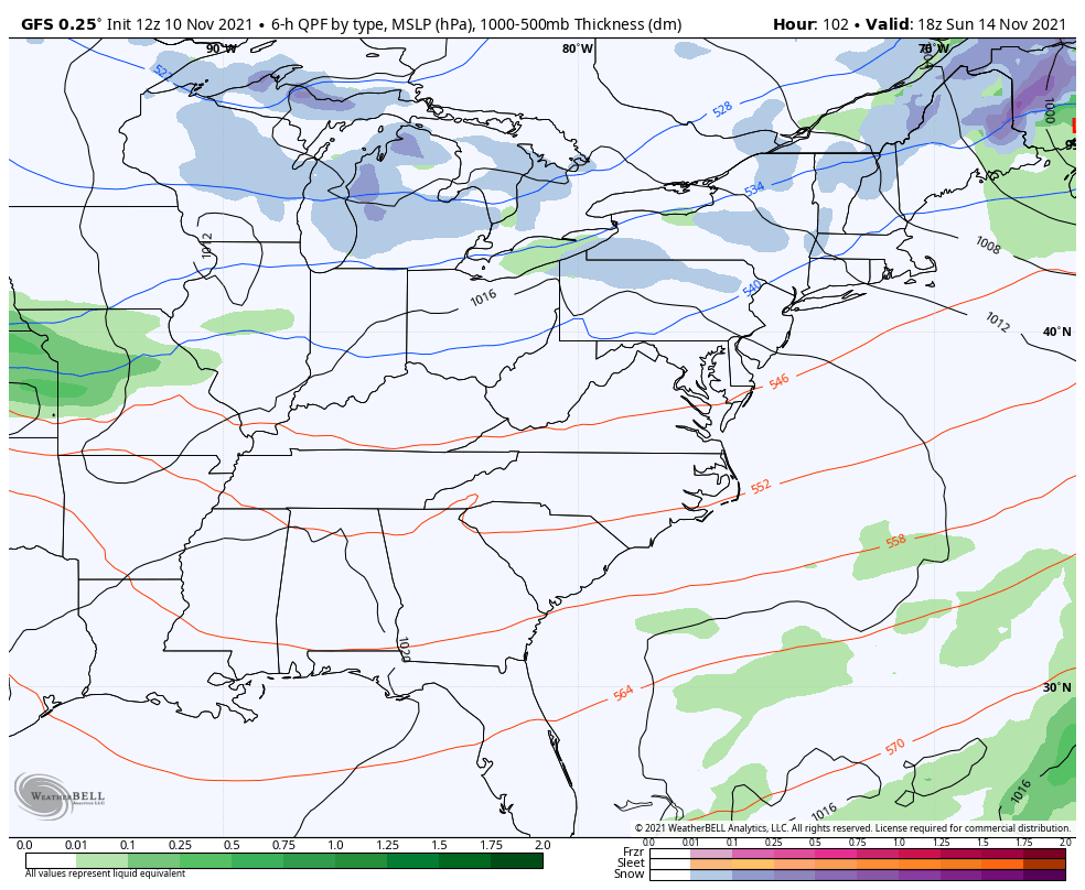
The GFS is finally catching up…
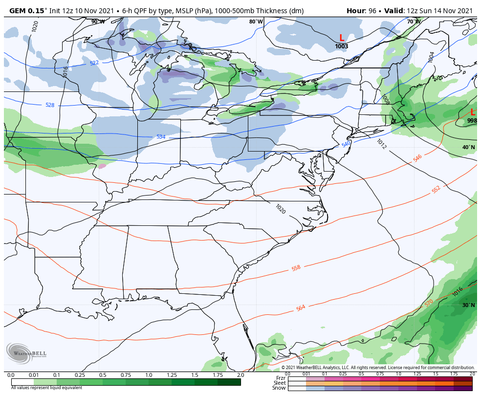
The Canadian Model was the first to show this and continues to hold steady…
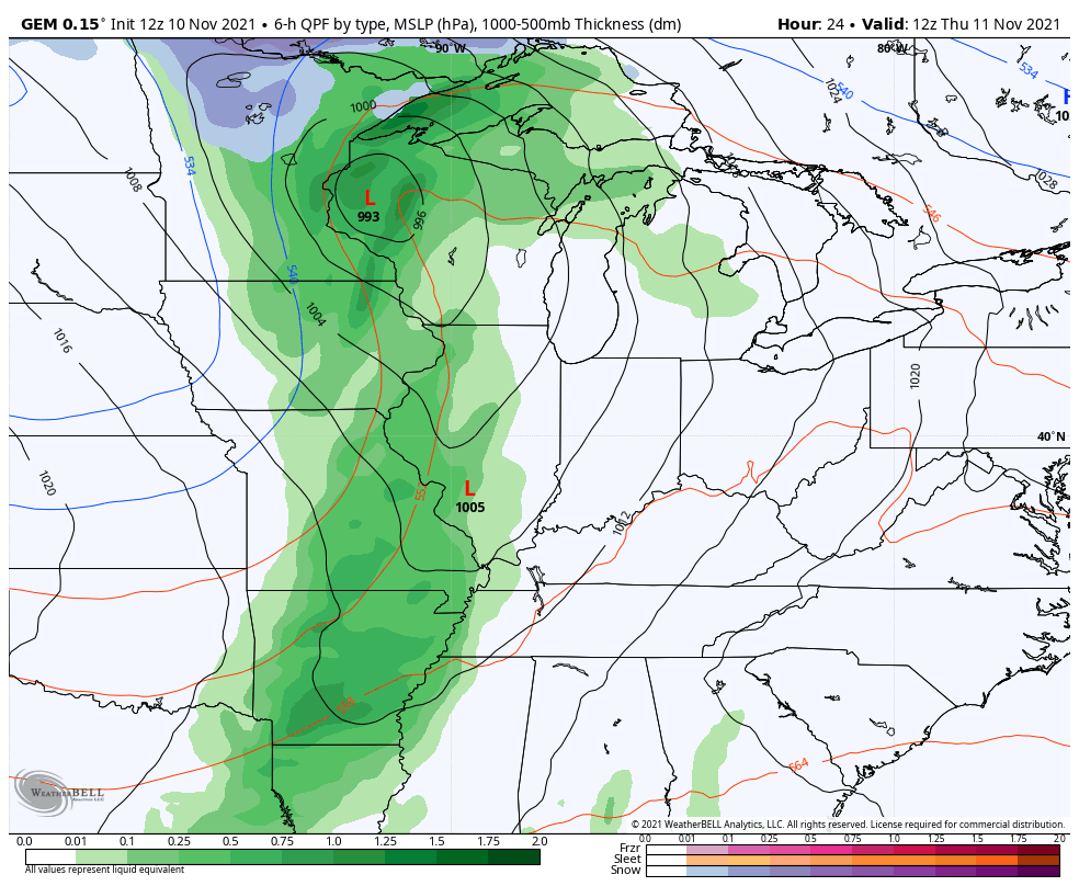
The short range Canadian likes the wraparound flake action…
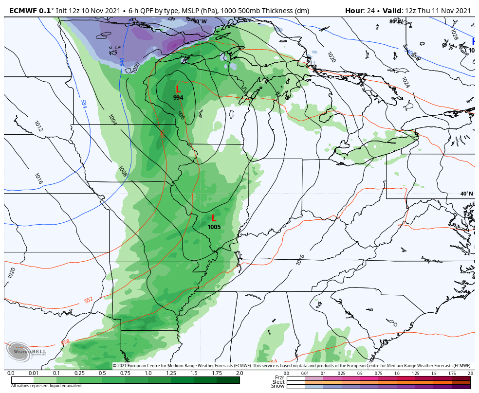
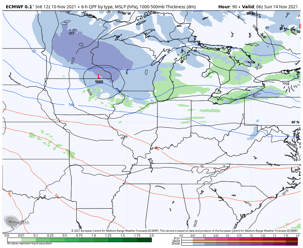
The EURO has a little bit of wraparound moisture…
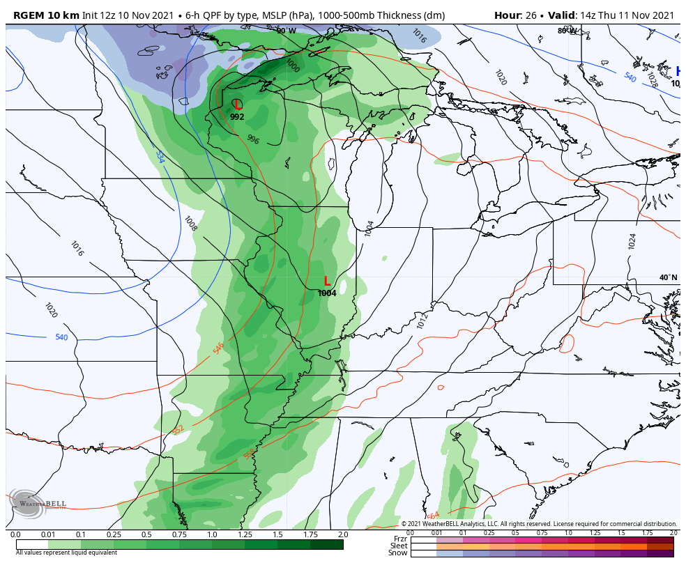
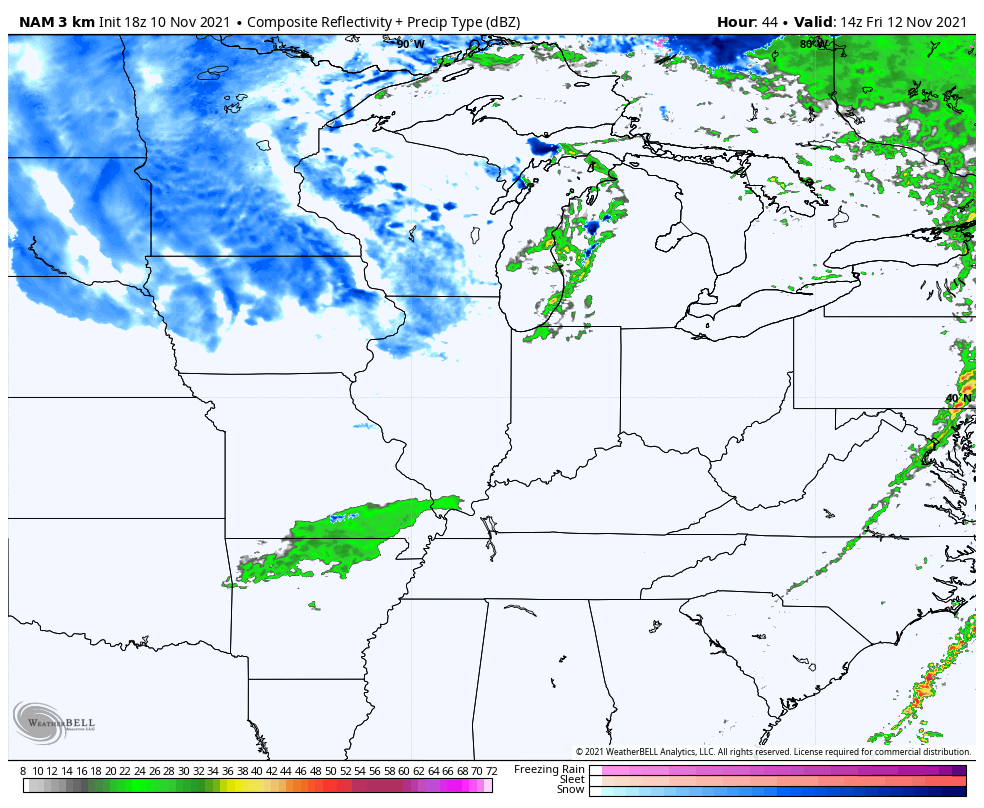
The future radar from the Hi Res NAM only goes through 1am Saturday, but you can see some rain and snow showers pivoting in here from the west and northwest…
The next system drops in later Sunday into Monday and looks like a clipper system. This brings a swath of rain and snow from west to east across the Ohio Valley and will be followed by some northwest flow snow showers and flurries.
The latest GFS is aggressive with this system, but is still way too fast in pushing it through here…
The Canadian is less aggressive, but still shows some wraparound snow showers and flurries…
The EURO continues to be absolutely all over the place with this system showing up differently from run to run…
Again, we have two chances to see some flakes in the coming days. Let’s sit back and enjoy the ride! ❄❄
Make it a great rest of the day and take care.
