Good Friday, folks. Our week is ending on a chillier note and it’s about to get even colder. We have two systems ready to impact the region over the weekend and both will bring much colder air in here. These two shots may also bookend the weekend with the chance for some snowflakes.
In addition to looking at the weekend flake potential, I’m also focusing on Thanksgiving week and a cold look setting up.
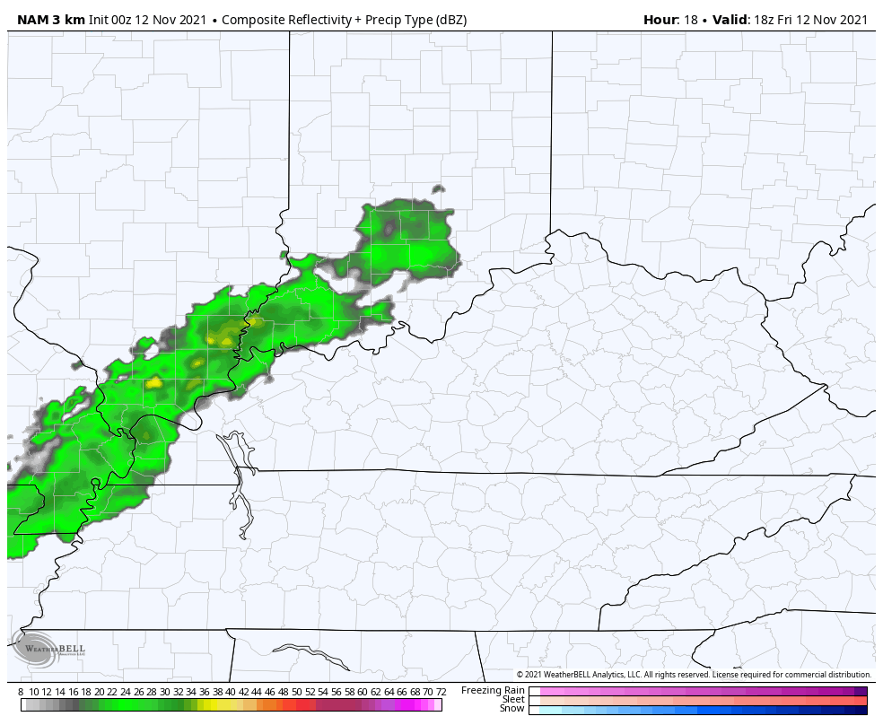
Let’s kick things off with the first of two weekend systems moving in late today into tonight. Gusty showers develop across western and central Kentucky and roll through the rest of the state this evening. Colder air comes in behind this and we may see a few flakes mixing in overnight.
With a northwest flow on Saturday, some flurries or sprinkles may show up as temps really struggle. You can see all this on the future radar from the Hi Res NAM from this afternoon through Saturday afternoon…
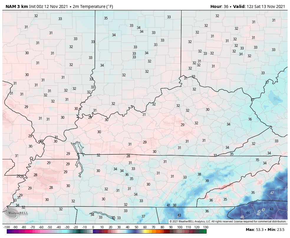
 Temps on Saturday are likely held in check and the NAM is showing some areas struggling to get out of the 30s…
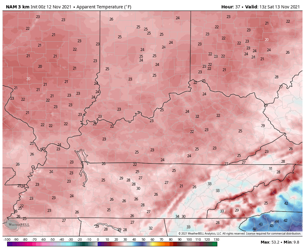
Throw the winds into the mix and those 7am-7pm Saturday wind chills are even colder…
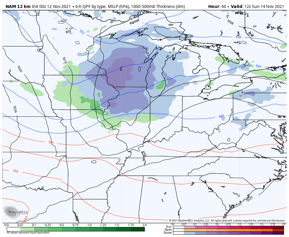
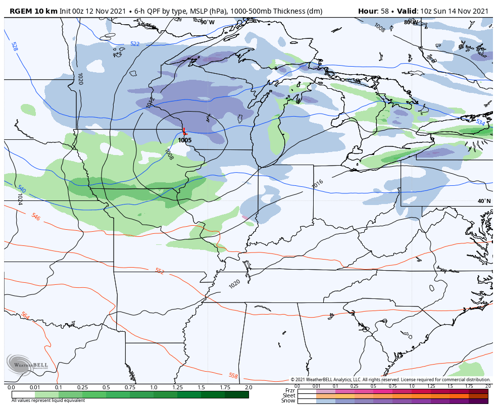
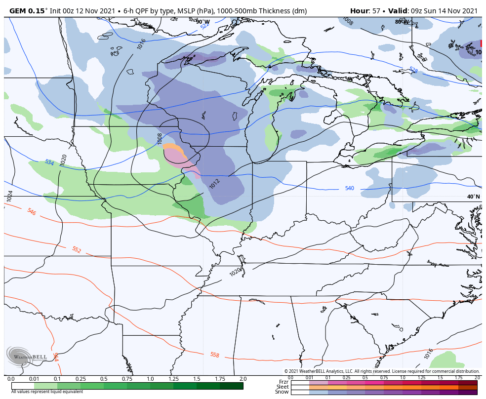
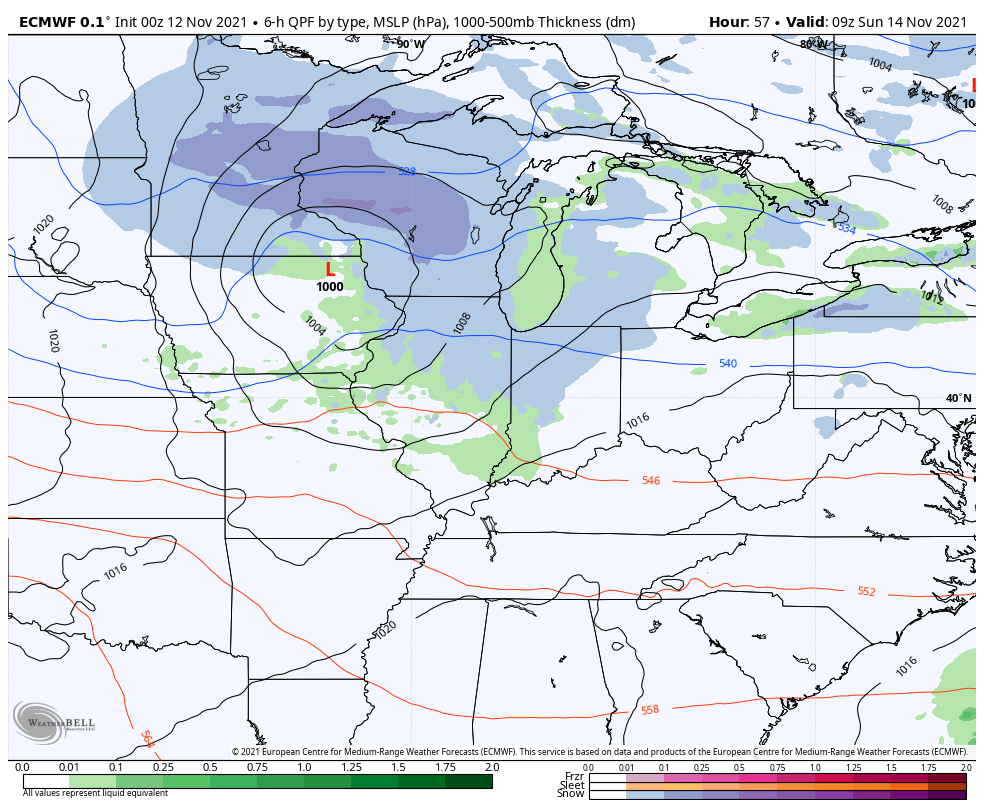
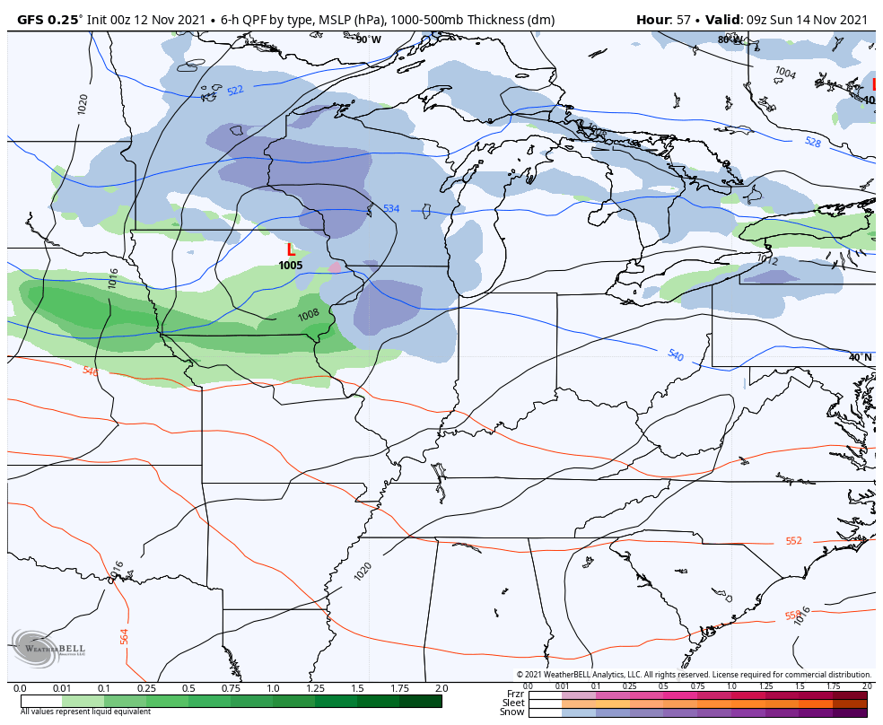
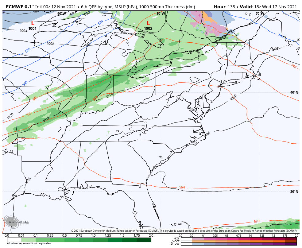
The clipper system diving in late Sunday into Monday continues to look like it can spit out a swath of some light rain and light snow across our region. That would be followed by some northwest wind induced flurries or light snow showers for some Sunday night and Monday.
There’s better agreement among the models with their latest runs.
NAM
Short Range Canadian
The Canadian…
EURO
The GFS is finally figuring this thing out and is trending farther south like most of the other models…
Monday is a cold and blustery day with temps likely staying in the 30s for many. Wind chills may even start things out in the upper teens.
Temps bounce back to normal for a few days behind this, but another system looks to dive in here by late Wednesday and Thursday as cold air tries to catch the back edge of a rain shield…
The EURO is really trying to unlock some very cold air behind that and into next weekend…
That’s a sign of things to come.
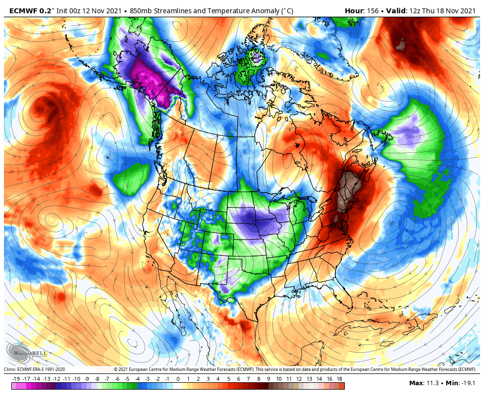
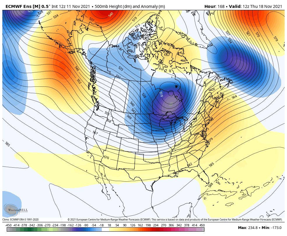
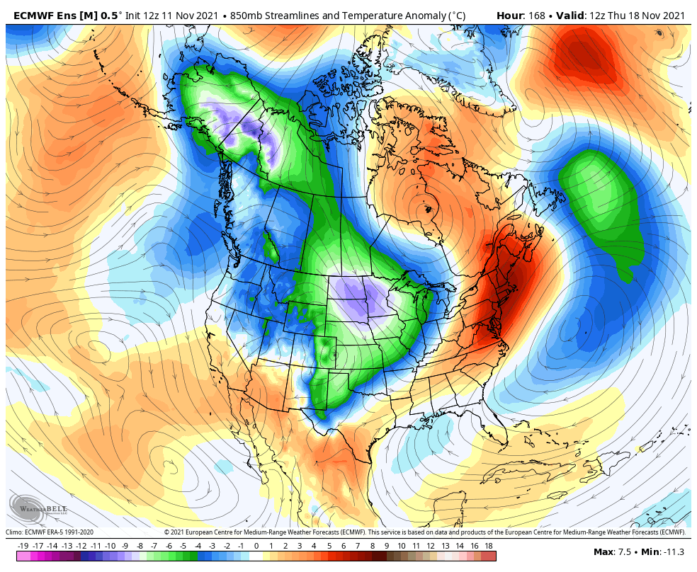
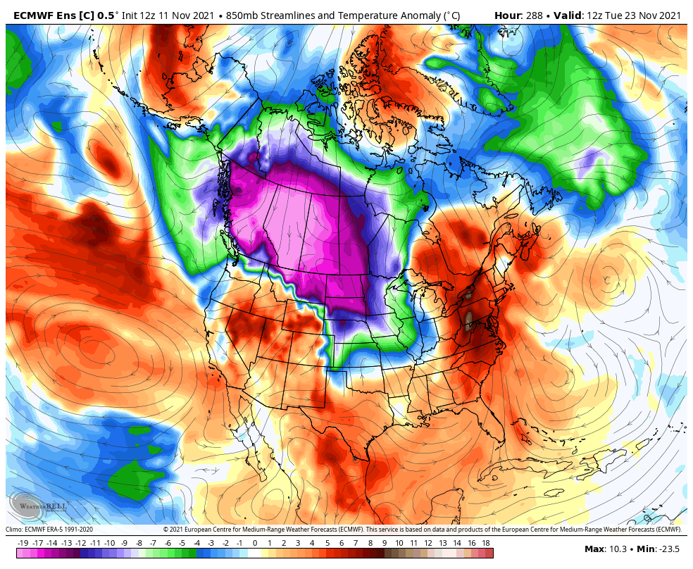
If we look farther down the road toward Thanksgiving week we find the EURO Ensembles once again showing a very cold look across much of the country. Watch the ridge pop along the west coast with another in Greenland. The end result is a deep trough across the central and eastern parts of the country…
Watch how these cold shots originate from Alaska and the Yukon and then dive southward across Canada and into the United States…
Keep in mind, that’s an average of 51 members that gets muted the farther out in time we go. Knowing all that, this is an impressive signal for cold and winter weather.
The single run of the Control Run of the Euro Ensembles show the potential arctic nature of that last shot Thanksgiving week…
If that verifies, it would be a major shot of cold across the country.
I will have updates later today, so check back. Until then, here are your radars to follow an increase in showers from the southwest…

Enjoy the day and take care.

Even with all the wind we had yesterday from the front it’s still a nice 60 out in my area.
Not here it’s cold and raw day in the 40’s