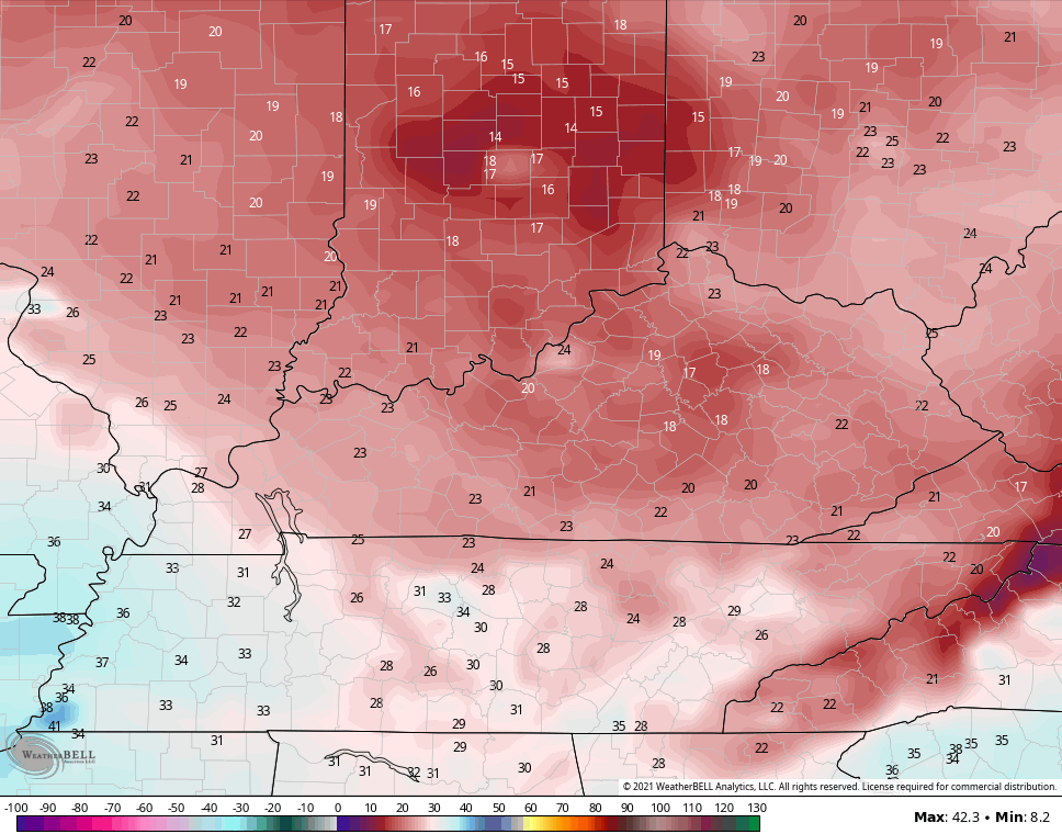
Good Saturday and welcome to a cold weekend in Kentucky. With the much colder than normal weather back in the region, it ups the ante for some light snows to show up for some as our next system moves in here on Sunday. The cold we are seeing now may be a sign of things to come as we inch closer to Thanksgiving week.
Let’s kick things off with what’s happening out there today. A few rain and snow showers may be noted early this morning across the southeast, but that pulls away fairly quickly. With a pocket of cold air overtop of us, we may see clouds bubble back up as the day wears on and that could produce some sprinkles of flurries. The best chance for that is across the north and your radars are here to find anything that’s out there…

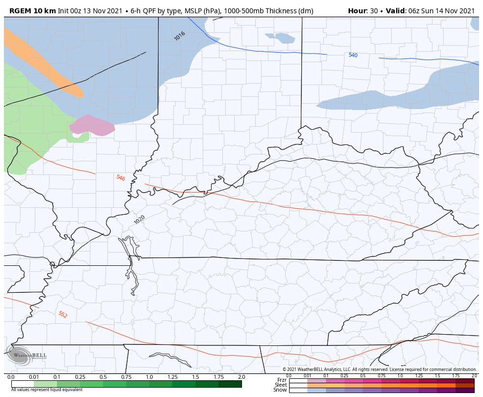
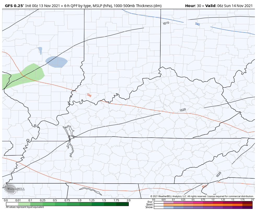
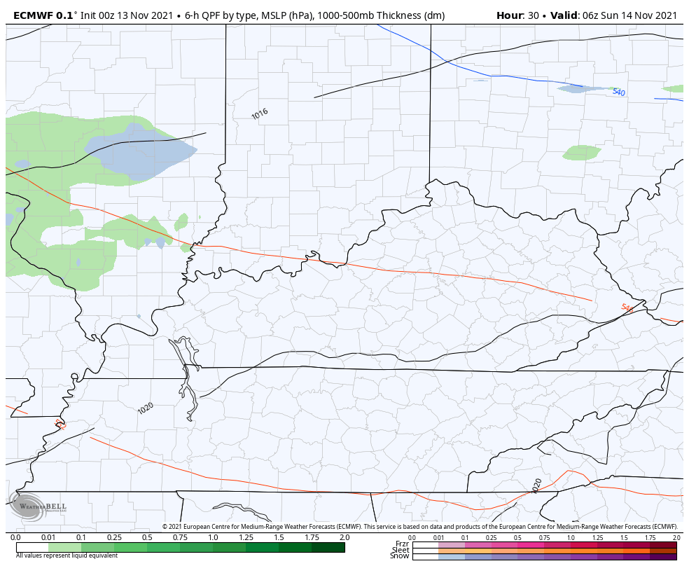
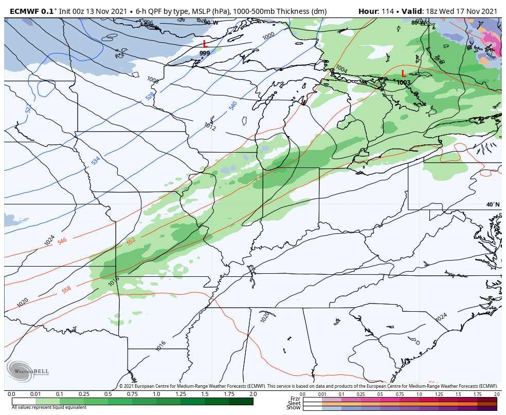
In terms of the Sunday system, we are likely to see a swath of light rain and light snow impact our region. This is the area I’m highlighting for the best chance of, at least, seeing some snow falling from the sky…
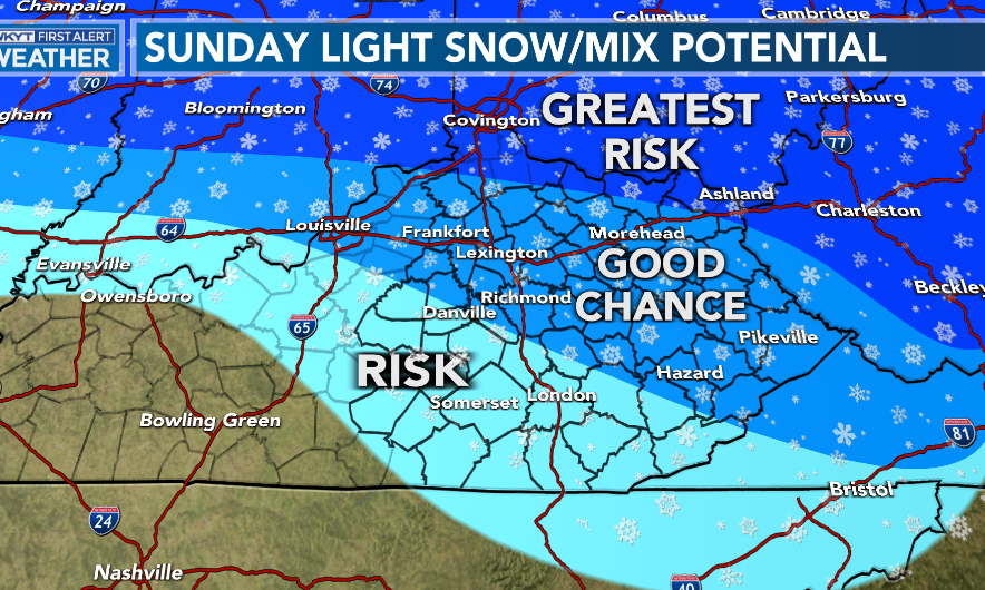
Can we get in on some light, slushy accumulations across the northern half of the state? Me thinks that’s a real possibility early on Sunday. I may even put out a First Call map later today.
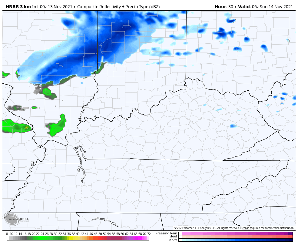
The absolute most aggressive model on the light snow potential is the HRRR. This short range model is likely pretty overdone, but the future radar is cool to see…
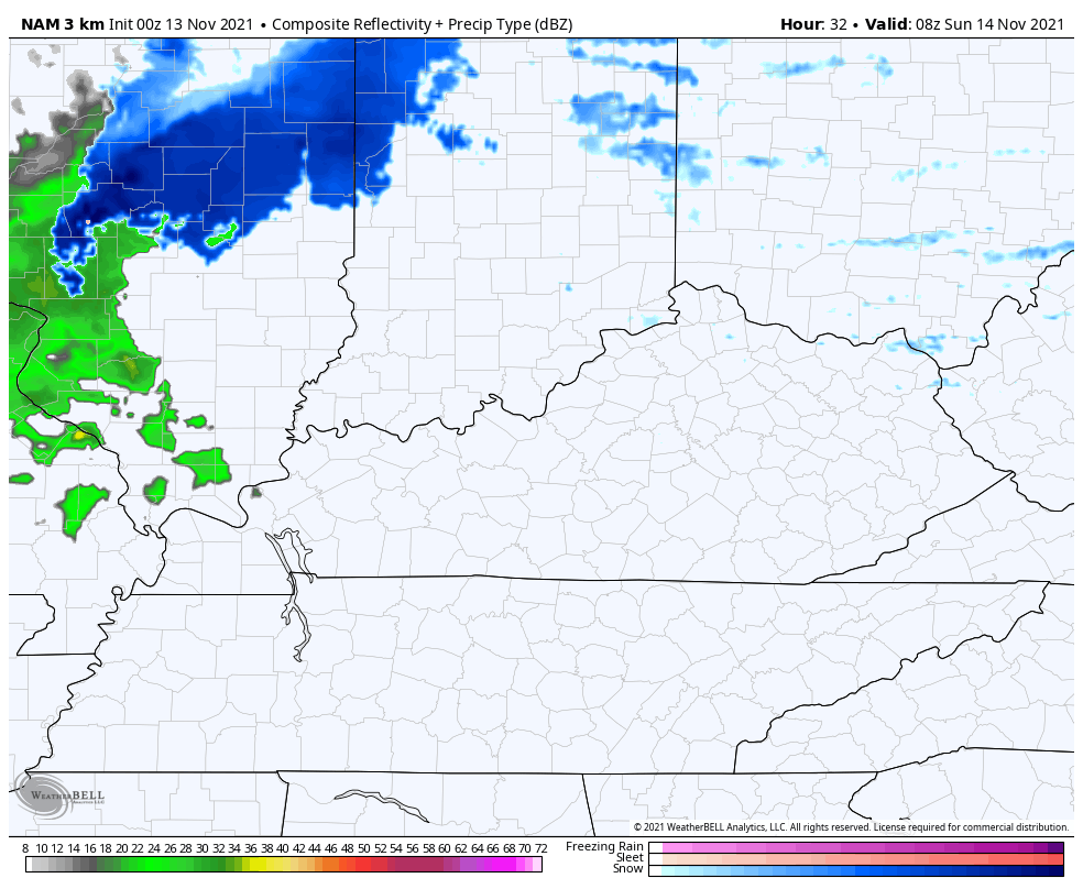
The Hi Res NAM is also a little aggressive with the light snow potential. Here’s the future radar…
That also gives you a look at the northwest wind flurry or light snow shower threat behind this Sunday night and Monday morning.
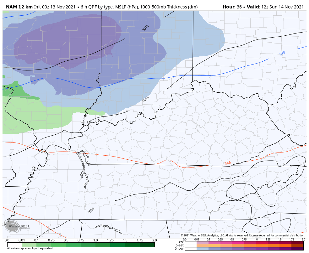
The regular run of the NAM is hitting more of northern Kentucky with a quick hitting swath of light snow…
The short range Canadian
GFS
EURO
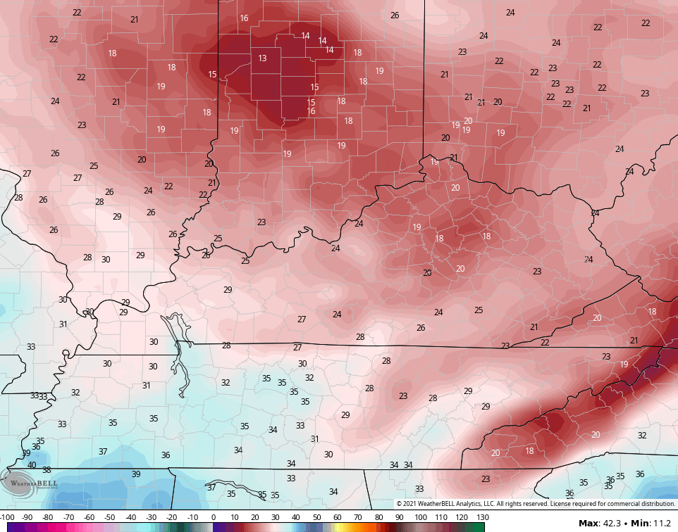
Wind chills behind this system will likely reach the upper teens by Monday morning for some areas…
NAM
GFS
Temps spike Tuesday and Wednesday ahead of our next system dropping in here by Wednesday night and Thursday. There’s a colder trend with this system and the EURO is trying to have the cold catch up to the rain before it scoots east of here. If that happens, it could bring another flake chance…
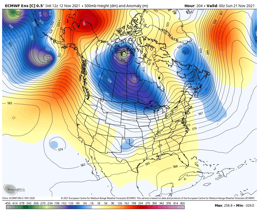
The Euro Ensembles continue to be very adamant on arctic air taking control of the pattern as we head into Thanksgiving Week. Check out this deep trough becoming established…
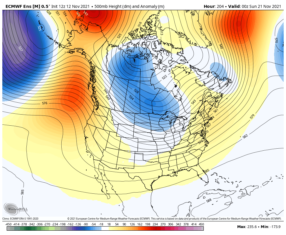
Remember, this is the average of 51 members and that’s terribly impressive to see. Several days ago, I posted about watching Alaska and the Yukon for arctic air building up and diving into the county. You can CLEARLY see these big time arctic shots working in on the same 51 member solution…
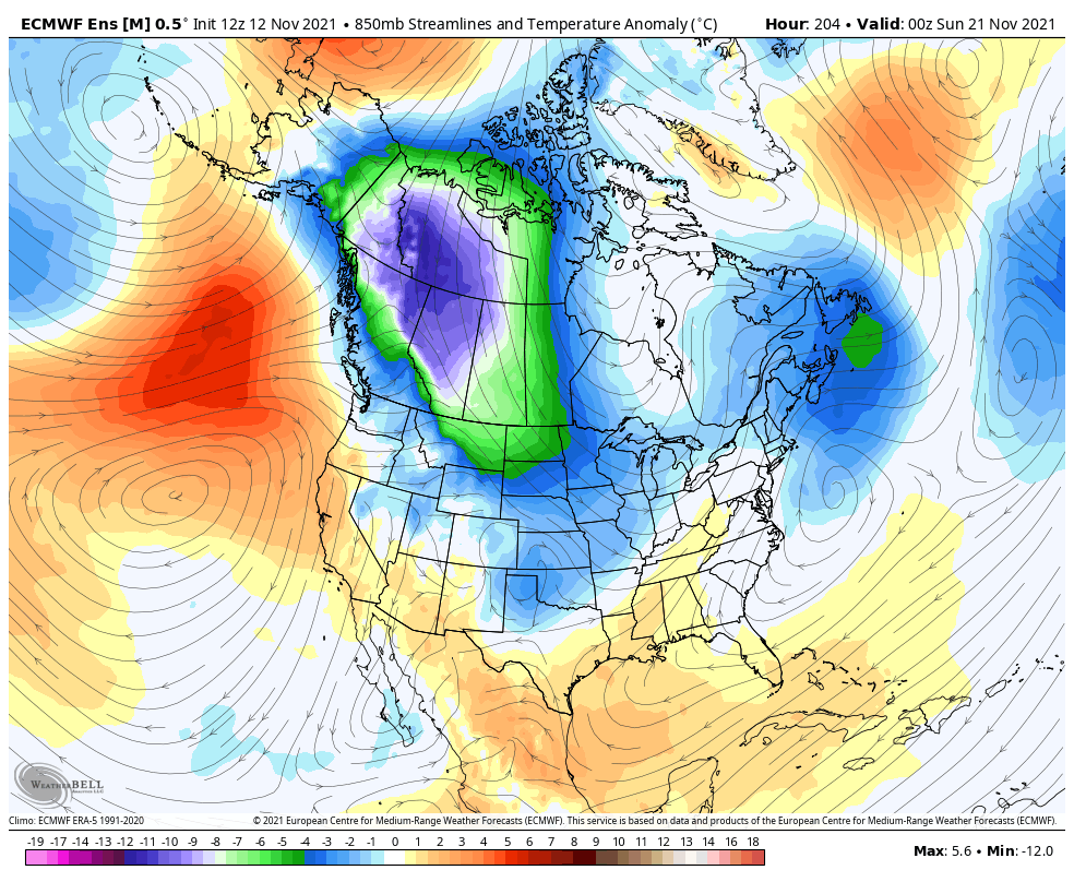
The single Control Run of the Euro Ensembles really make this point even better. Watch those troughs…
Now look at the arctic shots from that run…
Whoa! That could be some major cold for Thanksgiving week and would up the ante for snow chances around here.
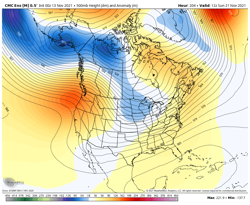
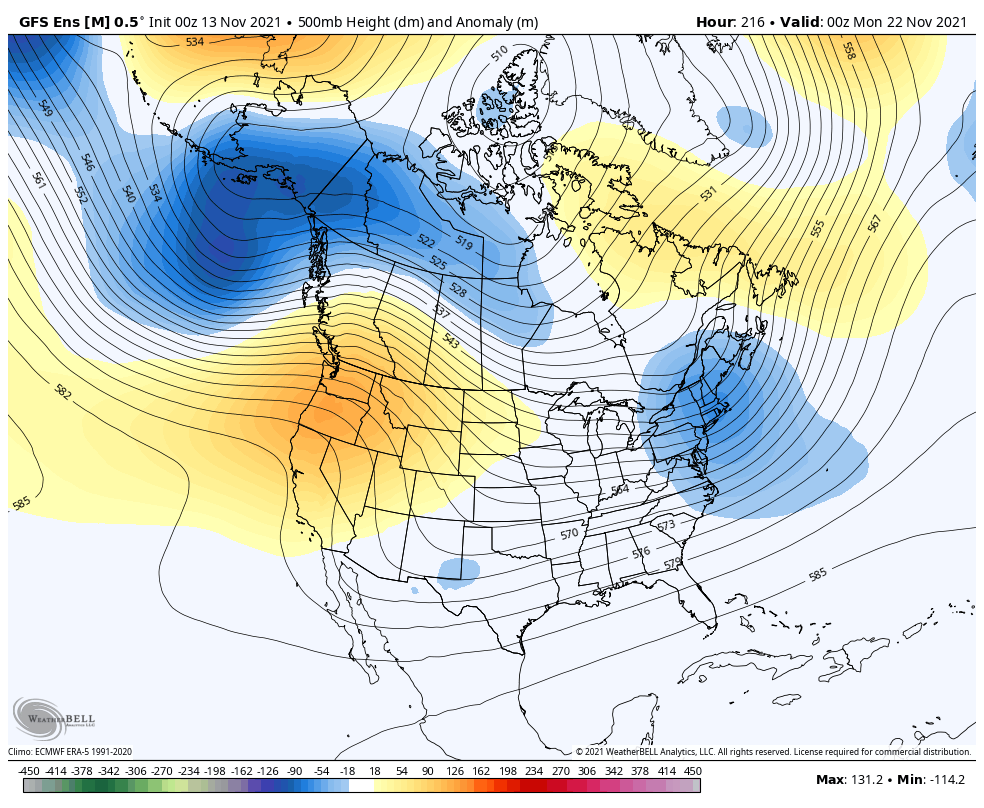
The other Ensembles aren’t as enthusiastic about the pattern turning that cold. Recent runs of the Canadian Ensembles and GFS Ensembles have had a much warmer look, but they are trending colder and showing more of a trough…
Canadian Ensembles
GFS Ensembles
I will have updates later today, so check back. Make it a good one and take care.

Many parts of the Chicago Metro Area saw the first measurable snowfall on Friday, as occasional snow squalls (some briefly heavy) moved through the area throughout the day. While Chicago’s O’Hare Airport received only a trace of snow, The NWS Forecast Office in the SW Suburbs received 0.6 inches.
Last November at this time, we had just come to an end of a record string of seven days in a row of 70+ degree temperatures, which had never happened before during the month.
The single control run of the Euro model seems to be also picking up a late season tropical system in the Pacific off Baja…..
I’ve got a long weekend in New York City the first weekend of December….trying to analyze these maps to see what kind of weather to expect and if we might see a snow flurry while sightseeing lol! Almost looks like the troughs pull out and warmer air flows in after Thanksgiving?! Where are my analyzers at?? What do you all think??