Good evening, folks. I wanted to drop by for a very quick thoughts on the upcoming round of light snow set to impact parts of the region Sunday into Sunday night. This system remains light, but things continue to come into better focus.
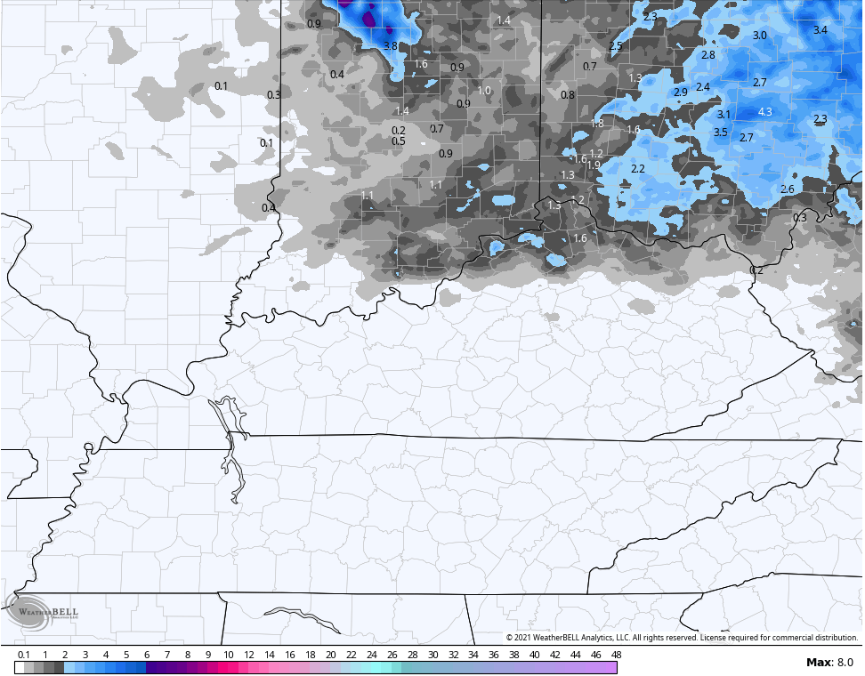
Areas of northern Kentucky are likely to see the first light snowfall of the season, especially on grassy and elevated surfaces. The farther north you live, the better the odds of picking up on some slushy light stuff starting early Sunday. Here’s a look at where I’m thinking…
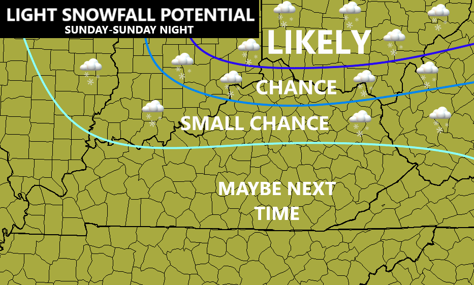
Can the Covington/Cincy area pick up an inch of snow? That’s certainly a possibility, but the greatest risk for a inch or more of of snow remains a bit farther to the north.
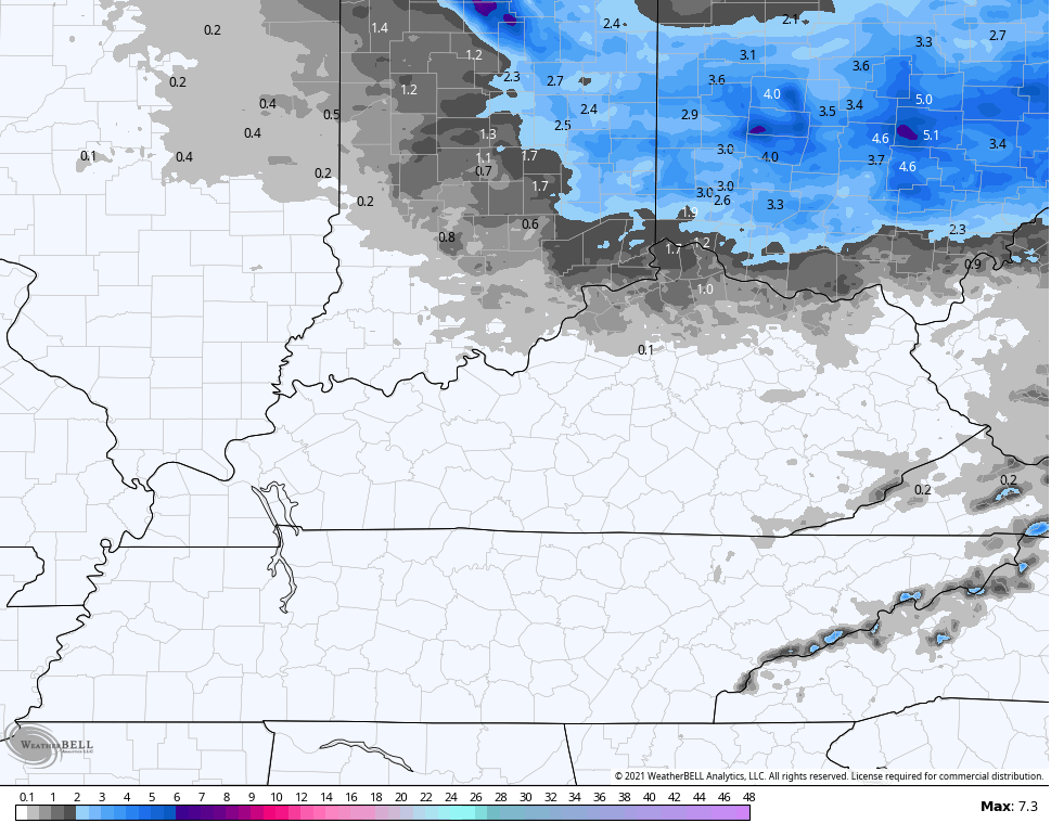
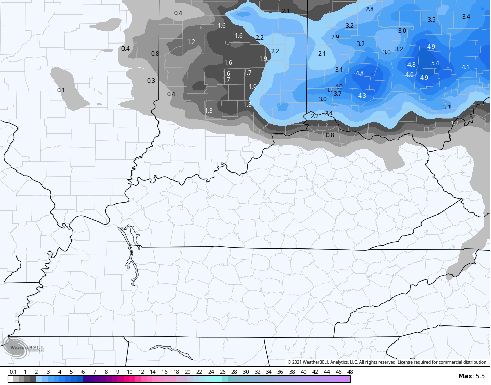
The latest model forecasts show what I’m talking about…
Hi Res NAM
NAM
GFS
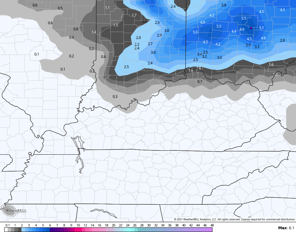
HRRR
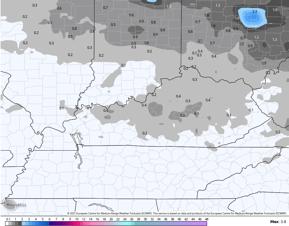
The EURO continues to look rather odd when compared to all the other models…
I will update all this and look much deeper down the road with my overnight update. Until then, here are your tracking tools to follow the system in from the west…

Enjoy the evening and take care.
