Good afternoon, folks. The first light snows of the season fell this morning in many areas of the region and we have a few more on the way tonight. That’s when a cold northwest wind kicks in and delivers a few flurries or snow showers across central and eastern Kentucky.
Before we look ahead, let’s look back at some of the morning light snows from my Twitter feed:
@Kentuckyweather @allyblakewx @AdamBurnistonWX @JimWKYT @brobwx @WLKYChris @NWSLouisville Light snow in SE Lexington this morning. pic.twitter.com/9n20y1DJkG
— james starr (@tripletdad2000) November 14, 2021
The first snow of the season here in Northern Kentucky. @Kentuckyweather pic.twitter.com/LXGh9IJ0lt
— Jim Dusso (@jimdusso) November 14, 2021
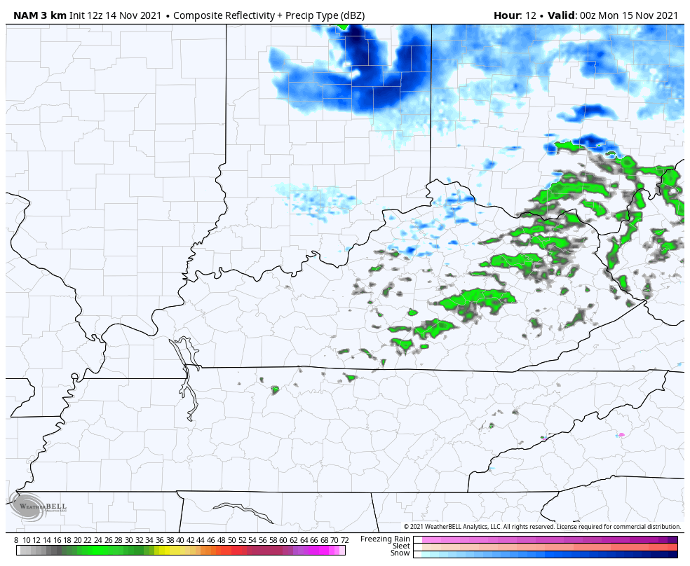
As expected, areas north of the Ohio River got in on some nice accumulating snows…
@Kentuckyweather Driving home from Columbus. It’s pouring the snow and the ground is getting white. Too bad it won’t be when we get to Somerset. pic.twitter.com/FWY62N1o9S
— Lindsey Lashley (@LindseyLashley) November 14, 2021
@Kentuckyweather We’re in central Indiana this morning. Looking like a winter wonderland! pic.twitter.com/VlyRRr6nbC
— Neil (@ntnoah) November 14, 2021
It’s good to see Mother Nature deliver on the flakes during the time we’ve targeted here on KWC for more than a week now. ❄️☃️
Cold air surges in here from the northwest this evening into the wee hours of Monday and brings some flurries and snow showers with it. Here’s a look at the future radar from the Hi Res NAM…
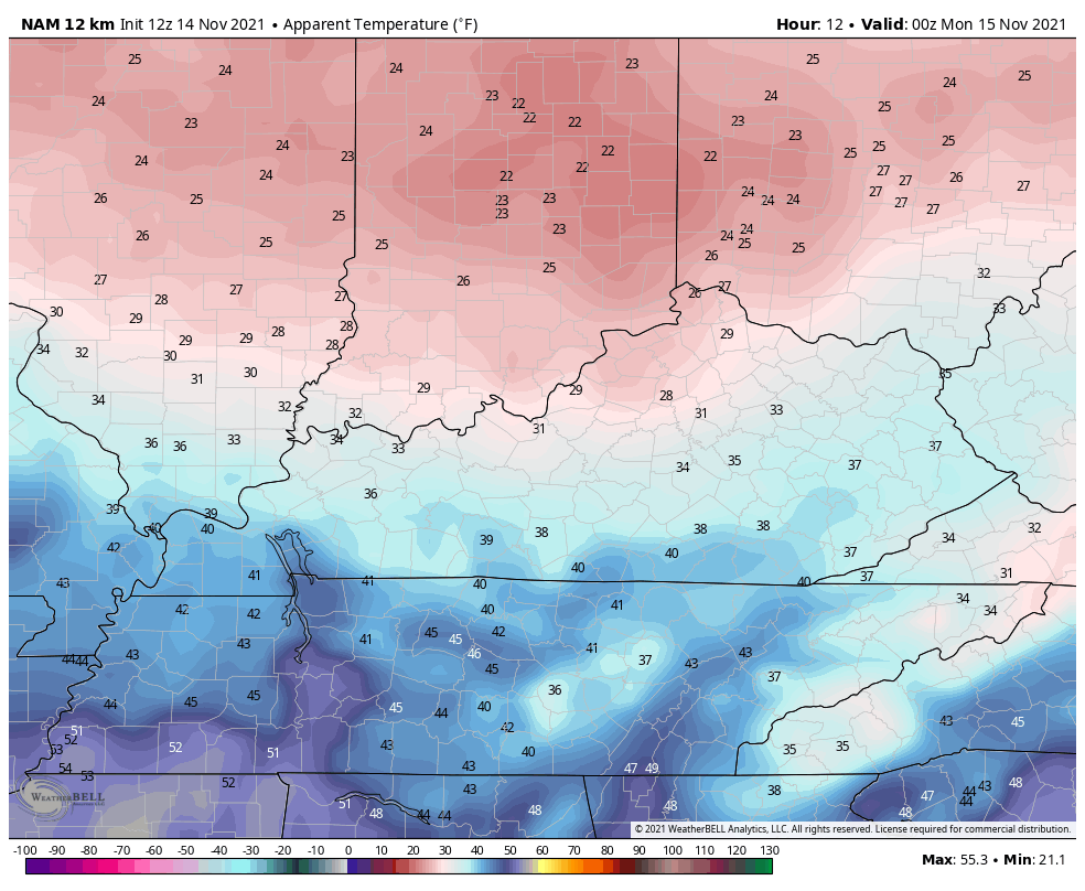
Wind chills from this evening through Monday morning can reach the upper teens at times…
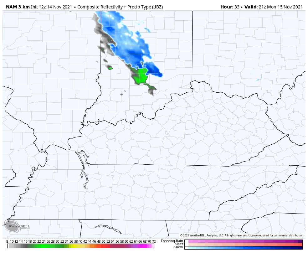
This sets the stage for a very blustery Monday as we get set for a milder wind to kick in for Tuesday. Can we get a touch of rain and snow shower ahead of that milder wind Monday night in the north? That’s possible and it shows up on the Hi Res NAM…
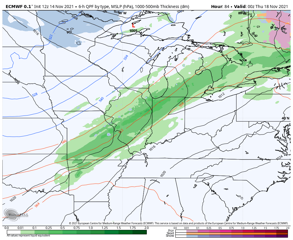
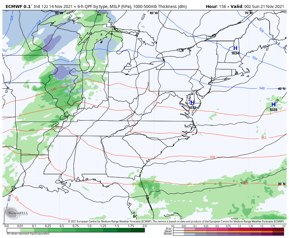
Temps for Tuesday and Wednesday turn mild ahead of another strong cold front dropping in here by Thursday. This brings a gusty band of rain with it and there’s a chance for a few flakes to mix in right behind the front as colder air works in…
The setup for Thanksgiving Week continues to look rather cold for much of the country. The EURO continues to bring arctic air into the country…
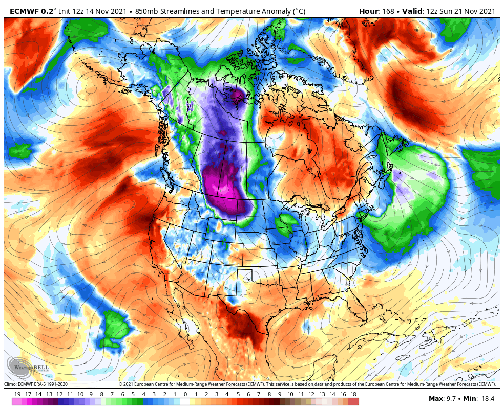
It does so with a couple of potential snow systems…
Last night’s EURO Ensembles went back toward showing arctic air diving into the country…
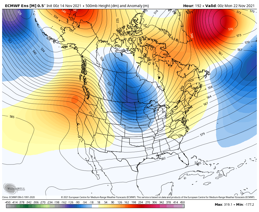
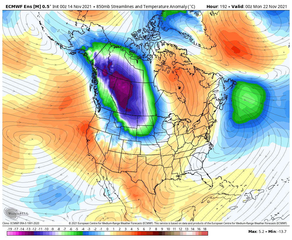
The Control run turned even colder…
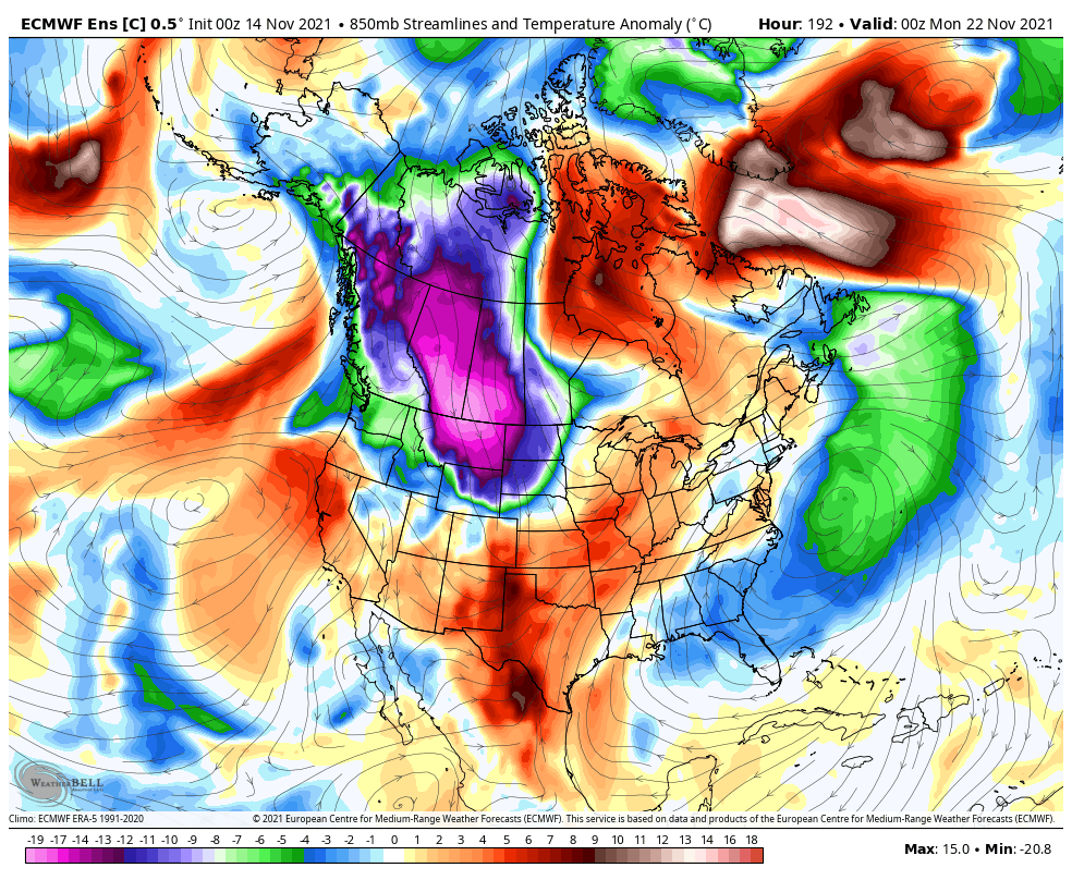
Some interesting signals are showing up during this time and I wouldn’t be surprised to see a big time winter storm system develop.
I may drop by for another update this evening, so check back. Here are your radars to keep you company for the rest of the day…

Make it a great day and take care.
