Good Monday, everybody. We’re coming off a weekend that featured colder than normal temps and a few flakes and this may be a sign of things to come. The overall pattern is threatening to grow even colder as we head closer to Thanksgiving and that could up the ante for some additional winter weather.
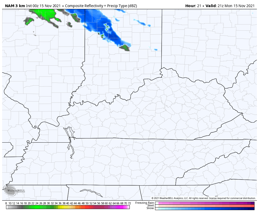
Speaking of winter weather, we have the winter feel out there today. Our Monday starts with wind chills in the upper teens to low 20s with a few flurries or a stray snow shower flying across some areas of the north and east. This isn’t a big deal, but anything that’s out there should show up on your radars…

Milder winds get set to blow in from the southwest starting early Tuesday and the leading edge of this may produce a touch of light rain and light snow tonight across the north. You can see that showing up on the future radar from the Hi Res NAM…
Temps really spike behind this and will be rather mild for Tuesday and Wednesday as that southwest wind kicks in ahead of our next system. That arrives Thursday in the form of a cold front and it’s likely to bring rain, gusty winds and a temp drop. There’s a small chance for a few flakes to show up on the back edge of this…
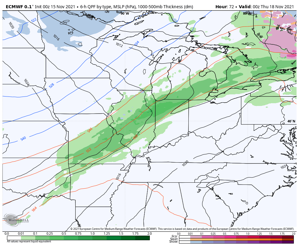
EURO
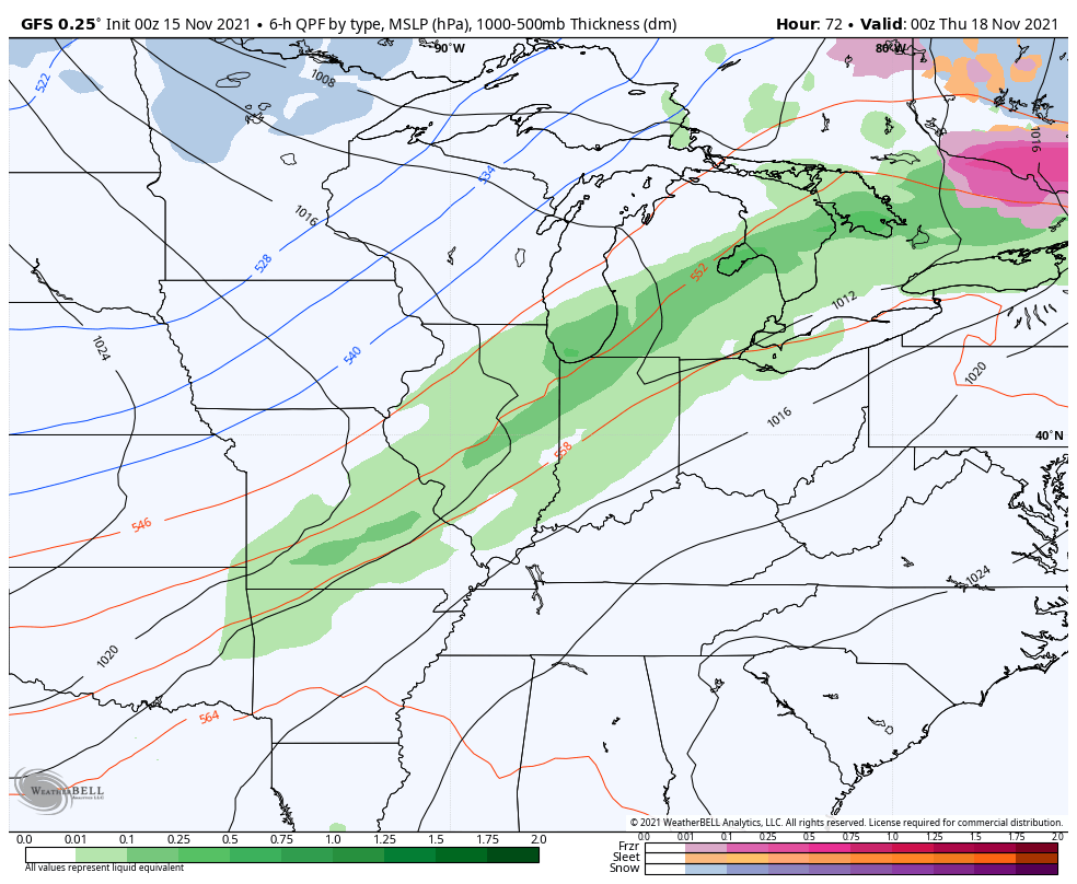
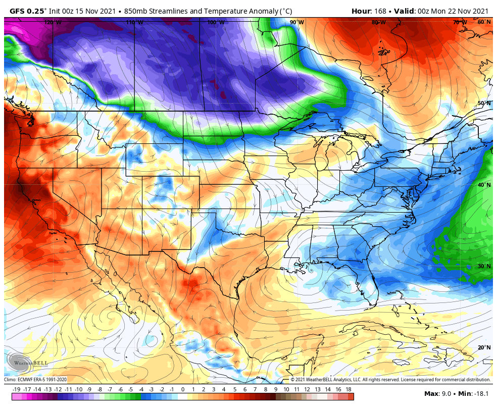
GFS
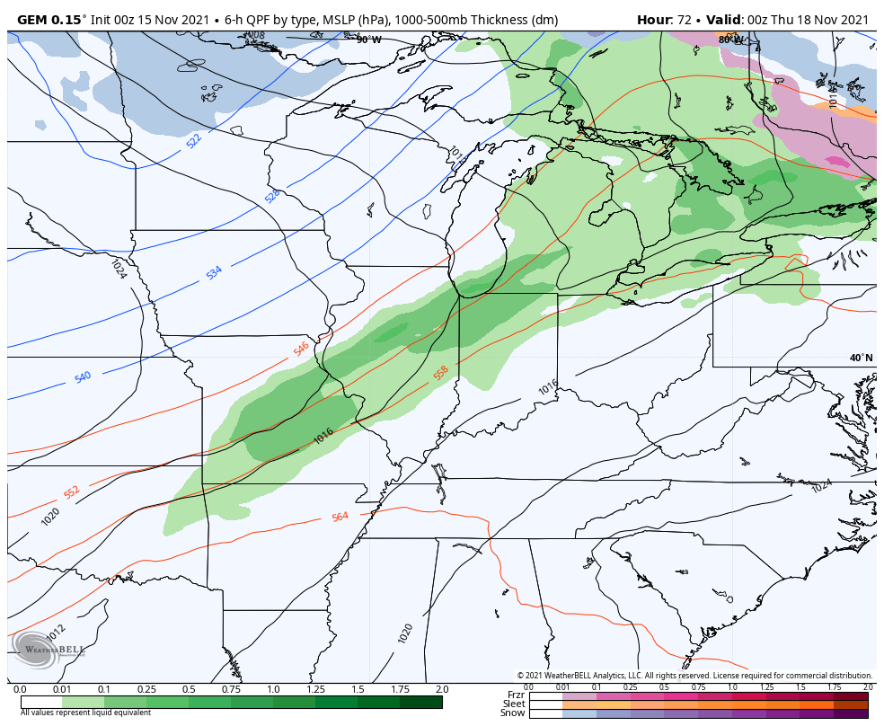
Canadian
That system is also a big wind maker and gusts of 30mph-40mph may show up once again. Temps behind that are cold and may not get above the upper 30s and low 40s for highs on Friday.
The longer range pattern from this weekend through Thanksgiving week is threatening to take our temps even colder than normal as there’s the potential for arctic air to get involved. I’ve been showing a lot of evidence supporting the idea and now we can add the GFS to the list…
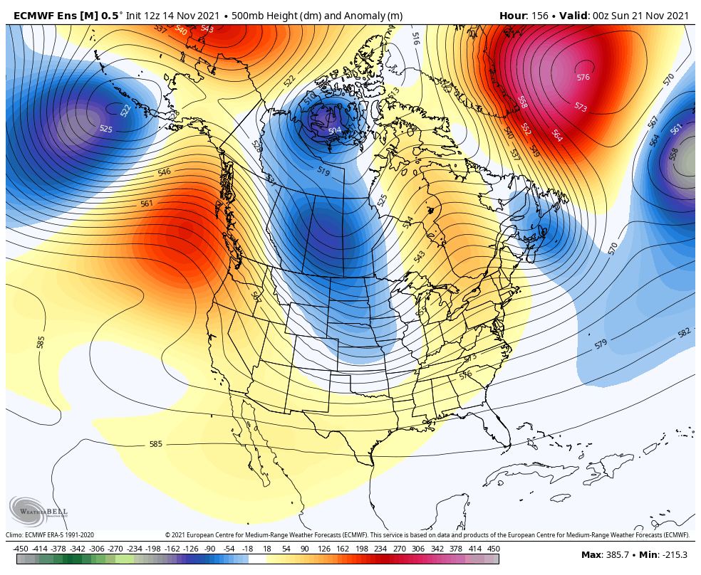
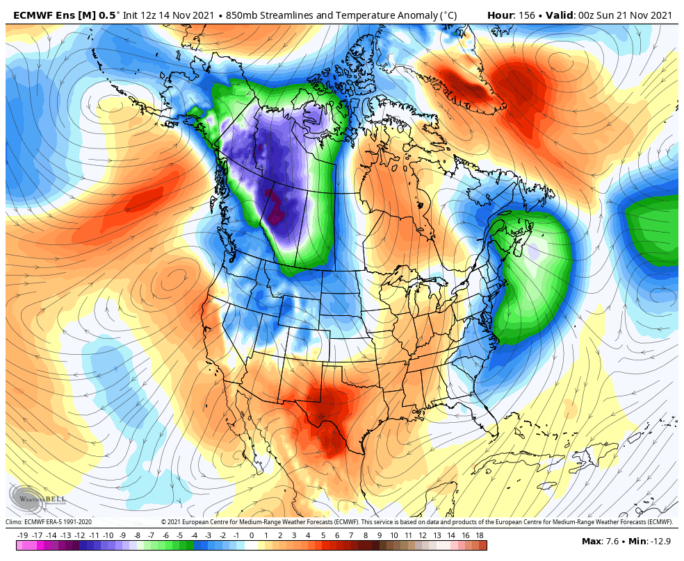
The EURO Ensembles have been very consistent with the frigid look for Thanksgiving week. Look at this trough getting fully established…
Watch how these shots of cold originate in the Yukon and Alaska and then dive southward across Canada and into our region…
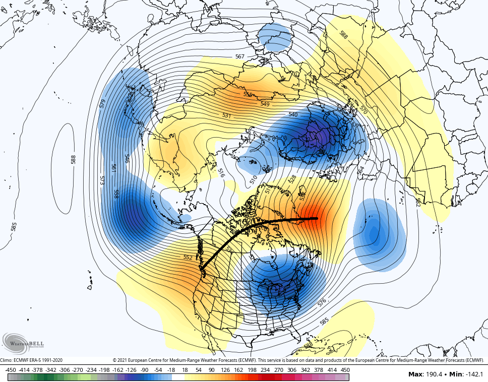
Something interesting starts to happen at the end of that run as we see two big ridges hooking up over the top and locking that deep trough in across the eastern half of the country. I’ve highlighted the connection from the ridge in Greenaland (-NAO) and the ridge up the west coast (+PNA)…
If you go through the history archives of some of the harsh winter patterns around here, you will find a similar looking map. Of course, this is just a model forecast, but it’s a consistent one. Let’s sit back and see what it can produce later in November and December. Hint: My winter forecast was already thinking this produces. That comes your way this Thursday at 6pm on WKYT-TV. 🥶☃️
I will have updates later today, so check back. Make it a great Monday and take care.

bout time for you winter forcast!!!!!!!!!!!!!!!!!!!!!!!
Rolo, in the past he always gives his winter forecast on third week of November and this is no exception. As far the thanksgiving week forecast that would be a rare cold outlook for thanksgiving even know i hear from old folks they remember there were snow on ground on thanksgiving and go rabbit hunting
When I was growing up still a youngster but old enough to remember. A little snow on the ground was not real uncommon., or some heavy frost for Thanksgiving morning. The guys would rabbit hunt in my family as well.
Excited for the winter forecast, I’m hoping since Chris has already made mention that November and December was looking to possibly be our coldest months. Hopefully we can get a snow for Christmas again this year. Last year was beautiful!
I don’t remember having any measurable Snow on Thanksgiving Day in South Central Indiana, (where I was raised.) Most of the major Snows occurred after Christmas or the beginning of the New Year and of course the deepest Snows occurred in February and March.
Looking forward to Chris’s Winter Outlook. I always watch him on line. Hoping there is a lot of Snow and not Ice in the coming Winter months ?
My brother and I went Rabbit hunting too, and we always came home with the limit of five Rabbits.
Saturday, I turned seventy years old. My question is: am I an “Old Folk” ??? LOL
You’re only as old as you feel physically!