Good Friday, folks. It’s a seasonably cold start to the weekend, but things are about to get a whole lot colder as we head into Thanksgiving week. The coldest air of the young season is ready to blow in here for Monday and Tuesday. B to the RRR. 🥶
Temps out there today hit the 20s to start and end mainly 40-45. Winds will be a little gusty, adding some extra chill to the air. This sets the stage for a quick drop in evening temps with the 20s showing up.
Saturday’s weather looks very nice and I suggest you get out and enjoy it. Highs hit the normal 50s.
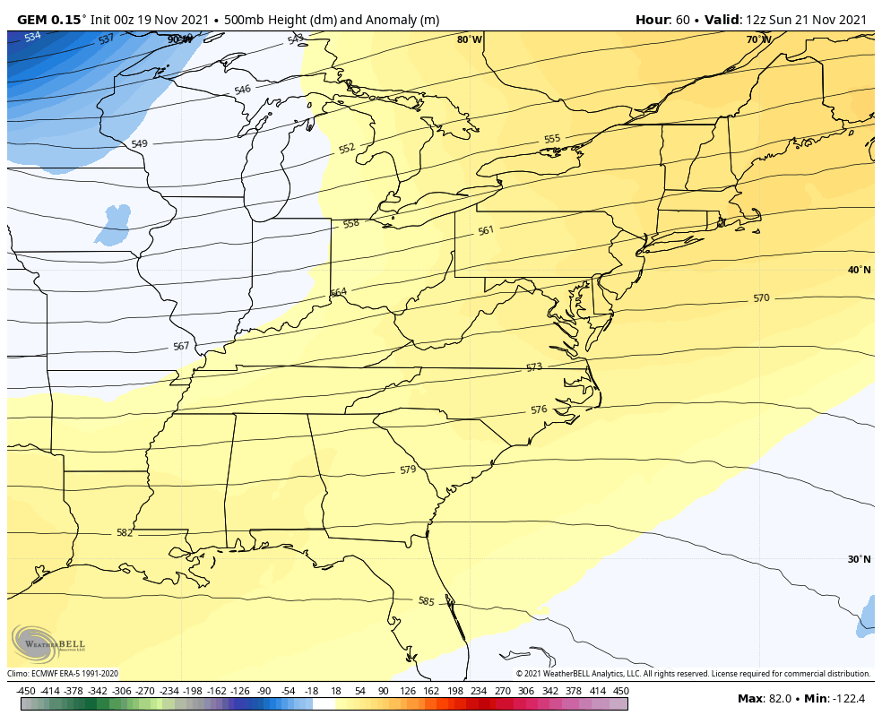
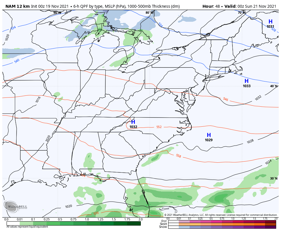
Rain quickly rolls in here on Sunday as our major dip in the jet stream shows up and brings frigid temps early in the week…
Here are some thoughts on what this may mean for us:
- Rain and gusty winds will be common on Sunday as temps crash from northwest to southeast late afternoon into the evening.
- A few flurries or a snow shower may show up Sunday night as the cold air catches up to the departing rain shield.
- That cold northwest wind may reach close to 30mph at times Sunday night into early Monday.
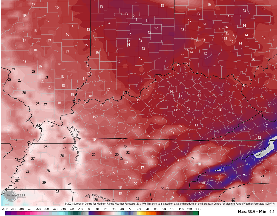
- Combine that wind with temps crashing through the 20s and Monday morning wind chills around 10 degrees will be possible.
- A few flurries may fly across the eastern half of the state as a touch of Lake Michigan moisture gets involved. If the flow is right, then some snow showers may show up.
- Highs on Monday may struggle to get to the freezing mark with gusty winds making it feel like the upper teens and low 20s much of the day.
- Tuesday is another really cold day with lows in the upper teens and low 20s and highs in the 30s.
Here’s how the NAM sees this system through 7am Monday…
 Those Monday wind chills are frigid…
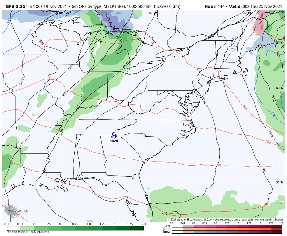
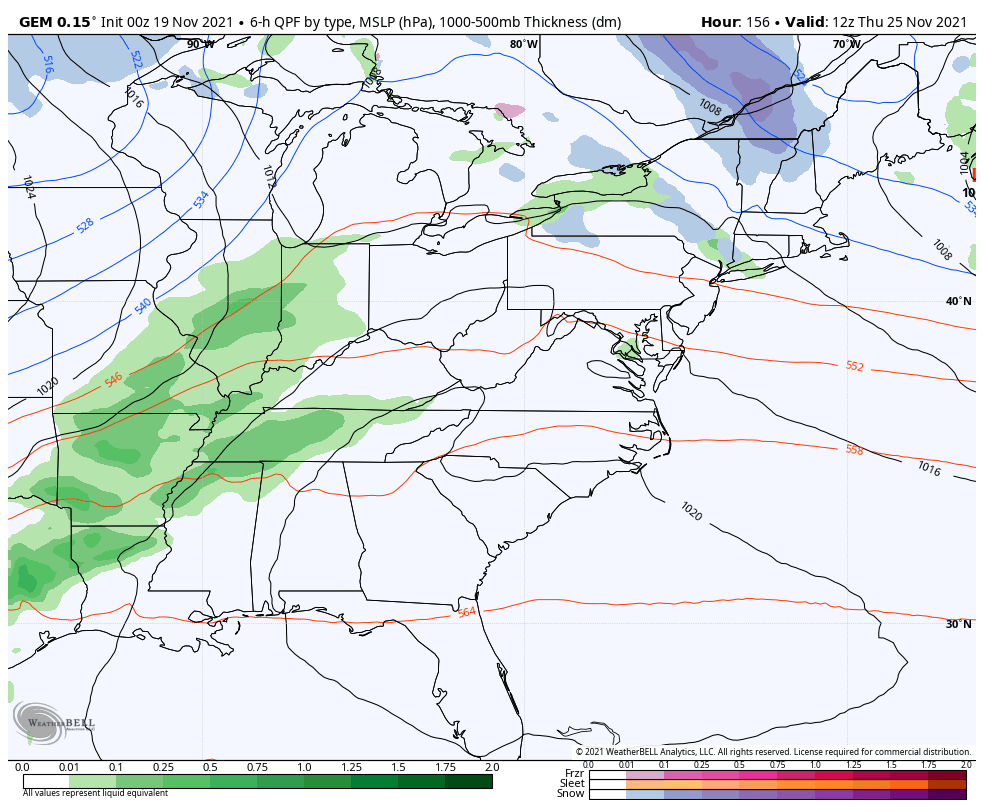
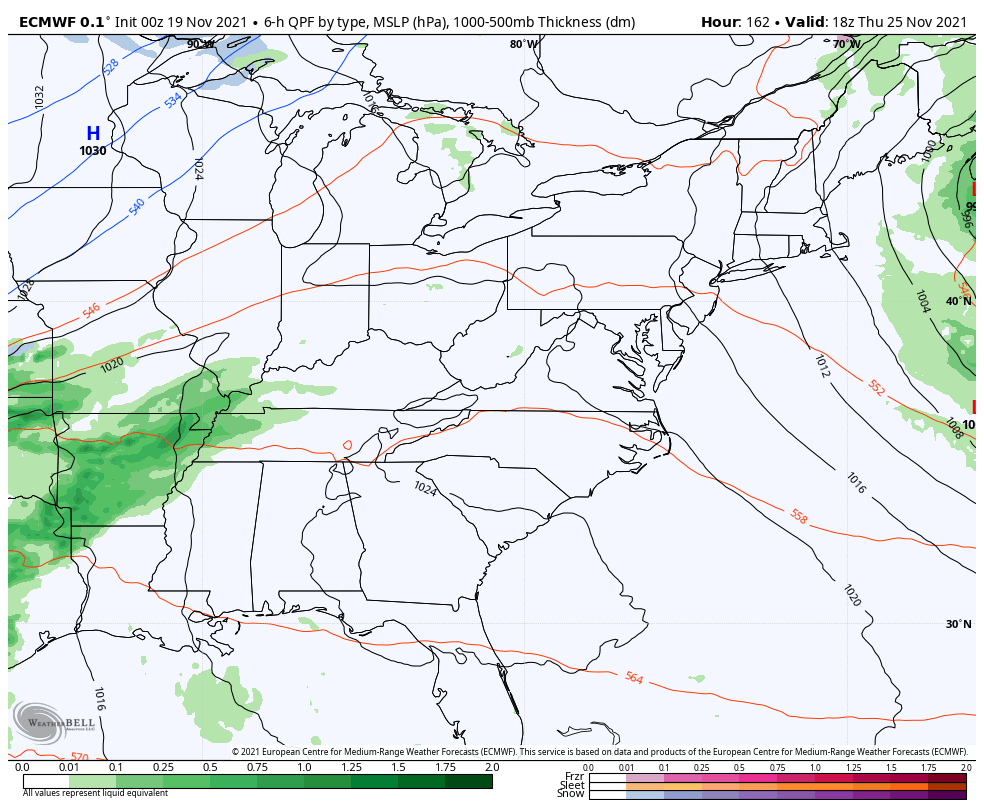
The busy Thanksgiving travel period kicks off with good weather on Wednesday, but the focus then shifts to what happens for the trip back home after Thanksgiving. The signal is still there for a storm system to develop across middle of the country, but the jury is still out on where this thing forms and goes. I’ve warned you about some wild model solutions, but we are starting to see them become more centered on the fact a storm system will be developing.
The GFS goes from nothing to a storm system…
The Canadian had nothing and now has a winter storm…
The EURO also went to a big storm, but it’s bias of holding too much energy back in the southwest is showing here. That allows the cold air to leave ahead of the storm and for this thing to wrap up way too much and be too far west…
Our pattern isn’t quite ready to lock straight into winter, but the The EURO Ensembles continue to show our trough becoming more established as we head into early December…
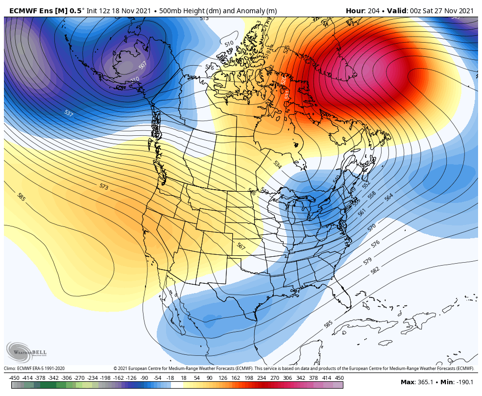
That’s still not terribly cold, but it’s a signal of where the pattern is likely to go as we head into the middle and end of December.
I will have updates later today. Make it a good one and take care.

Thanks Chris, Enjoyed your Winter Outlook last evening. I hope we all received more Snow than last year ?
A wind driven winter storm, I wonder he’s preferred a blizzard maybe? Thanks for the outlook Chris and the everyday duty you do. Have a great day!!
The storm after Thanksgiving will probably be mainly rain. Maybe a few flakes near the end.