Good Sunday to one and all. Rain is rolling across the state today as a strong cold front sweeps through our part of the world. This brings the coldest air since last winter for Monday and Tuesday and this is how we begin our Thanksgiving week. It’s a week that will average much colder than normal around here.
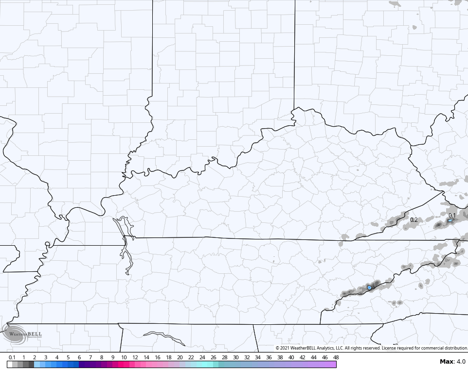
Today’s rain will be heavy at times and some folks may see a half to one inch of water fall from the sky. This action looks to slow down from west to east this evening as colder and drier winds kick in. Here are your soaker of a Sunday radars…

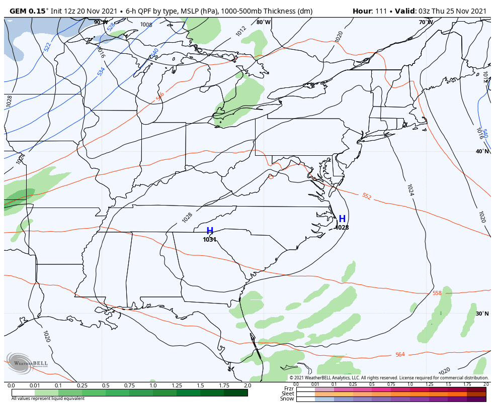
That cold air has a chance to cause a few late night flakes to fly in extreme southeastern Kentucky. The Hi Res NAM is showing the best chance right along the Virginia border counties…
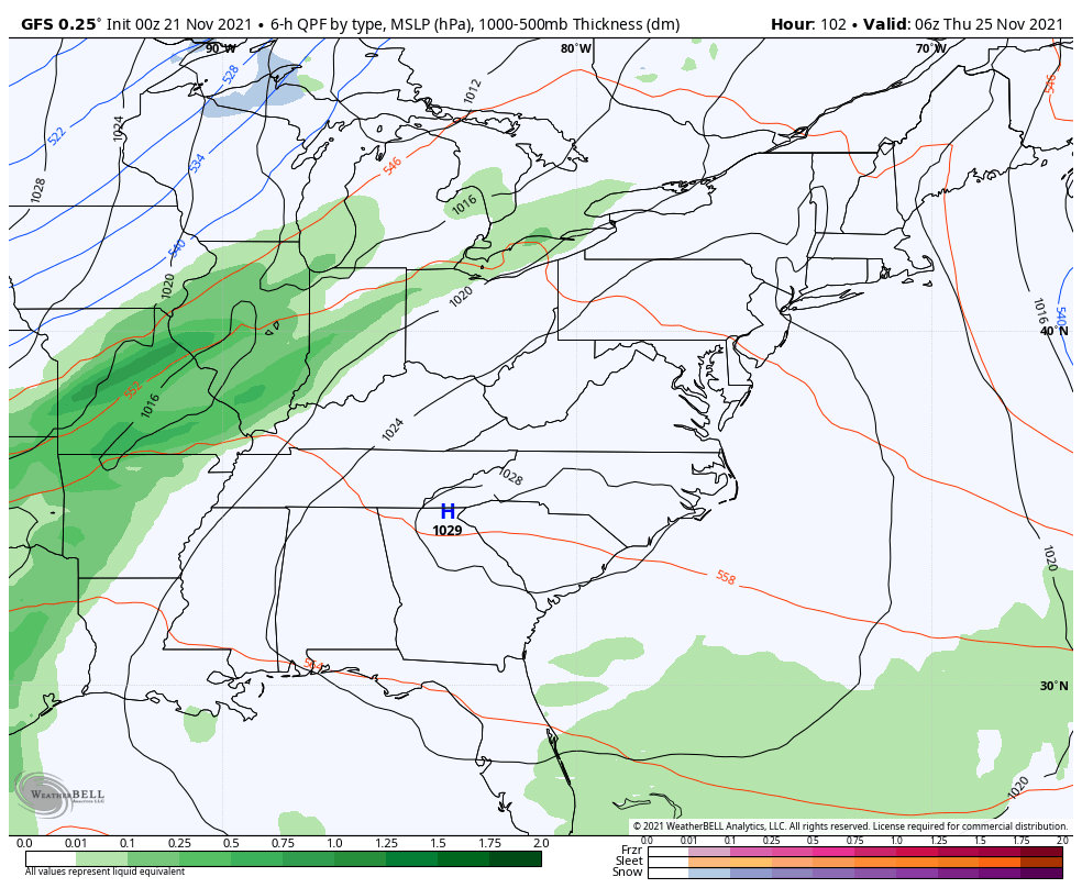
Monday and Tuesday and windy and cold with dry weather. That dry weather continues into most of the big travel day on Wednesday as clouds quickly thicken from the west. Those clouds are ahead of a Thanksgiving Day cold front that brings rain, wind, falling temps and the chance for a few flakes to fly through Black Friday. That may be followed up by a clipper system over the weekend.
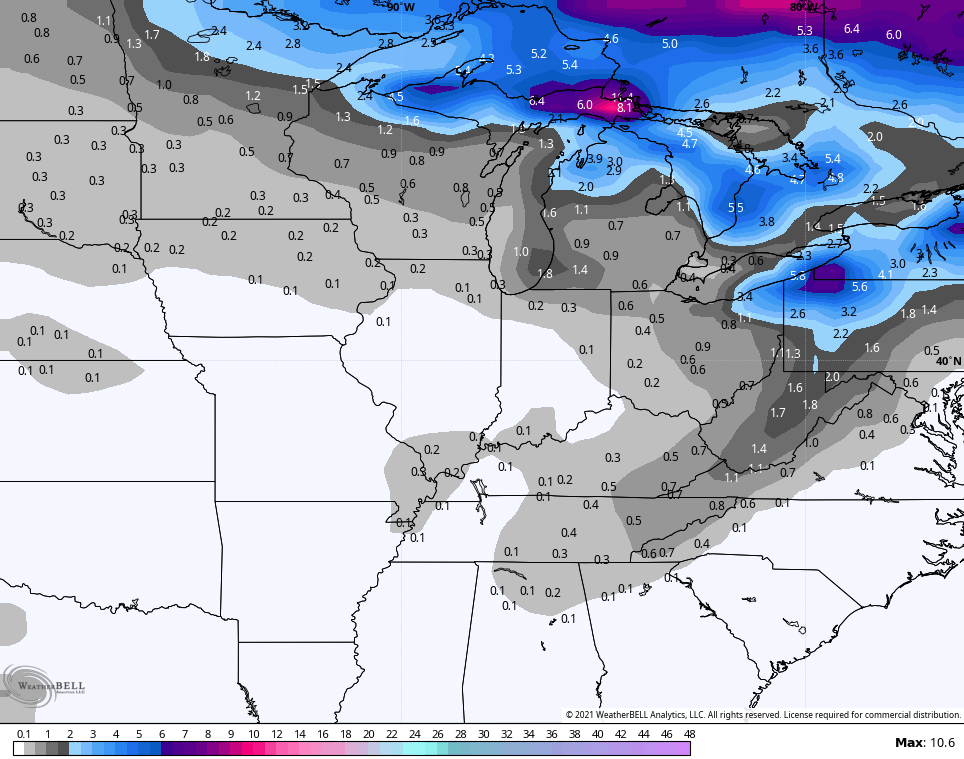
It took a while for the GFS to latch on to all this, but it’s becoming much more consistent as we get closer. If you’re a snow lover, you’re hoping the new run of the GFS is on to something as it shows rain to light snow Thanksgiving and Black Friday then some clipper light snow behind that late Saturday…
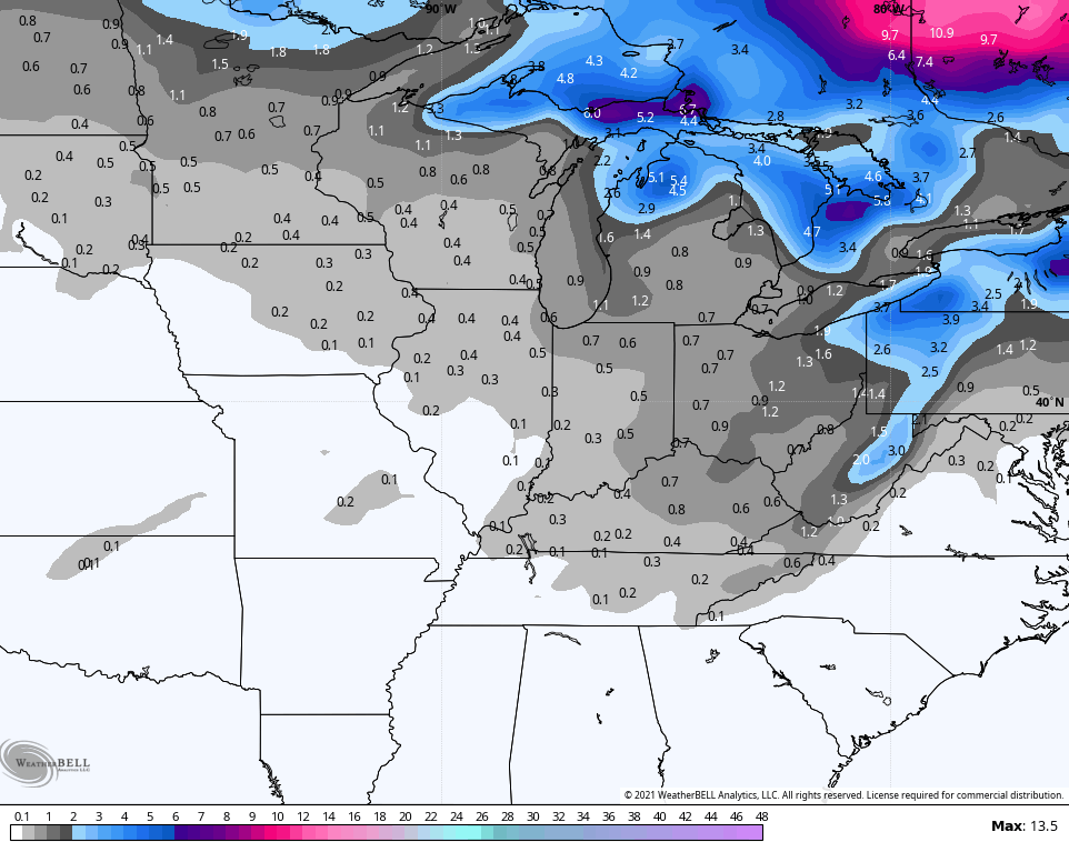
Yea, we shall see about that, but the GFS Ensembles are actually showing the light snow potential…
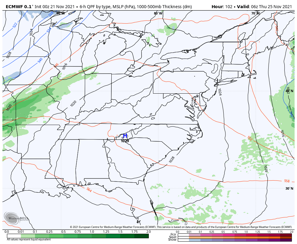
The EURO is also jumping on the light snow potential, but doesn’t have the clipper…
The Canadian wants no part of it…
But the Canadian Ensembles do…
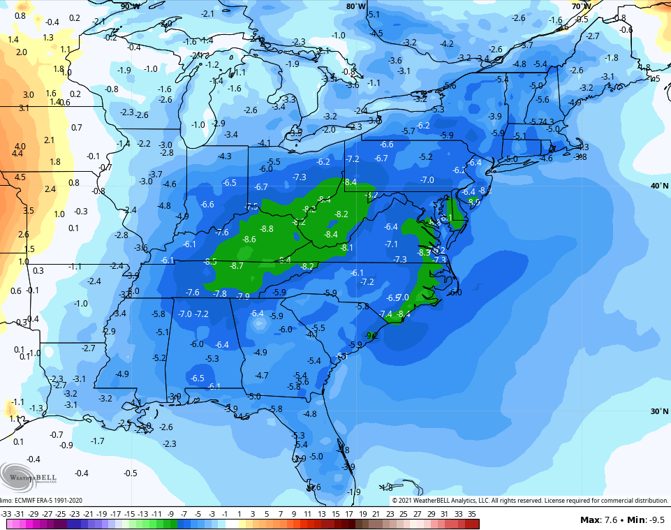
Regardless of any light snow possibly showing up, temps for Thanksgiving week as a whole are much colder than normal. The GFS continues to trend colder with the 7 day temp anomalies…
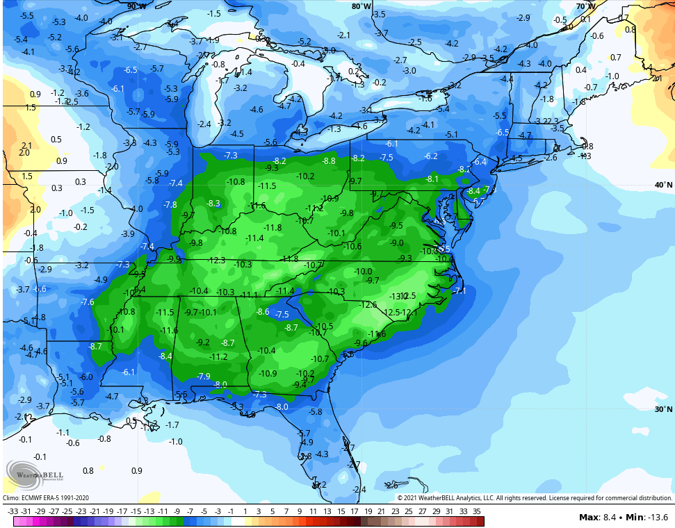
The Canadian is even colder…
I will have updates later today, so check back. Make it a good one and take care.

Borderline snow chances is the storyline.
Not much rain here in the Chicago area. It rained lightly for about 45 minutes earlier this morning before ending.
Now, we await the colder temps and gusty NW winds for tonight and Monday morning.