Good afternoon, everyone. Rain is rolling across the state today and it’s making for a rather soggy and gloomy day. This rain is ahead of a push of cold air on tap to begin Thanksgiving week with another blast of cold set to arrive by the end of the week. Can that one bring a few flakes to town? Maybe.
Let’s begin things with what’s going on out there today. A cold front is inching closer to us and has widespread rain out in front of it. We’ve even had a few rumbles of thunder across the western part of the state. As the rains fall, temps are in the chilly 40s. Here are your radars to track the nasty stuff…

Cold air and gusty winds crash in behind the front for Monday and Tuesday, but it’s dry.
We stay dry into the busy travel day Wednesday, but another cold front moves in for Thanksgiving Day. This brings widespread rain along and ahead of the front. As the cold air quickly moves in behind the boundary, there’s the opportunity for some flakes to show up Thursday night and Friday morning. That will be followed up by a disturbance on Saturday that can bring a period of light snow and light rain. There could even be a third system right behind that.
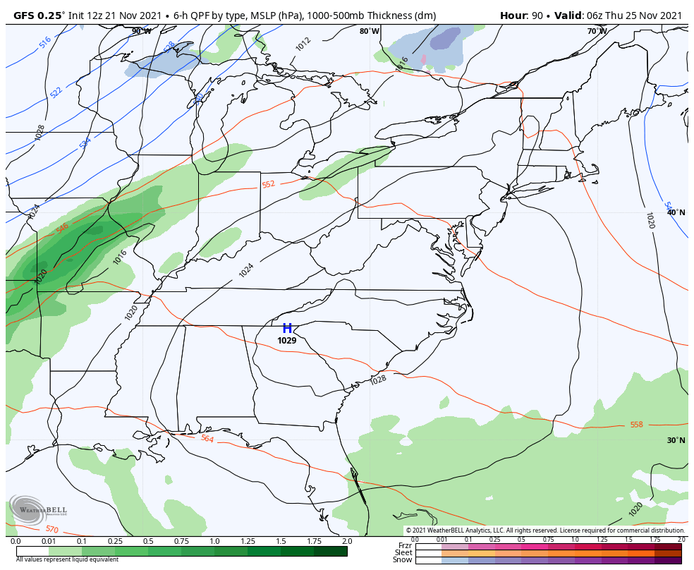
Here’s the current run of the GFS showing all 3…
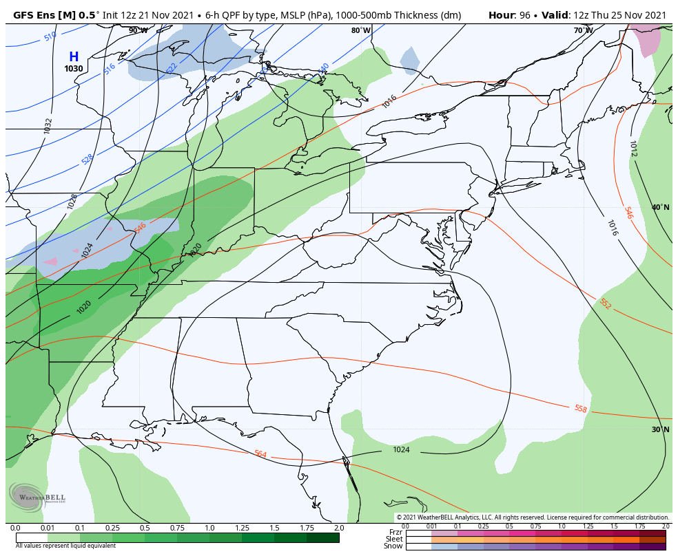
The GFS Ensembles are pretty jazzed up on some light snow behind the Thanksgiving front…
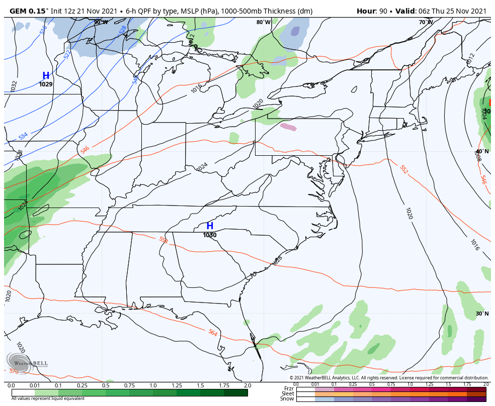
The Canadian…
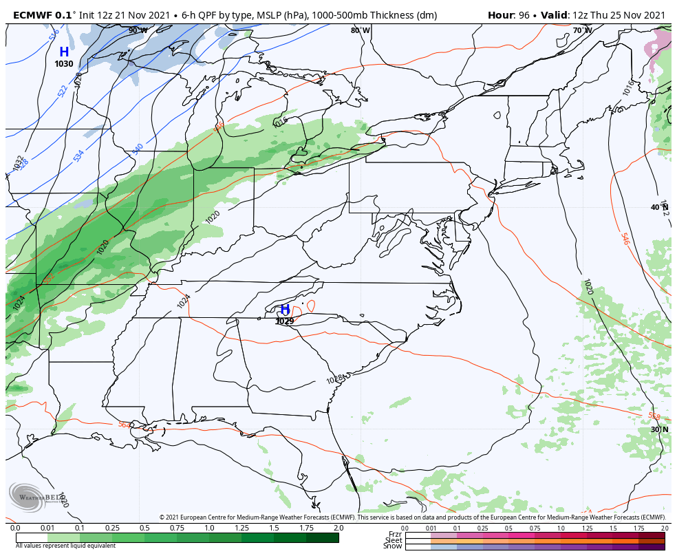
EURO
Behind all this is likely to come another trough digging into the east and possibly getting cutoff to end the month and begin December.
That’s all you crazy kids get today. I have to go roast my good friend Sam Dick as we celebrate his upcoming retirement from WKYT on Wednesday.
Make it a great day and take care.

I could be wrong I don’t think it be as cold that he advertised last week the arctic air isn’t going to be as deep he thought. Only down in the 20s tomorrow night not in the 10s digit. I notice that front has really pick up more moisture as goes through the state. Here in my hometown by the Ohio River we didn’t receive as much rain and it’s been that this year