Good evening, everyone. Here’ hoping you are having a wonderful Thanksgiving Day. Obviously, the weather has been as lousy as advertised with chilly rains and gusty winds. Crashing temps are showing up now and we have the chance for a few flakes to show up later tonight.
The cold front continues to quickly push across the state this evening as temps drop quickly through the 30s behind the boundary. Northwest winds will kick in and give areas of central and eastern Kentucky the chance for a few flurries or an out and out snow shower. The Hi Res NAM future radar from 10pm through 1pm Friday shows what I’m talking about…
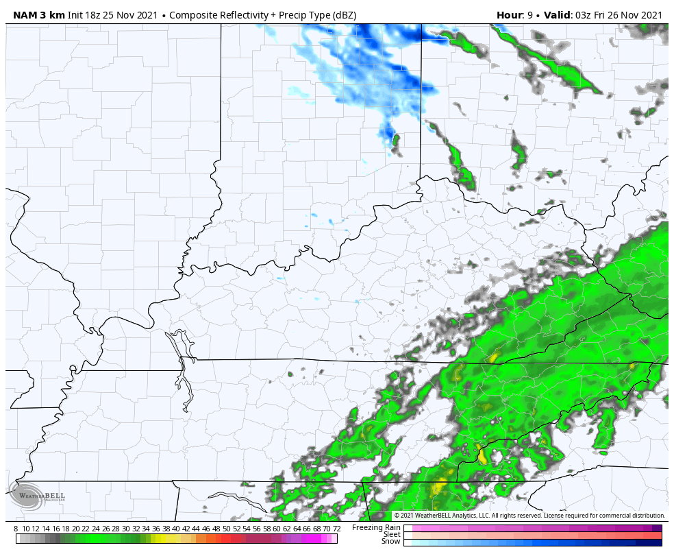
Here are your radars to track the evening action…

Friday is a cold day with clouds slow to break across the east.
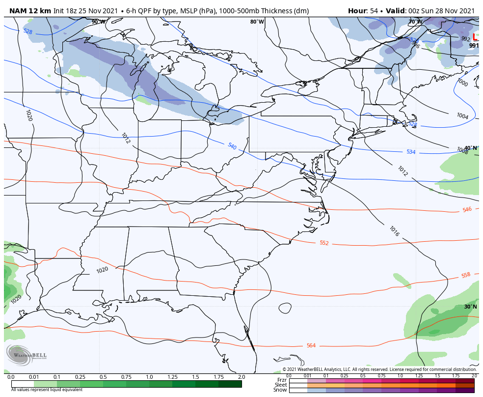
Our next system shows up Saturday night and Sunday, but the greatest impact stays just to our north and so does the system right after it for Monday…
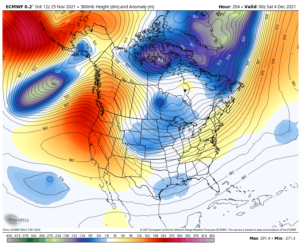
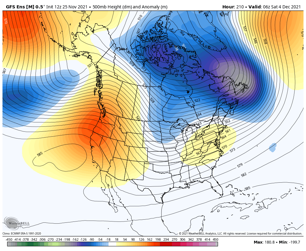
Temps are likely to come up a bit by the middle of the week but there are signs of another deep trough digging into the region late next week into the following weekend. The models vary on how strong this trough is, but the signal for a deep system is there.
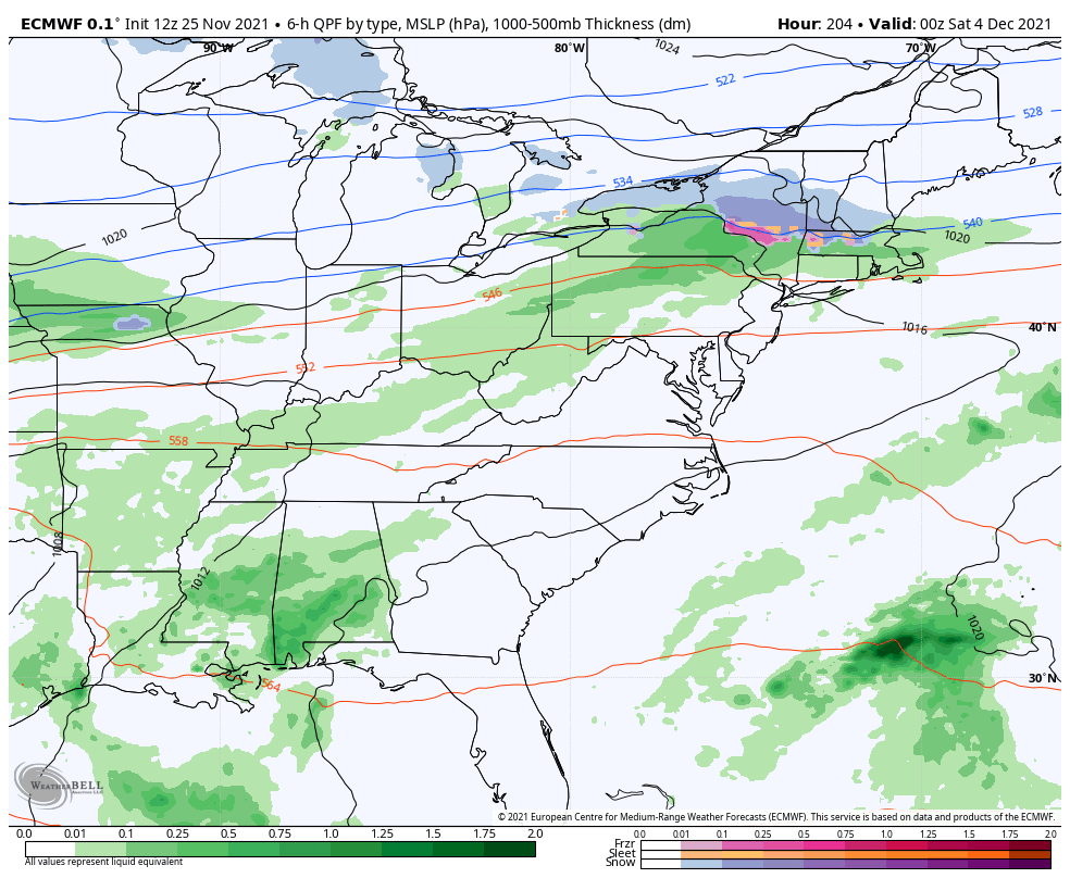
The EURO has an eye-opening setup…
The GFS Ensembles are pointing toward a deep system as well…
It’s out there in fantasy land, but the new EURO is an attention getter…
It’s just a week or so away… What could go wrong with a model forecast from this far out? 🤷♂️😎😁
Enjoy the rest of your Thanksgiving and take care.

The snow chance on the Euro is showing the best chance for a decent snowfall so far in this young winter season.