Good afternoon, everyone. We’re putting the wraps on a really nice weekend across Kentucky as we get set to close out the month of November in a few days. The overall pattern continues to look volatile on the models as a lot of flipping and flopping takes place.
There’s nothing really exciting in the near-term, so I’m focusing more on the pattern changes into the first week of December.
Up until a few days ago, the models were all agreeing on major amplifications showing up with the jet stream across the eastern half of the country. The past few days, most of the models flipped dramatically to a warmer signal. Now, we are seeing a slow trend back toward the colder look and that’s even in the Ensembles.
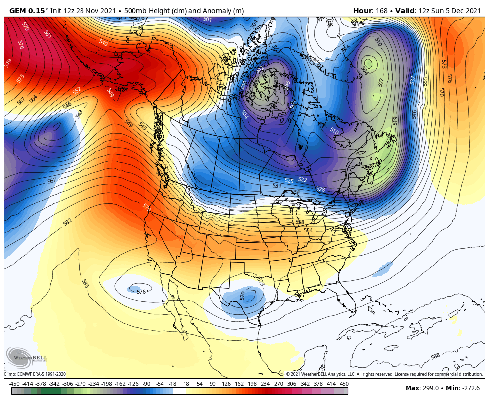
The one model that didn’t jump in with the warm chorus was the Canadian. The new run has an even colder setup from December 5-8…
You can see the cold surging in with this surface animation…
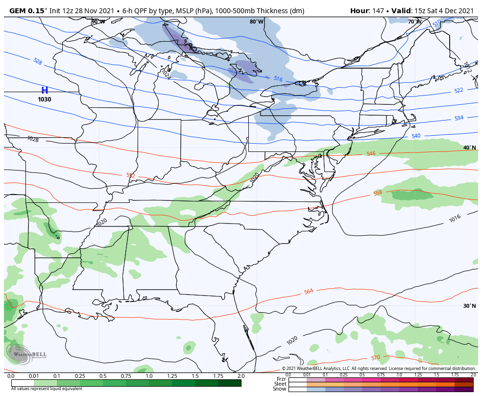
The EURO isn’t as erratic as it’s been over the past few days and has this at the surface…
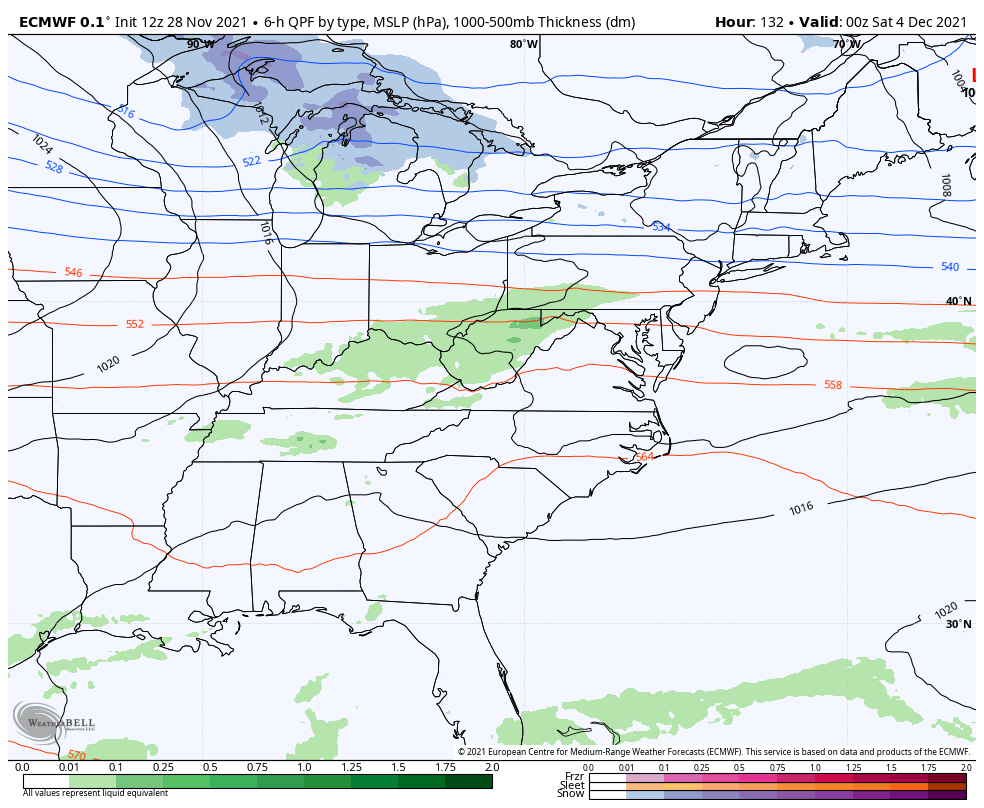
The bias of the EURO is to be too slow with troughs and energy coming out of the southwest. This setup means more wild solutions from the EURO are likely.
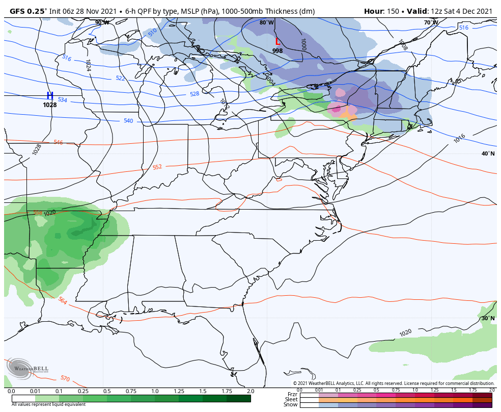
The bias of the GFS is to be too fast and flat with everything…
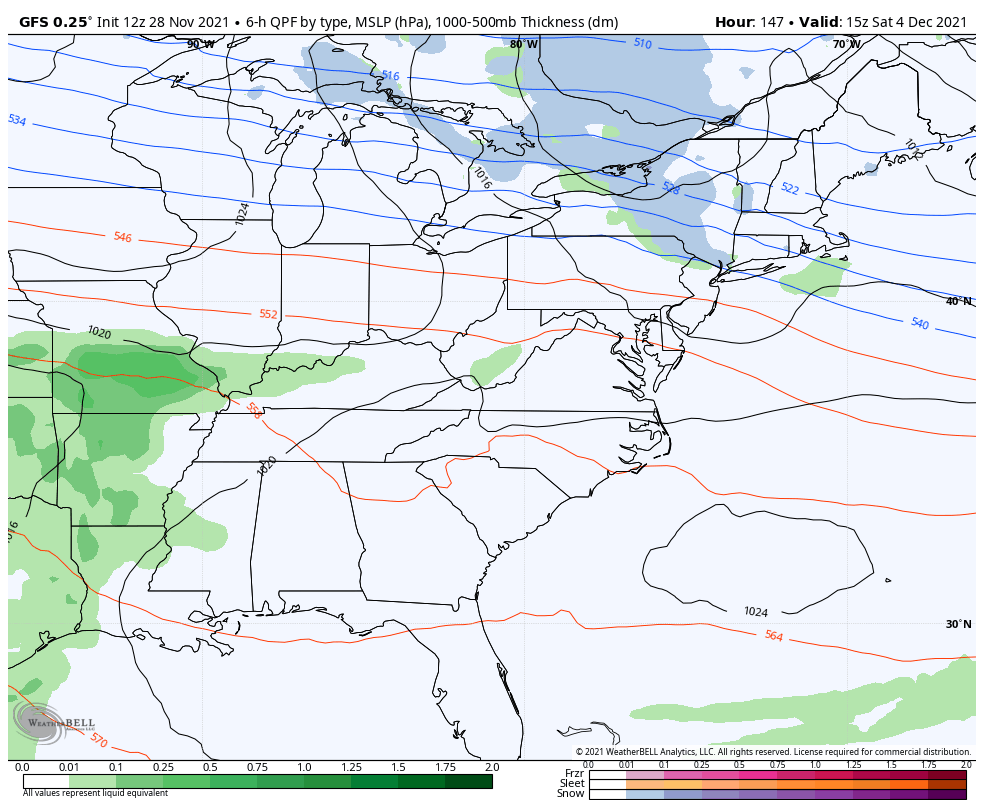
The 6z run of the GFS was more amplified and had a different outcome…
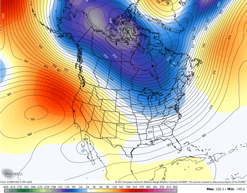
If we consult the ENSEMBLES to see what they have to say, they actually have a much colder look and suggest the operational run of the Canadian has a better idea than the other models.
Here’s the 5 day average 500mb height anomalies from the GFS Ensembles for Dec 5-10…
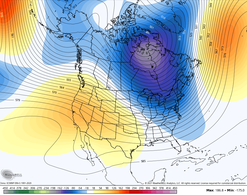
That’s a cold look for the eastern half of the country.
The EURO Ensembles are going that direction during the same time…
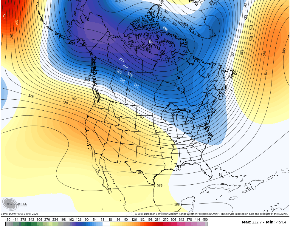
Here’s the control run of the EURO Ensembles…
I do think this pattern has a lot of wild temp swings in it for the first half of December before we flip back to a consistently cold pattern through second half of December into the first half of January.
Enjoy the rest of your day and take care.
