Good Monday to one and all. It’s a windy and seasonably cold day across the state as we get closer to finishing up the month of November. With December just a few days away, our temperature pattern gets set for some big ups and downs. 🎢
Temps start out Monday deep into the 20s with a wind chill in the upper teens. By the afternoon, a mix of sun and clouds boosts temps into the upper 30s to upper 40s across the state.
Tuesday is a milder wind blowing as clouds thicken ahead of some overrunning moisture streaming in ahead of a push of mild air. This means some showers show up for day one of December on Wednesday…
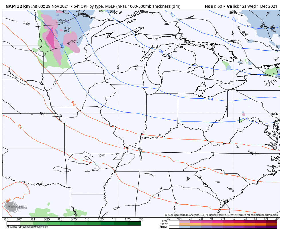
You can see the milder air pushing northeastward Wednesday afternoon…
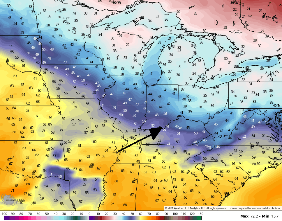
Temps make a run at 60 during the second half of the week.
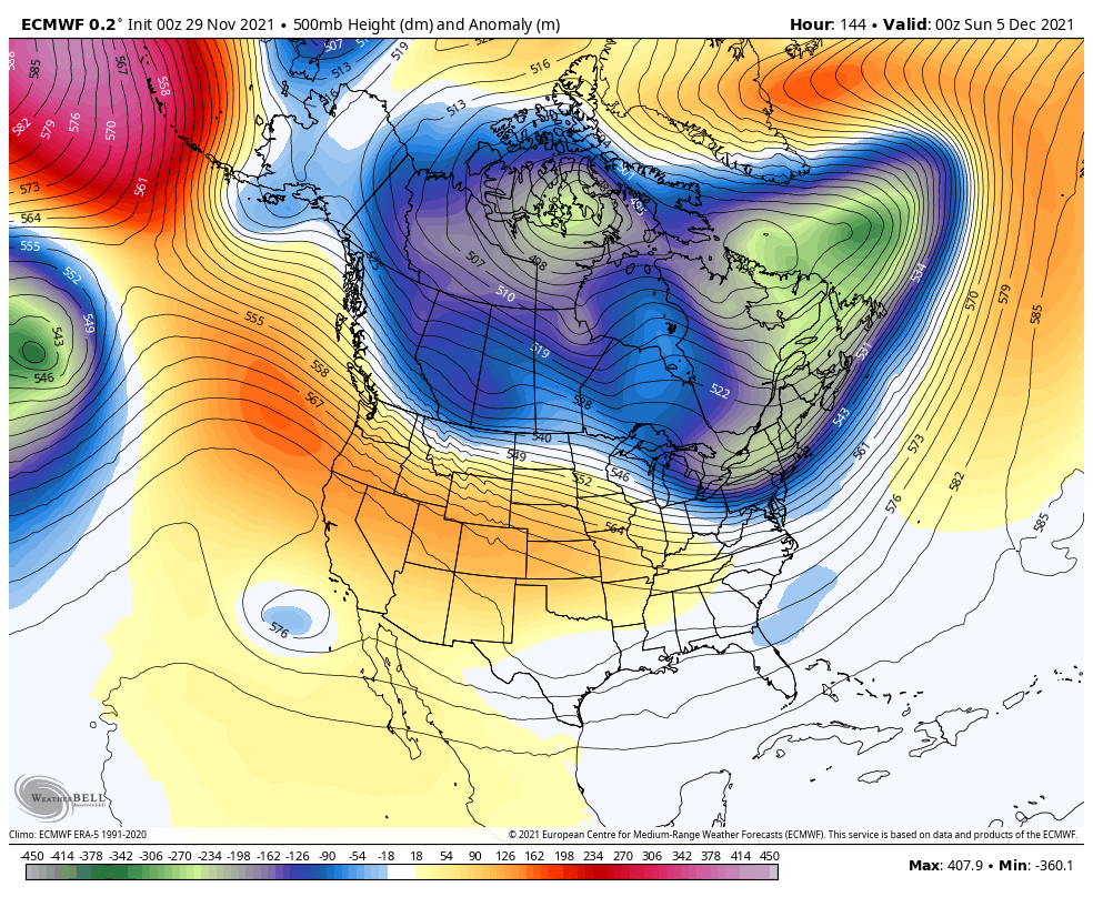
This brings us to the interesting part of the program as changes begin to show up this weekend. Some big time amplifications of the jet stream are likely across the eastern half of the country for the first full week of December. The first such dip in the jet may actually arrive this weekend.
From there, things try to get interesting. The Canadian Model continues to be the most consistent in putting deep troughs into the eastern half of the country and we are starting to see the other models going back in that direction.
The latest Canadian goes to the extreme…

The surface map is NSFW…

Told ya we would see some extreme solutions in all directions!
The EURO is back to seeing the troughs diving back into the east as opposed to them crashing into the west coast…
Here’s what the surface looks like…

The GFS is slowly coming back to seeing these troughs in the east starting this weekend, but then manages to leave energy back in the southwest with that system next week…

Here’s the surface…

Again, that’s a far cry from what the model was just showing over the past few days.
Moral of the story continues to be the models correcting toward more troughs diving into the east. This was something they were very consistent with up until 3 or 4 days ago when they somehow flipped on a dime. Now, the trend is back toward the original thinking.
This is why I caution against kneejerk reactions based on models. You could clearly see this was a pattern ripe for wild model swings and that’s what we’ve been seeing and will probably see for a few more days before they settle down.
I will have updates later today, so check back. Enjoy your Monday and take care.

Thanks Chris, I just can’t get interested in La Nina Winters. Maybe next year we will have a dramatic change in the Tropical Pacific from cooler to warmer which would give our part of the World a better chance of a Snowy Winter.
This weeks weather looks nice and quiet for outdoor yard work or for some late Fall fishing. I’ll take the fishing. LOL
Schroeder, some helpful research to know is no two La Nina Winters are alike, so don’t assume this one is going to be warm. That’s no better than what local Mets and weather apps do, and Chris has been talking about avoiding those all fall. Also when a La Nina winter follows a moderate one like we had last year it’s always weaker and colder, and this one looks to be in the cooler section. Plus we have an already negative QBO that’s likely to bottom out in January and February where last winter is was positive. So instead of throwing your hands up just because it’s a La Nina why not do some research or listen to Chris? I don’t mean to sound negative, but it’s like Chris says the weather will do X and you basically disagree with everything he says while showing no work for your conclusion.
A couple of good days ahead to finish up outdoor work.