Good Tuesday, everyone. We’re putting the wraps on a much colder than normal month of November with a fairly pleasant day out there. Things turn milder as we head into the first few days of December, but a very active pattern is a wild card starting this weekend and into next week.
I’m also going to take an extended look at a couple of the global indices to see how they can change the overall weather picture as we get deeper into December.
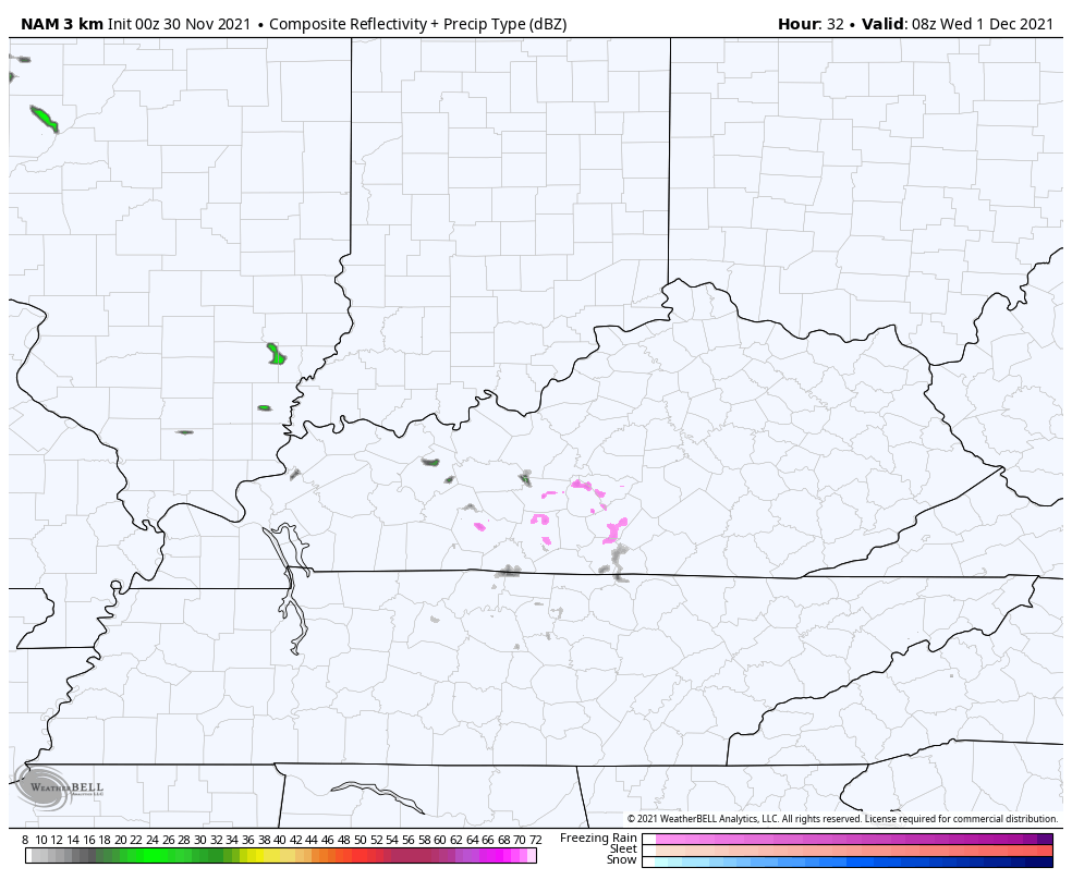
Let’s start things out with a system rolling in here for Wednesday. This is set to bring some nasty weather to start the month with showers and chilly temps on tap. Here’s the future radar from the Hi Res NAM…
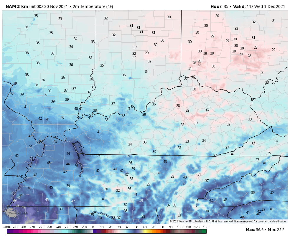
Can we get a touch of frozen stuff at the beginning of that? There’s a slight chance of that happening before temps warm into the 40s. Here’s the Hi Res NAM temp forecast from 6am-6pm Wednesday…
This is on the edge of much milder air surging in here for Thursday and Friday. Temps can easily hit 60 or better on both days.
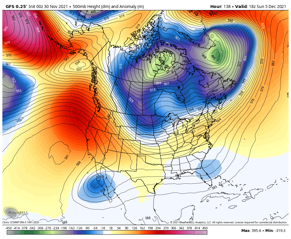
From here, we focus on the pattern likely to throw a couple of nice troughs our way starting later this weekend into next week. The GFS has a good handle on this first trough, but I think it’s lacking with the second trough…
Here’s what to watch for:
- A weak front gets in here with some showers Saturday.
- The next system arriving Sunday with rain increasing as low pressure works into the Ohio Valley.
- As this system moves to our east, it has a window of opportunity for some wraparound flakes Sunday night and Monday.
- Much colder air rushes in to start next week.
- Another system is likely to develop and follow this up by later Tuesday and Wednesday.
- All of these systems are still a work in progress.
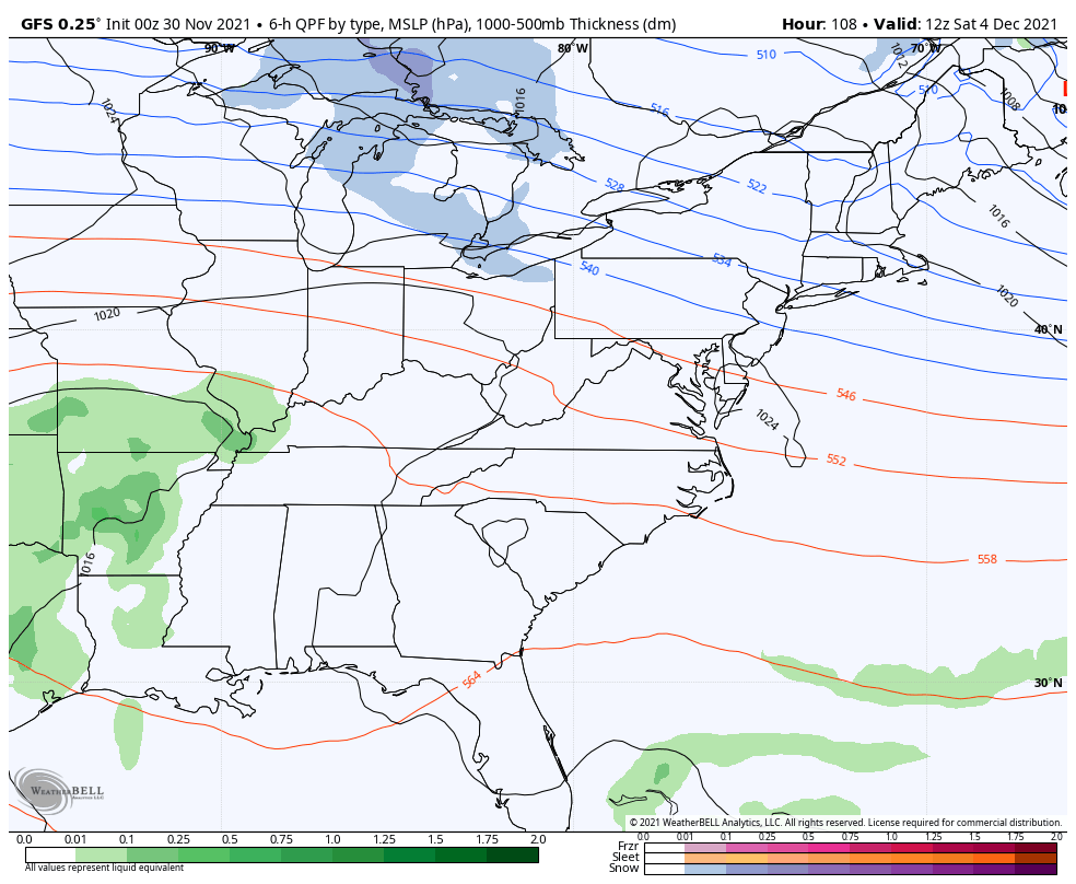
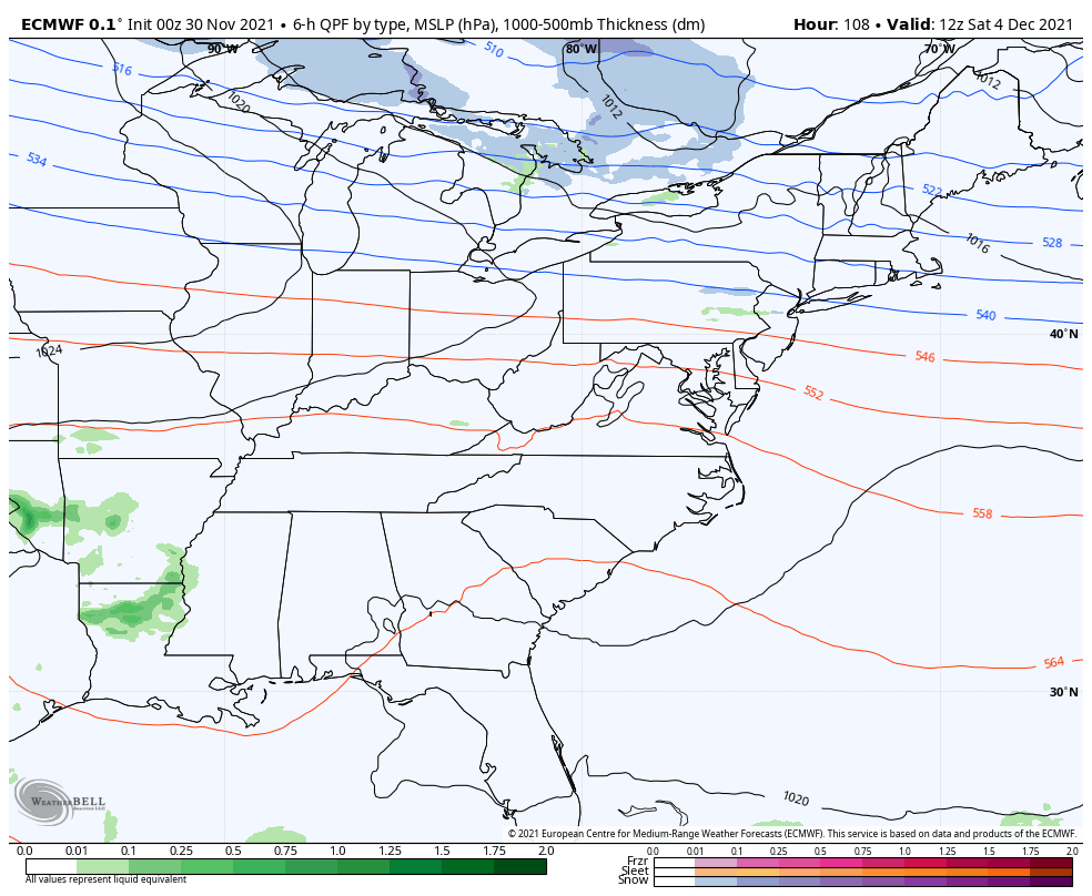
Here’s how the GFS sees the Saturday front and the bigger system behind it for Sunday and Monday…
The EURO had no such system on the Monday run, but the overnight model found it…
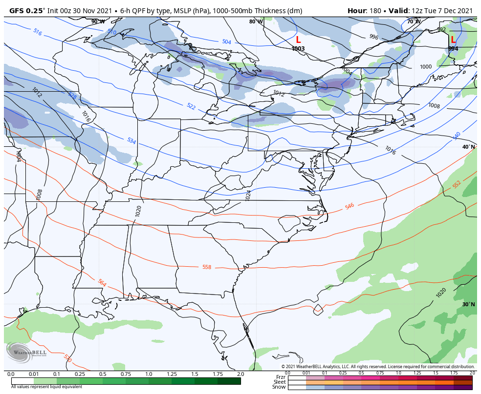
Here’s how both models see the second system…
GFS
EURO
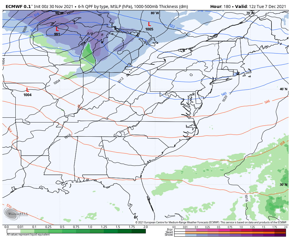
Told ya, this is a work in progress.
Two of the biggest drivers of the weather across North America in the wintertime are the North Atlantic Oscillation (NAO) and the Eastern Pacific Oscillation (EPO). For cold and snow lovers in our region, you like seeing either of those indices in a negative phase. If you can get both to match up negative, then that bodes well for snow and cold around here.
In November, we had essentially had a -NAO driving the pattern while the EPO stayed positive.
If we take a look at the GFS Ensembles forecast for the two of them over the next few weeks, we find the NAO averaging more positive in the mean with the control run more negative…
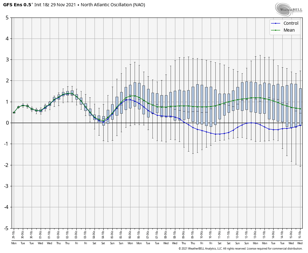
That’s a little conflict in the signal.
What about the EPO during the same time period? We find it dropping negative in the coming days before bouncing positive for a while, and then dropping strongly negative…
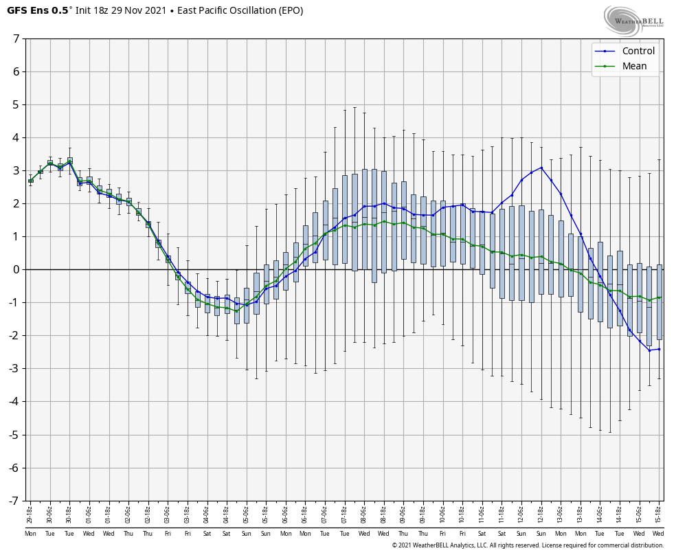
That would be around the middle of the month and would time out with my second half of December colder look.
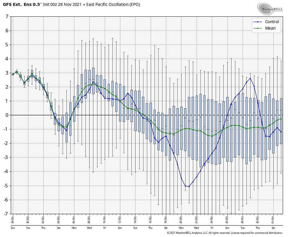
Backing that colder look up even more is the GFS Extended Ensembles EPO forecast. This goes through the month of December and shows that second half of December EPO tanking negative…
What about the NAO during this same period?
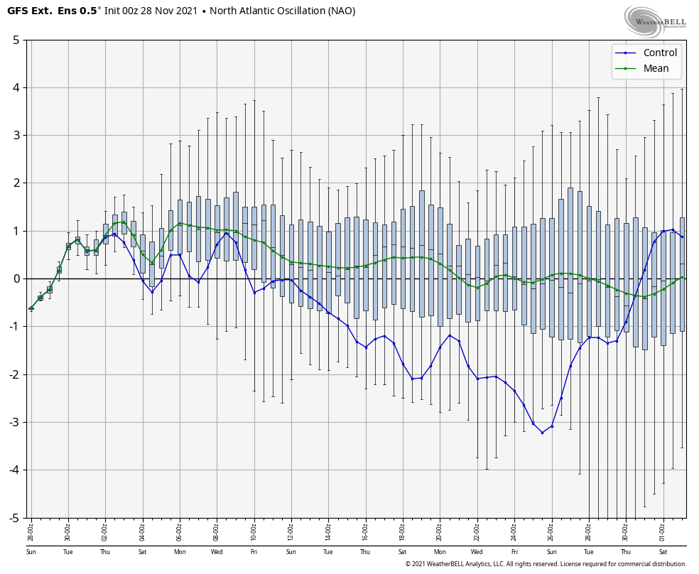
The MEAN is neutral to slightly negative with the Control going strongly negative. Again, if we can get a -EPO and a -NAO together, then you can get a harsh winter period.
Another index I’m cutting my teeth on is the Madden Julian Oscillation (MJO). I’ve made posts on this before and it can be a good indicator of where a generalized pattern is going over the next month of so. The MJO is currently heading into Phase 6 and is likely to go toward Phase 7. This diagram shows the forecast…
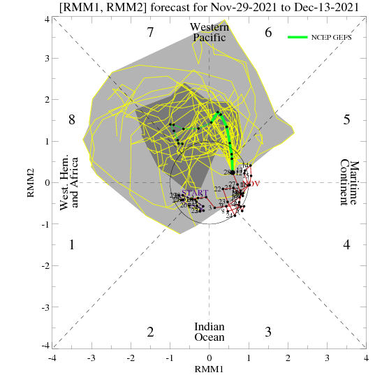
I realize that’s not a very easy thing to read, but it’s kinda cool for us nerds. The different phases give us different results at different times of the year. As we head into December we see Phase 6 means a pretty warm country with Phase 7 and 8 turning much colder…
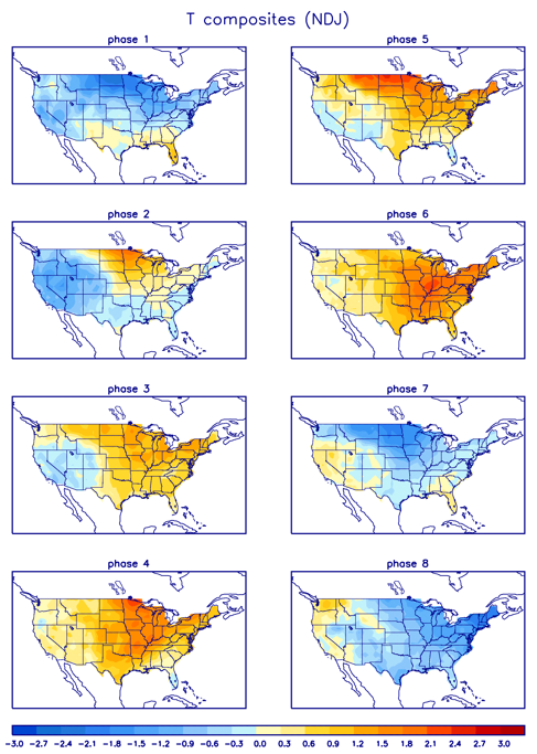
Phase 6 matches the pattern we are entering into. If you want a cold and winter pattern, you need the MJO to zip through Phase 6 and get into 7 and 8 pretty quickly.
Now you guys see why I don’t get caught up in kneejerk reactions to model flips and flops as I look at a whole lot more than just what I have the time to share here on KWC.
I will throw you additional updates later today, so check back. Make it a good one and take care.

Thanks Chris for taking the time to explain what is currently going on in our Global atmosphere. A wait and see game as to how the Teleconnections will behave this coming Winter.
I also watch the PDO which is currently negative and will most likely stay that way, but there is some indications that may change in the Spring 2022 ?
The GFS Computer Model shows significant snows hitting the Chicago area Sunday and late Tuesday, which I’m not buying into at all. The European Computer Model shows those snows much further to the north in Wisconsin, which I think is the more likely case.
Mike, I just checked out the Ventusky weather site through the middle of December and found not a flake of Snow for my area of Kentucky. Looks like now we will just have to wait for that major Snowstorm a lot longer than I thought earlier.
Don’t know what models the Ventusky weather site uses for their extended forecast. I just supposed they use the average of the three main ones ?
All of this changes day by day.