Good afternoon, folks. As we end November, we are looking ahead to the start of December and things continue to look to start out with some big temps swings. That’s right… We are about to take a ride on the temp roller coaster.
Before we look ahead, check out this fun fact about November…
Lexington finishes November with 15 days with lows in the teens and 20s. That ties 1984 as the 3rd most 29 or colder lows in the last 50 years.
Only 1976 (18) & 1995 (16) had more. #kywx
— Chris Bailey (@Kentuckyweather) November 30, 2021
Does this mean anything about the winter ahead? The sample size is low, but all three of those winters turned harsh and had memorable events. 1976/77 is legendary and so is 1995/96. 84/85 may be the most underrated winter ever around here. December was incredibly mild before January and February turned crazy cold and snowy.
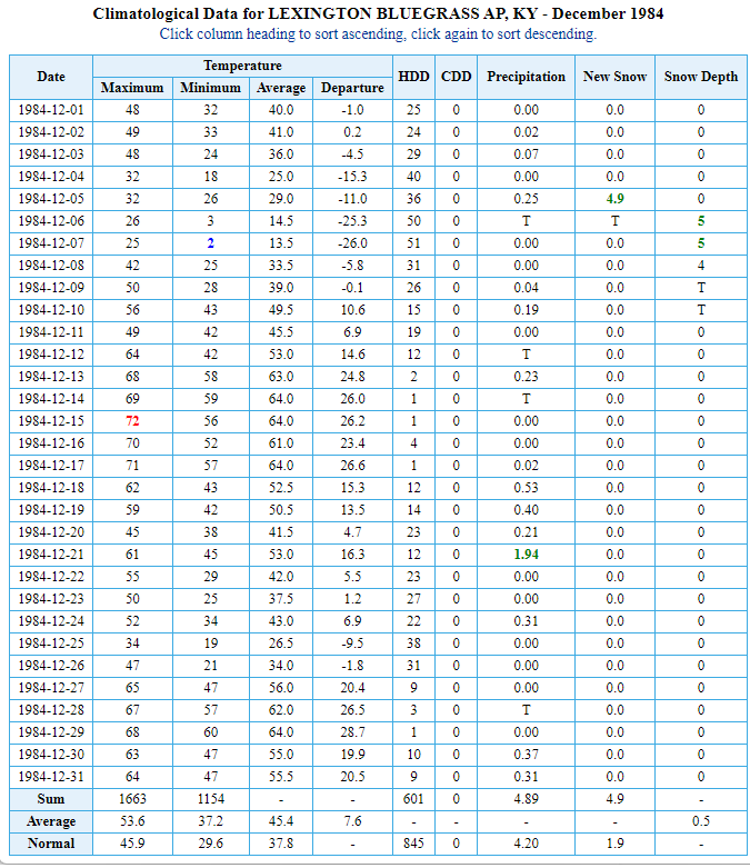
Look at how warm that December was for Lexington…
Think of how crazy snow lovers would be going if that happened today? 👀
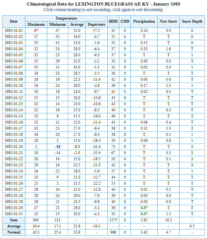
Now, watch how fast this flips after New Year’s Day…
That continued into February…
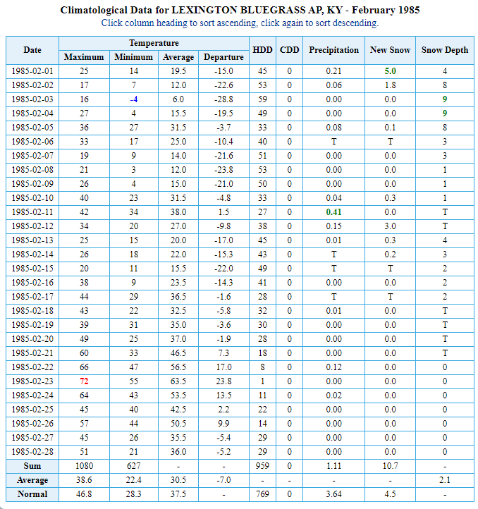
We had snow on the ground for roughly 6 straight weeks.
The one thing that is becoming lost with this new version of meteorologists is historical perspective. If you don’t know the history of your forecast area or have any kind of climatological perspective, you’re in this for all the wrong reasons. Unfortunately, this is the reality of many professions nowadays. I’ll spare you guys of a good old fashioned CB rant. 😜🤣
As we look ahead, we find the models starting to take on a more similar look over the next week. It’s a look they originally had before going haywire for a few days and this is usually something we see in today’s modeling world.
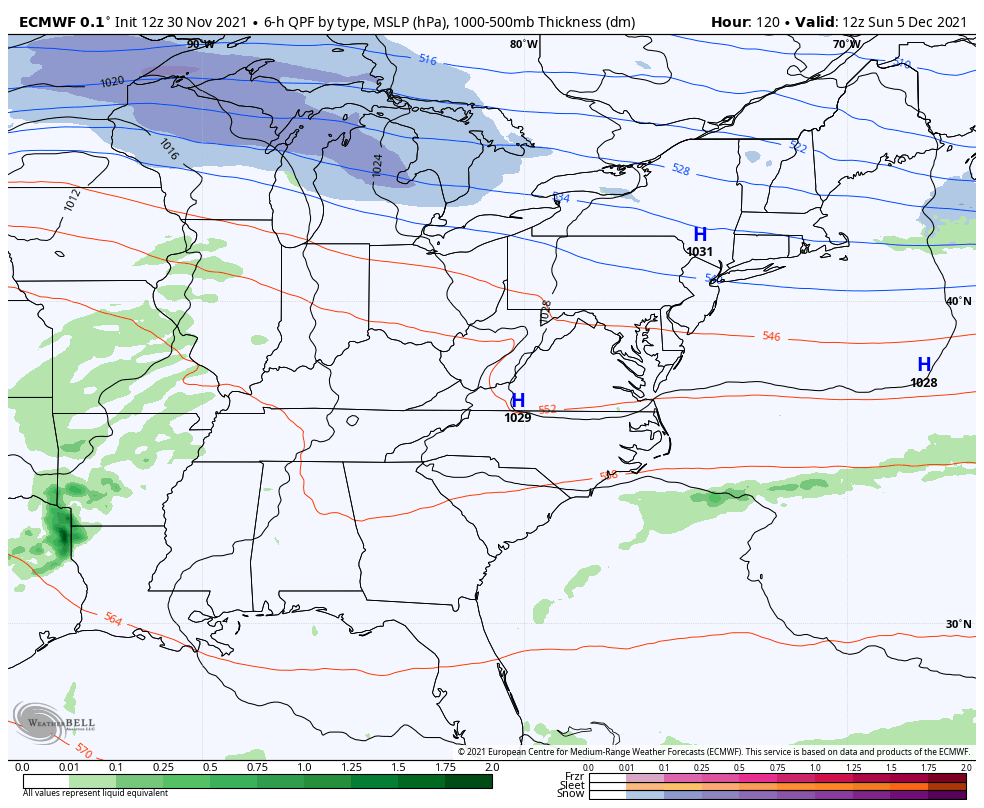
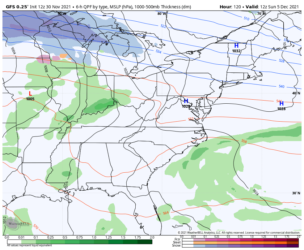
The EURO has come around to the Sunday-Monday system moving through with cold air crashing in and the chance for some flakes behind it…
The GFS is a little too progressive with this system…
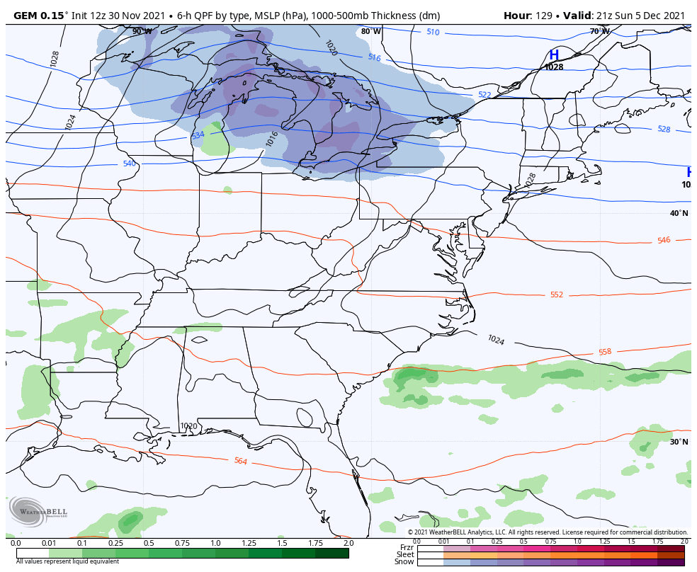
The Canadian had nothing, but the new run found this system to an extent…
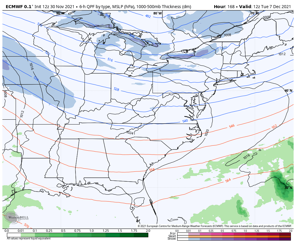
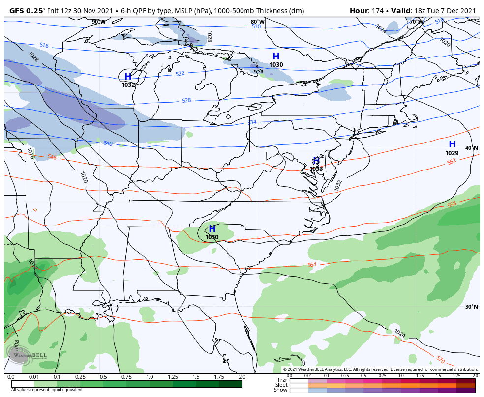
The second system may wind up being the more interesting of the two as it moves into the region late Tuesday and Wednesday of next week. The EURO is now going toward a full blown winter storm for the Ohio Valley…
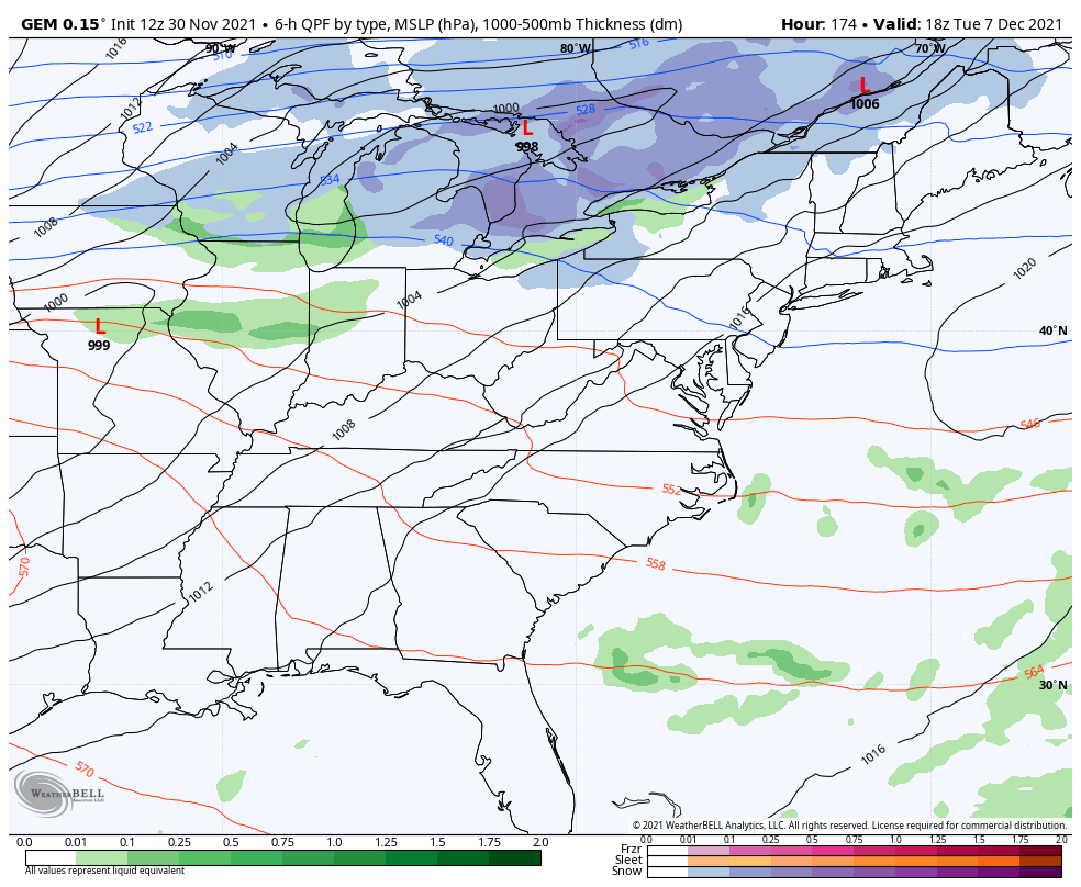
The Canadian is doing something similar…
The GFS is trying…
We certainly have no shortage of systems to track in the first full week of December.
Enjoy the rest of the day and take care.

It looks like all the ingredients are in the snow pot. Let’s see how the stew that is beginning to brew turns out.