Good afternoon, folks. It’s a little dreary across parts of the state as showers roll through, but these showers are bringing much milder air to the region. Once into the weekend, things begin to change as we track the first of two systems in here. Can we get some winter stuff we these two? Maybe.
As mentioned, scattered showers are out there today with the greatest concentration in the north. A broken line of showers then works through the area into the evening, but this won’t amount to much. Here are your radars…

Temps continue to look really mild for Thursday and Friday. Temps come down some for Saturday as dry weather continues.
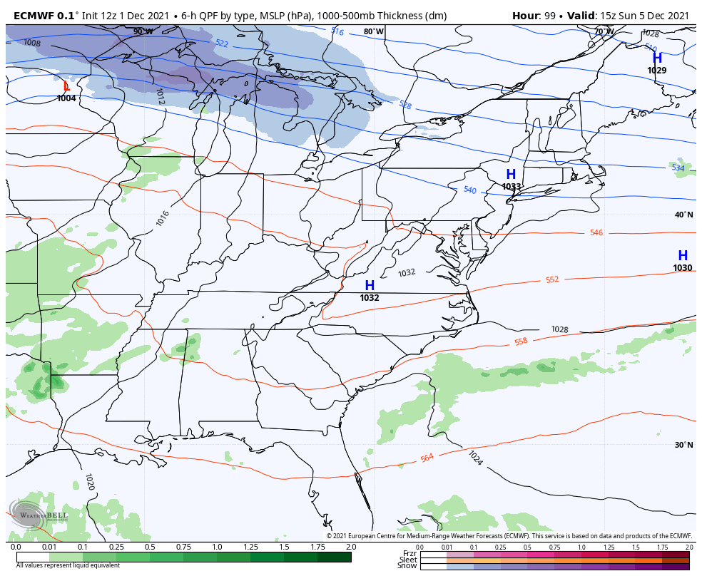
Those numbers bounce up again Sunday as we get ready for the first system to roll across the region. This is the first of two, or maybe even three, systems to impact us next week as the jet stream continues to dive into the eastern part of the country. The models continue to jump on this more and more. Check out the EURO…

Low pressure works into the Great Lakes and drags a cold front across Kentucky Sunday night and early Monday. Rain increases ahead of this front and there’s the potential for some flakes behind it as the cold crashes in. Here’s the EURO…
 The GFS now shows a period of light snow and flurries Monday morning…

The Canadian has a low flake chance…

The next system moves in quickly behind this for later Tuesday and Wednesday, but the models are bouncing around with where the low tracks. The latest EURO has a much colder look than earlier runs and now has two lows moving through here…
The Tuesday-Wednesday system is also showing up colder on the Canadian…

The latest GFS decided to take the low into the northern Ohio Valley and Great Lakes…

The prior run of the model was down in the Tennessee Valley…

So the latest trends are for a colder week and that, at least, gives us better odds for some winter weather across our region. Again, that’s why we don’t do kneejerk forecasts based on sudden, and likely, bogus model flips.
Enjoy the rest of the day and take care.

GFS= yo-yo. or “on the other hand.”
Since I have December 17th off of work, I am ALL IN on this:
https://pbs.twimg.com/media/FFjzrORXIAMk4za?format=png&name=medium