Good afternoon, folks. As I continue to hone in on how next week’s active setup plays out, I get a little more concerned about the possibility of too much rain falling in our region. An active storm track is taking shape and it could put down a lot of water in this region.
The setup for next week features some big dips in the jet stream across North America and how the models handle these dips is still changing, but we find the EURO and Canadian in the same camp while the GFS is alone in what it’s showing. Stop me if you’ve heard that one before.
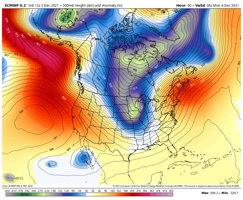
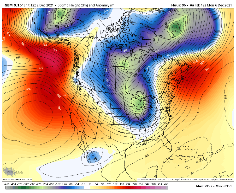
The EURO and Canadian are much more progressive with these systems rolling out of the west and give us a colder overall look…
EURO
CANADIAN
This is a very active setup with frequent systems moving through here with a lot of precipitation on the way.
The first system arrives later Sunday into Monday and likely brings heavy rain into the region. This may end as a few flakes on Monday…
EURO

CANADIAN
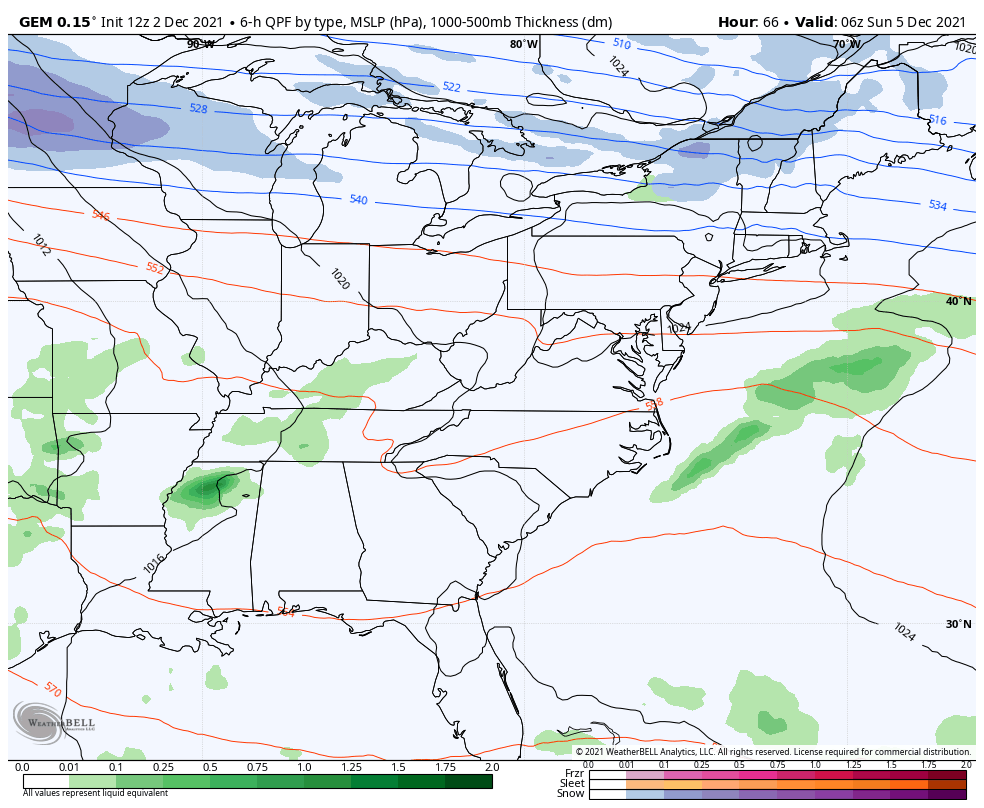
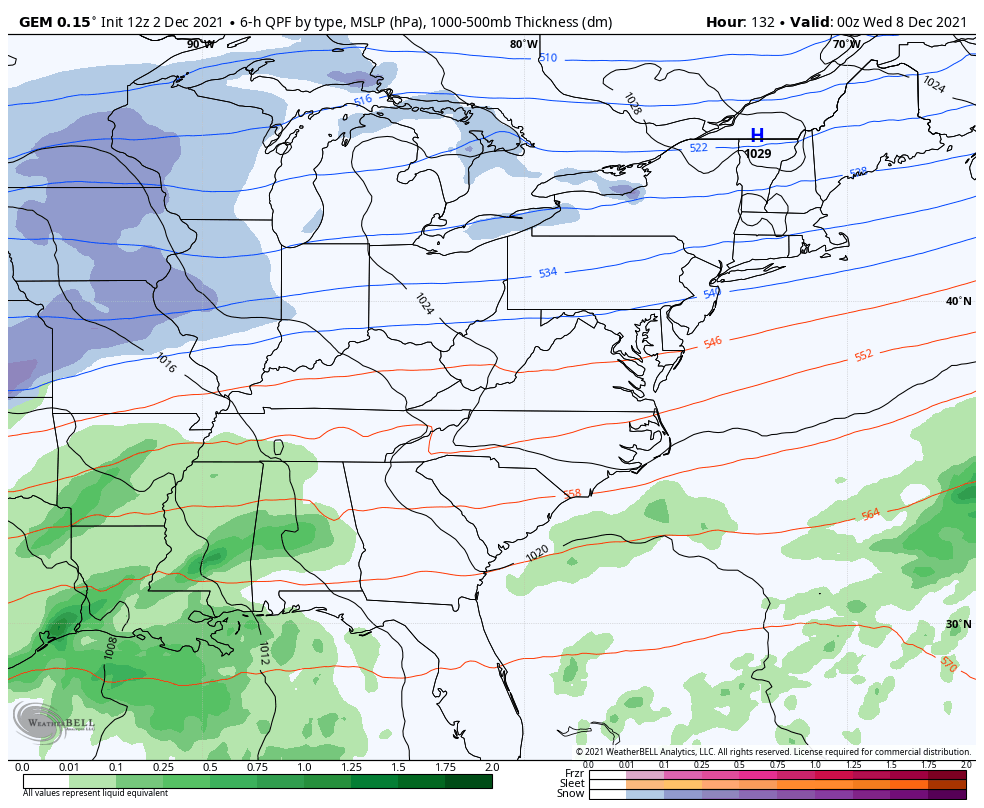
GFS

I mentioned how the EURO and Canadian are much more progressive with the troughs coming from the west. The GFS has a much different look as it holds back a lot of the energy. I was looking at the upper air plot from the GFS for next week and I thought, “I’ve seen this before”.
Here’s the GFS for the middle of next week…

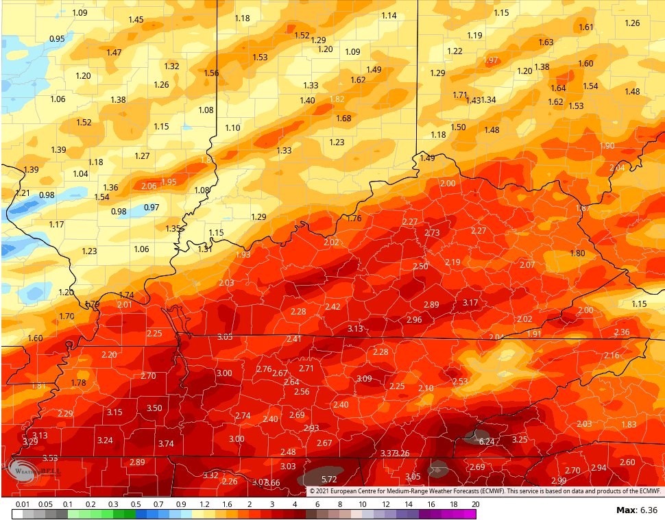
Now, check out the same week back in December 1978…

December 1978 produced massive flooding across the region, so let’s hope this scenario doesn’t play out even close to that. But, you can certainly see the similarities in the overall setup. As someone who studies weather events of the past, it certainly got my attention. For reference, December 1978 was mild and very wet across our region then January and February turned brutal.
That means the GFS has all rain makers showing up through the week into next weekend…
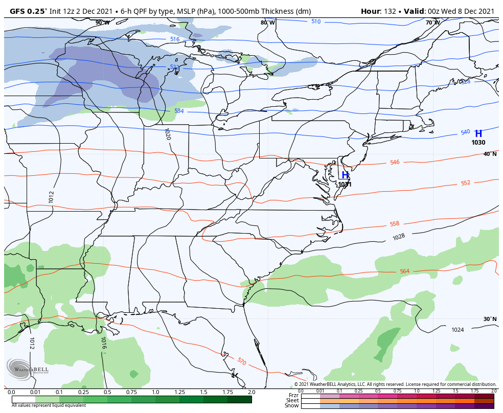
The GFS rainfall forecast through next week…

The EURO and Canadian Models are much more progressive with the systems and have that colder look with a touch of winter weather.
EURO
CANADIAN
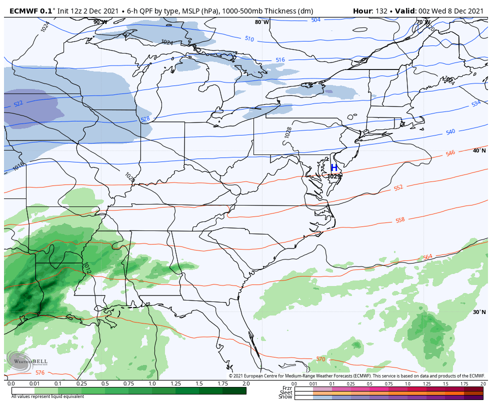
Both models still produce a lot of rain around here during this time…
EURO
CANADIAN

So, this is a very active pattern taking shape and we have to be on guard for too much rain over the next week and change. There’s also the chance for winter weather to creep into the mix as well.
This is going to be an interesting pattern to forecast, so check back.
Make it a great rest of the day and take care.

A lot of cold rain headed to your town next week.
Don’t want any flooding, but I take the rain .