Good afternoon, folks. As we head into the first weekend of December, we continue to look ahead toward a very active weather pattern across our part of the world. This setup can bring a lot of rain our way and even has the chance for a touch of winter weather from time to time.
We have a weak cold front dropping in here tonight and Saturday and this will knock our numbers down some. This also has the chance to produce some light showers across the southern half of the state. Here’s the area the NAM thinks will see some rain through Saturday morning…

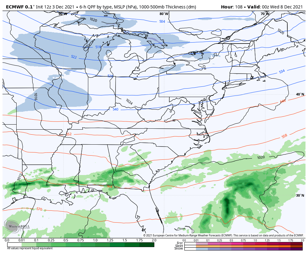
Temps surge again Sunday as a powerful cold front pushes into the region from the west. This will bring a few showers in here during the day, but the bulk of the rain arrives along the front Sunday night and early Monday. This has the chance to drop a quick inch or two of rain. Here’s the GFS…

The EURO

Winds are a big player Sunday night and Monday. Check out some of these gusts…
GFS

NAM

The setup after this system continues to look similar on the GFS and Canadian models, but looks much colder and more like winter on the Euro.
The EURO has these troughs much more progressive and move much farther east into our region…

That leads to several systems that can take on a little more of a winter look…
The GFS is actually going more in that direction with those systems, but is still much wetter…

The rainfall map over the next 10 days is concerning…

The Canadian is actually just a bit northwest with the heaviest rains…
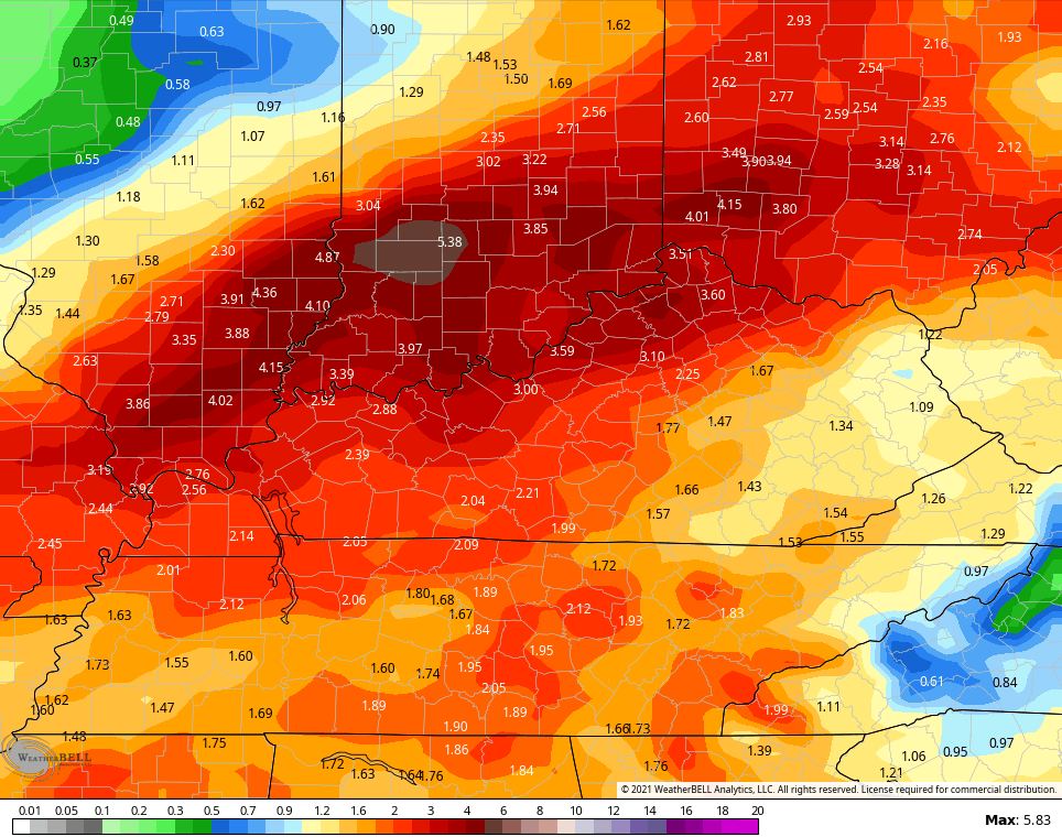
The EURO has much lighter amounts…

Here’s hoping the EURO verifies for many different reasons, but the lower rain amounts being the main one.
Make it a great rest of the day and take care.

Chris…my question. Is this typical to have rapid changes troughs to ridge…then repeat for this time of the season?