Good Saturday, folks. It’s a chillier pattern taking shape across the region today, but bigger changes are on the way for the first full week of December. Several different systems will roll through here and could put down a lot of rain and even bring some winter weather. This is a wild pattern that deserves a long post so buckle up.
Temps today are down compared to the past several days, but are still a bit above normal as a weak front moves in. This is also touching off some early day isolated showers across southern Kentucky…

Gusty southerly winds kick in on Sunday as temps surge one more time. This will bring a few showers into the region as the day wears on with heavy rain and some thunder moving through Sunday night and Monday morning.
As a matter of fact, there’s a low-end risk for a few severe storms in the west late Sunday…

This line rolls across the state Sunday night and Monday morning with gusty winds that can reach 50mph in some spots…
NAM

GFS

Rainfall numbers with this system are likely to hit 1″-2″ in some areas of the state. The models have their typical differences on where the heaviest rains show up…
NAM
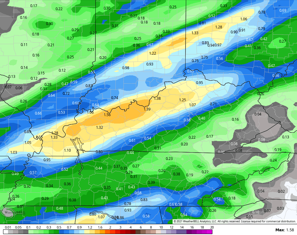
The GFS actually has a swath of higher amounts…

Temps crash into the 30s behind this front and stay there through the rest of the day. Gusty winds make it feel much colder than that through Tuesday morning. Here are the wind chills from the GFS from 1am Monday through 7am Tuesday…
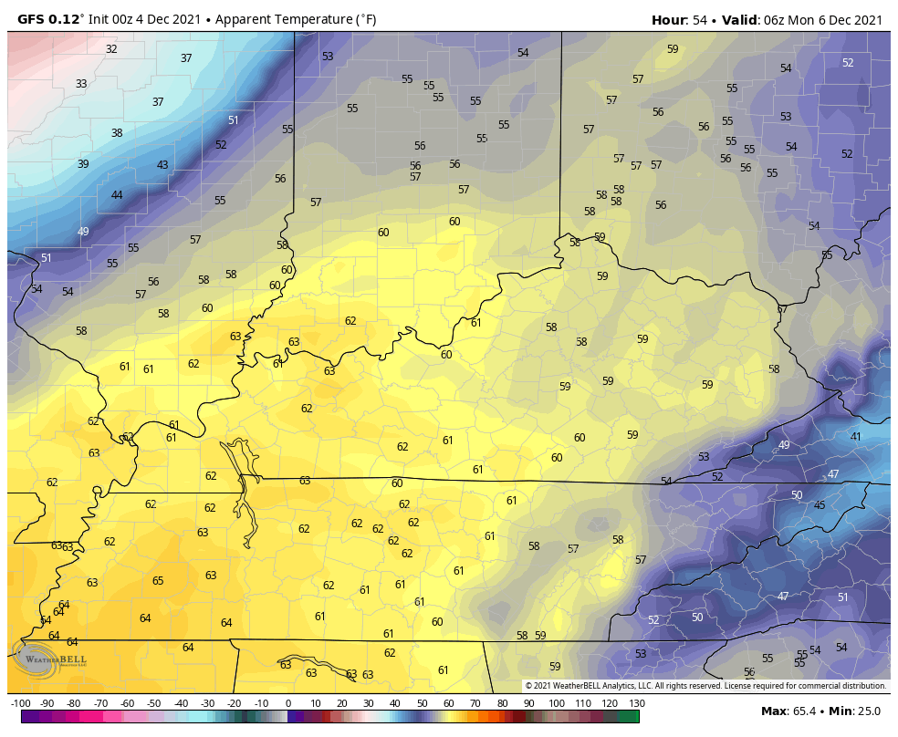
The EURO has even colder wind chills…

That’s quite the change folks!
The EURO has been showing troughs in the west coming east and they’re showing up deeper with each run. Now we have the GFS joining in on the party, giving us a better potential for some winter weather. Here’s how the GFS sees the next system arriving late Tuesday into Wednesday…

That certainly looks more interesting as it would bring rain, a mix and some light snow to the region through early Thursday.
The Canadian is trying to do something similar…

Ironically, the EURO has now lost this system as it keeps the streams separate…

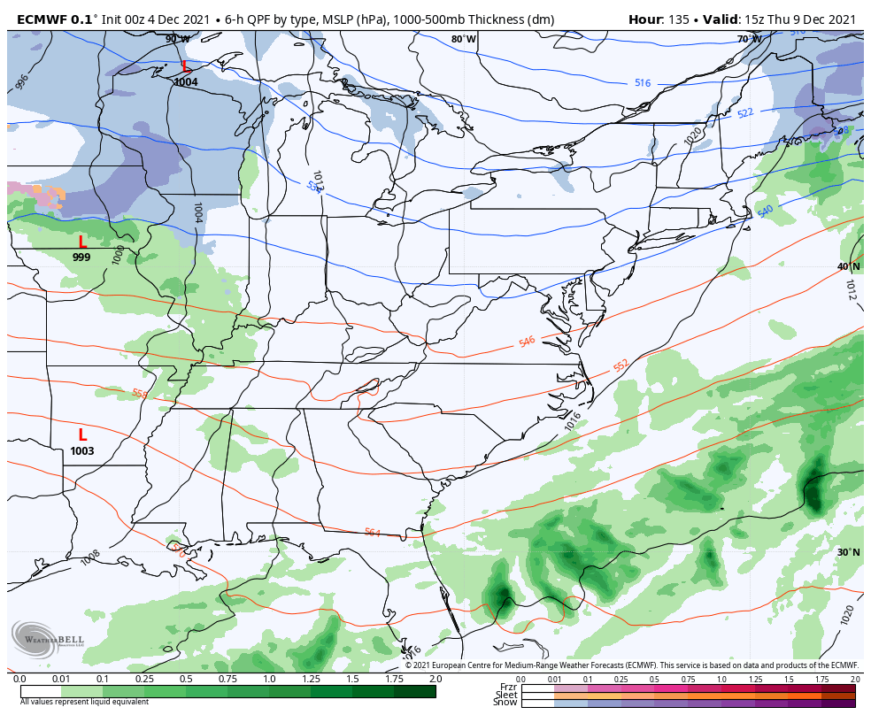
The system coming behind this next weekend is looking stronger and stronger with big thunderstorms to snow on the GFS…

The EURO has a weaker system ahead of that on Thursday, but the weekend system is even stronger than what the GFS has…
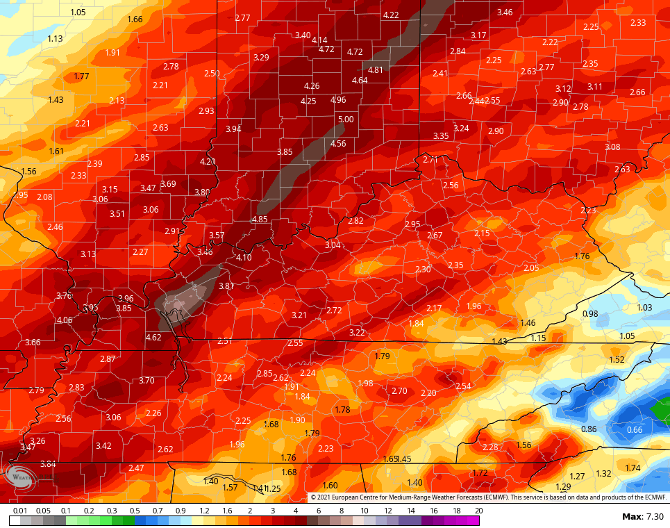
As far as total rainfall is concerned through next weekend, the GFS is still showing troubling amounts…

The Canadian continues to be a little lighter and farther northwest…

The EURO has increased totals…
I’ve touched on the MJO in some recent posts and how this is moving into a more favorable phase for cold air as we get deeper into December. I suspect we are seeing the models respond to this right now.
The latest MJO forecasts show this moving into Phase 7. Here’s the one from NCEP…

Some of the members have major amplitude as it gets into Phase 7 with a few going toward Phase 8.
The EURO extended also goes into Phase 7…
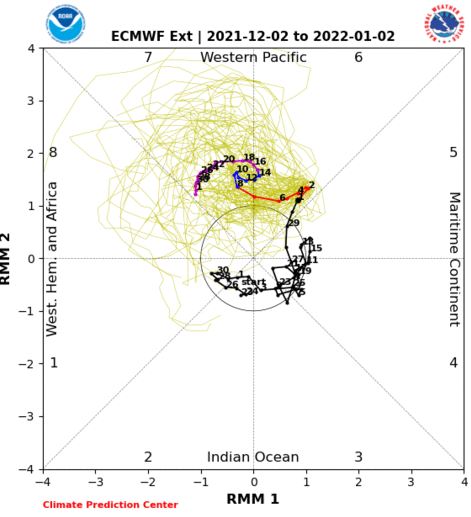
Notice how similar that matches up with the NCEP run.
For references, Phase 7 for December is typically much colder…
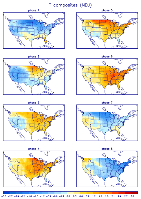
You can see how Phase 8 is even colder.
I will have another update later today. Make it a good one and take care.

Thanks Chris, I’ll take the rains in any amount. A lot of dry woods around my property. Certainly don’t need a Forest fire.
If the forecast for the MJO does go to phase 7 or 8, wouldn’t the NAO and AO be strongly negative ? If it did we could have a better chance for Snowstorms here in Kentucky.
The Ventusky Weather Site however is seeing no change through the 18th of December. In other words more of the same according to them.
The significant snow that was predicted for Northern IL for Tuesday/Wednesday by some of the computer models earlier this week is now scaled back to just a little light snow.
It will be cold though with wind chills approaching zero for Monday night/Tuesday morning.
Snow showers on the backside of the low pressure system are forecast for later this week for my area of Kentucky. If this occurs it will be our first flakes so far this season. Can’t wait to build that “Frosty the Snowman.” LOL
Models starting to react to MJO