Good afternoon, folks. A potent cold front is working toward the region and is bringing the potential for severe thunderstorms and high winds. This boundary will also introduce much colder air and may have a quick-hitting light snow maker coming in behind it by Wednesday.
The line of strong to severe storms develops across western Kentucky this evening and rolls quickly across the state. Damaging winds are the main player, but there is a low-end risk for a tornado spin up.
The Storm Prediction Center continues to highlight the severe threat across central and western Kentucky…

With out without true severe storms, high winds are possible. Gusts of 50mph will be possible…
Hi Res NAM

GFS

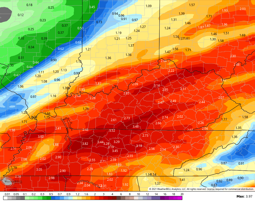
Heavy rainfall of 1″-2″ will be possible with this line, but the models vary on where the heaviest rains occur. Here’s the current thinking of the GFS…

Local high water issues may be noted late tonight and Monday morning.
Colder winds blow Monday into Tuesday as temps come way down. A quick-hitting streak of light snow then tries to impact the region late Tuesday into Wednesday. The GFS shows this well…

Here’s the Canadian…

EURO

Another light system works in here late Thursday and Friday with a much bigger system for the weekend. The models continue to waffle on how to play this one. The current GFS is mainly a heavy rain and thunderstorm maker…

The GFS run right before that looked much different and had rain to snow…

That looks a little more like the current run of the EURO which has a lot of rain and storms to some snow…

The rainfall forecasts through next weekend continue to be way up there on the EURO…

GFS
CANADIAN

I will drop by for another update if needed later today. Until then, here are your Sunday storm tracking tools…

Current watches

Possible Watch Areas

Enjoy the rest of the day and take care.

GFS probably has the best handle on future events.
I would only show the weather models when they are in agreement. Which is seldom.
The storms that will eventually comprise a squall line are starting to pop up in Northern Arkansas/Southern Missouri. We can expect serious downpours and gusty winds. Also, the SPC predicts bowing along portions of the line, which could significantly amp up the winds. Fortunately, the jet stream will not be playing a role over Ky(see link), so shearing and rotation should be minimal, once the line reaches our area.
https://weatherstreet.com/models/gfs-jetstream-wind-forecast.php
Might have to mow the lawn again with the rain and heat showing up on models..Personally don’t believe what’s showing but who knows..PNA on steroids.NAO heading in the wrong direction,MJO stuck in phase six and don’t want to move..It’s early so there’s that..Maybe around Christmas thing’s improve.
Put in more perspective the fall and winter is still fighting to transit to change and of course it’s early I have seen December be warm and then boom the fartic air takes over. Only mother nature knows