Good Monday, folks. Our day is starting out with heavy rain, strong storms and big time winds rolling across the Commonwealth. This is ushering in more of a winter look and feel for the next few days and may even bring some light snow in here. Down the road, we are watching a major storm system for the upcoming weekend.
As mentioned, this morning is bumpy across the state as the line of strong to severe storms moves through. Damaging winds and local flash flooding continue to be the main players. All your storm tracking tools are at the bottom of this post.
The rain moves out very quickly today with cold air crashing in behind it. Temps drop into the 30s with a gusty wind making it feel much colder than that. Wind chills late tonight reach the middle and upper teens…

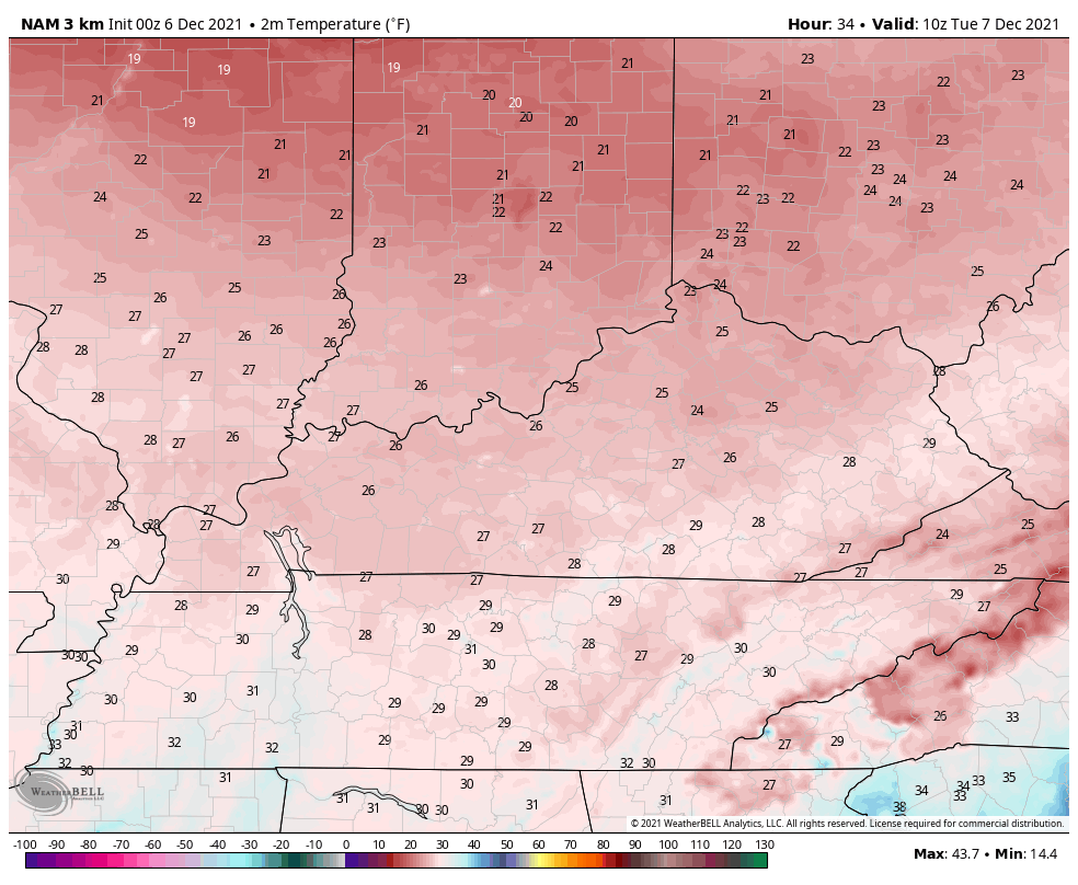
Tuesday is a cold day with temps in the low and middle 30s. Here’s the Hi Res NAM temp forecast from Tuesday morning through 7pm Tuesday…
A system moving in Tuesday night and Wednesday morning will likely have a quick-hitting area of light snow with it, but the models vary on where to place this.
The GFS has been most consistent with our system…
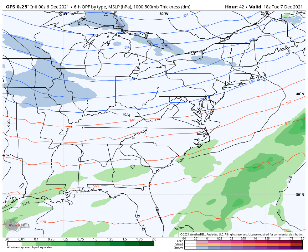
This run of the GFS is putting down a light snowfall across the northern half of the state…

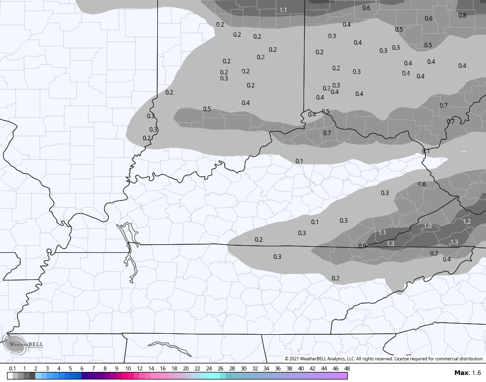
The Canadian is a little more choppy with the light snow with one band north and another in the southeast…
The EURO has really struggled to find this system and is also choppy and farther north…

A weaker system moves in with some showers late Thursday and early Friday and that sets the stage for another potent storm system for the weekend. This will likely feature a mild surge of air ahead of it and a big temp crash behind it. Near record highs are possible Saturday before temps drop nearly 40 degrees in less than 24 hours. Heavy rain and strong/severe thunderstorms will be likely ahead of it with the potential for a switch to some snow as the low goes by.
The models continue to flip around with the track and timing of it all, but that’s normal from 5 days out.
Here’s how the current GFS sees things…

The Canadian Model has a little better snow look…

This run of the EURO continues to look suspect…

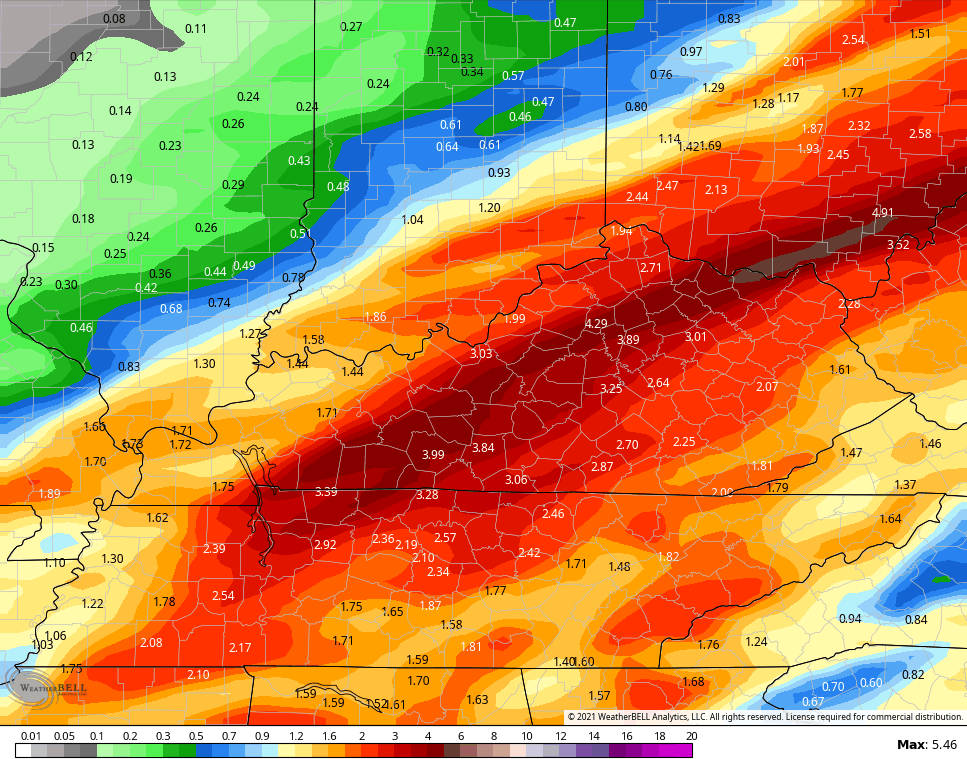
The rainfall numbers from today through Sunday continue to show some concerning totals…
GFS
Canadian

I will have updates later today so check back. I leave you with your early Monday storm tracking tools…

Current watches

Possible Watch Areas

Have a great day and take care.

Very heavy rain, lighting and thunder and occasional power failure high lights this morning’s weather in Maple, Kentucky, but we really need the rain to wet down the dry leaves covering the Forest floor and Mother Nature is doing a good job as I write this post.
Doesn’t look good for any Snow accumulation for my area of Kentucky in the next 10 days. This La Nina is destroying our chances for receiving any measurable Snowfall as it appears to be getting stronger in intensity as we approach the Winter season.
NOAA and the Ventusky Weather Site are still showing a “blow torch Winter.” UGH !!!
Looks like it may warm up after the weekend..Chris did say would be a roller coaster..You can see the AK ridge rebuilding around the 20th so maybe just in time for a Christmas surprise..It’s still early so I wouldn’t say a blowtorch winter..La Niña winters are known for wild up and down swings temperatures wise..
All I see is hype and no true cold or measurable snow. Other than that big cold ten-day period last Feb, winter last year was warm too. I expect more of the same.
What is really troubling and unexplainable to me is the teleconnection called the Pacific Decadal Oscillation. The current phase of the PDO is strongly negative. The question I have is how this effects the other Oscillations like the NAO, AO and the PNA ?
I know that the PDO is affiliated with ENSO. And why was the Winter of 1917-18( a La Nina Winter) which was one of the coldest and snowiest Winters of the 20th century in the eastern part of the US ? The PDO would have to be in the positive phase, which would mean an El Nino Winter ? Very confusing to me.
OK based on rainfall – that last system definitely overperformed
In my area of North Taylor County we recorded around 3.00 inches of rain in the last 48 hours. The water runoff was tremendous. Going into town this morning all the Creeks were out of their banks.