Good Sunday, everyone. It’s a much calmer day across Kentucky and that’s desperately needed after our state experienced one of the worst tornado outbreaks on record. A lot of communities and families are struggling so send them up a little prayer if you’re the praying kind. If not, some good thoughts and vibes can’t hurt.
Our overall weather pattern is about to undergo some big changes in about a week from now. These changes will likely result in a colder pattern that can deliver some snow threats for Christmas week.
Before we get to all that, let’s talk about the calmer weather of today is also colder with temps in the 20s to start and 40s to end. Skies will be partly to mostly sunny.
Temps continue to climb on Monday and reach the 50s with the 60s waiting on us for later Tuesday and Wednesday. Moisture does increase on Wednesday and that could spawn a shower or two.
The threat for rain and some thunder will increase Thursday as a cold front drops in from the northwest. That is likely to be followed up by another storm system set to impact us over the weekend, bringing much colder air behind it…

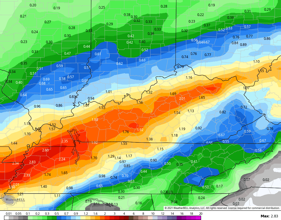
The models are spitting out heavy rains during this time…
GFS

CANADIAN
EURO

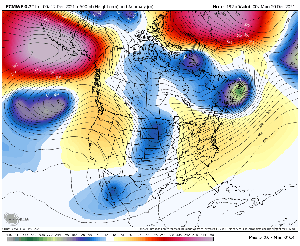
The setup after this is likely to turn much colder as we head into Christmas week, but we are seeing the usual model variations. The latest EURO is not shy about the winter pattern with a huge trough taking control of the pattern…
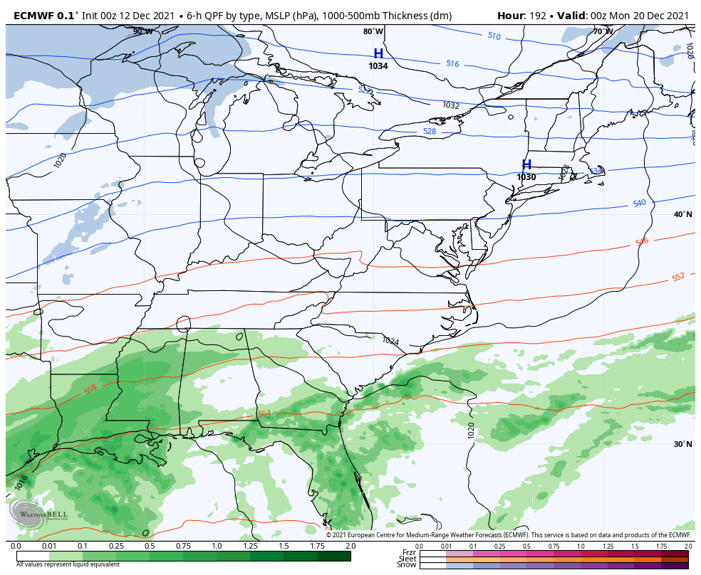
This run sets up a snow system to start the big week…
Snow lovers have something to track again and the timing on it is even better! ❄️🎄🎅
I will have updates later today. Have a good one and take care.
