Good Tuesday to one and all. It’s another quiet day in the bluegrass state, but things are about to ramp up again for the end of the week through the weekend. That’s when a series of systems will impact our weather, bringing gusty winds and heavy rains. In the longer term, the pattern continues to head toward a colder look.
As I said yesterday, I don’t like the looks of the upcoming pattern from Thursday through Monday. Here’s why:
- Gusty southwest winds crank late Wednesday into Thursday ahead of a cold front. Gusts of 40mph or a bit higher will be possible and we may have some issues from this. With weakened structures and trees from the recent severe weather, the threshold for damage will be lower.
- Showers and thunderstorms then rumble in from the northwest on Thursday as the front sweeps in.
- This front slows down with an area or low pressure rolling through Friday and Saturday. This brings heavy rain and a few thunderstorms to the region.
- Rainfall totals from Thursday through Saturday should average 1″-3″ with locally higher amounts.
- Colder air looks to win the battle for Sunday as the front moves south a bit. Maybe a morning flake in the east?
- We have to be on guard for a third system to develop to our south and southeast. This could bring another round of rain in here with the potential for a little winter at the end of it Monday night and early Tuesday.
Let’s start with the wind potential of the next few days. The NAM has gusts well in excess of 40mph…

Here’s how the GFS sees all three systems playing out…
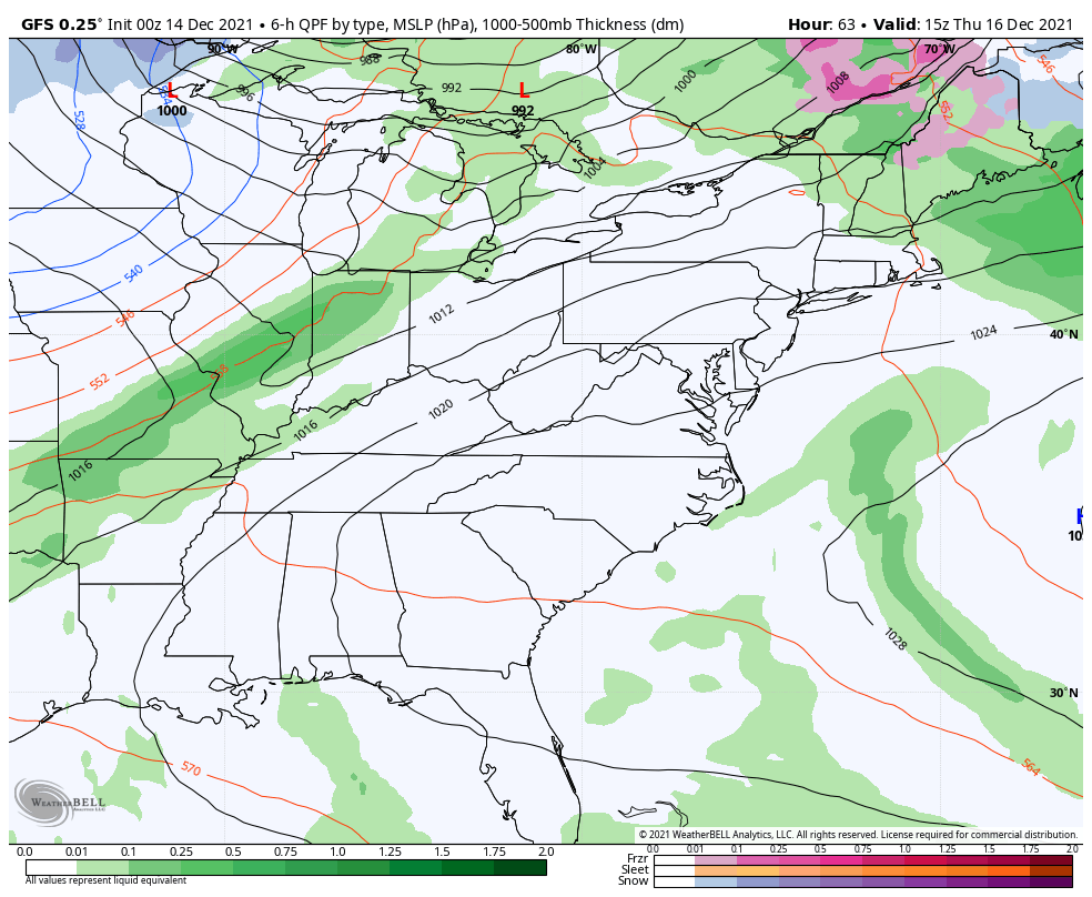
The rainfall numbers during this time…

Temps spike then crash down behind the second system…

Even colder air comes in here from later Sunday through early next week…

The Canadian does something similar in with all three systems, but has more of a winter look behind the third…

Here’s the rainfall forecast…

The EURO is coming around to what the other models have been showing with the rainfall and it’s beginning to see the third system, even if it’s too far southeast…

Here’s the rainfall forecast from this run…

Looking deeper into Christmas week and Christmas weekend, the GFS continues with a very active pattern…

I will have updates later today. Have a good one and take care.

You said in a tweet that Kirksville had damage they got a few years back am I right.