Good afternoon, folks. Milder winds are blowing out there today and those winds will really crank over the next few days. This is ahead of a potent setup that’s likely to bring heavy rain back into the region. This will set the stage for a flood threat from late Thursday through Saturday, with the potential to extend that into early next week.
I’m very concerned about the flooding potential from late Thursday-Saturday. A stalling boundary will have waves of low pressure rolling along it during this time. This will bring rounds of heavy rain and thunderstorms across the region. There’s likely to be an enhanced southwest-northeast band of torrential rains setting up and where that sets up is the key.
The NAM only goes through 7pm Friday…
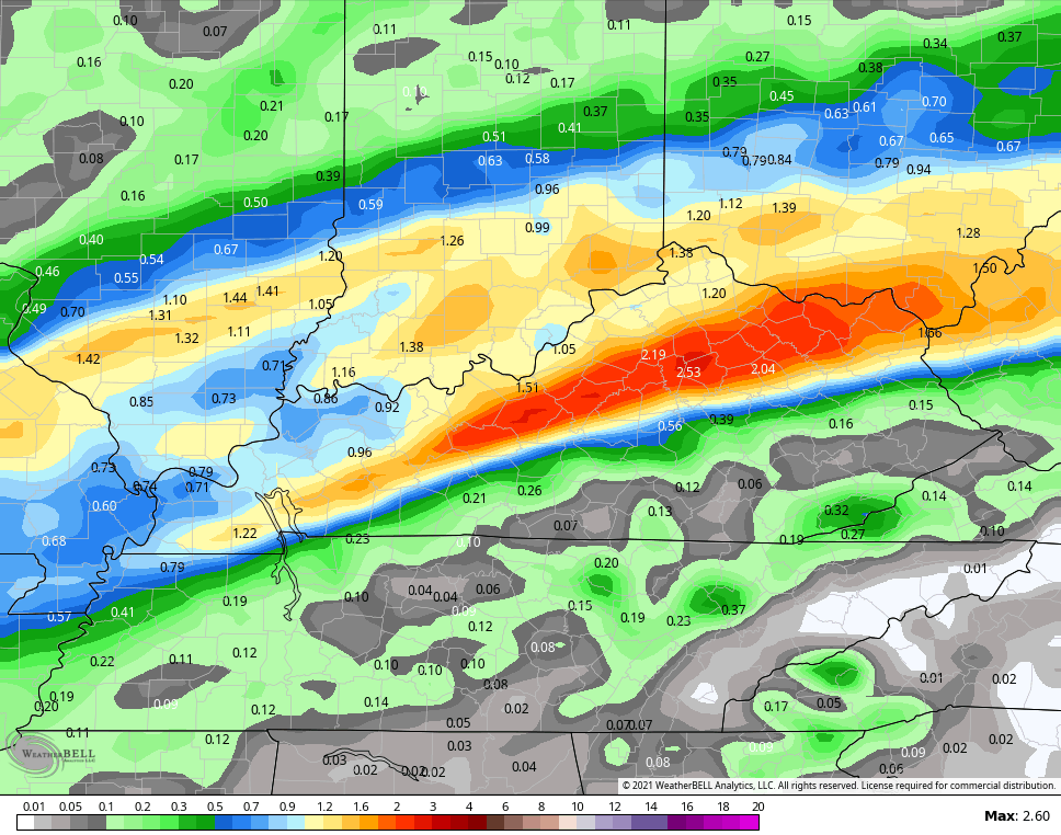
The GFS through Saturday shows the potential…

Remember, the models usually underestimate rainfall from thunderstorms. Please stay alert to the changing forecast in the coming days.
Winds will be a big player ahead of the rains…

The models are keeping the Monday system farther south and east and I’m not going to complain about that at all.
The setup as we get closer to Christmas continues to be muddled, but the EURO is showing the trough moving in…

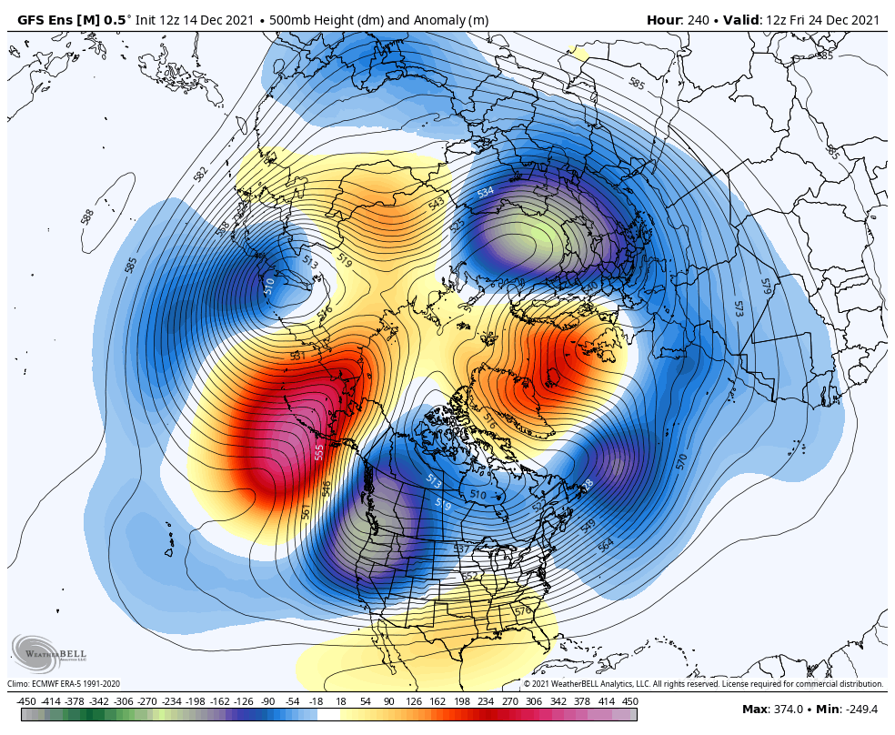
The GFS Ensembles are showing some massive blocking showing up across Greenland and around Alaska…
Looking deeper down the road, we find the GFS Ensembles Extended taking on a really cold look to end the year and begin the new one. Here’s the 7 day average for week one of 2022 from the Ensembles average…

Check out the 7 day average from the same period on the control run…

Check out the following week…

That’s a cold look, my friends!
The new EURO Weeklies are warm biased, but they are also going toward a cold look. Here’s the 30 day temp average from December 27-January 27…

For the EURO weeklies, that’s a really cold look.
Have a great rest of your day and take care.
