Good afternoon, folks. It’s another very mild weather day across the Commonwealth as we get set for another busy period. Winds are beginning to crank and will continue to do so into Thursday as rounds of heavy rain and storms target the region. Both of these may cause issues in the coming days.
Before we get to the local weather, I’m in awe of how far north today’s severe weather threat is. Areas of Minnesota, Wisconsin and Iowa are in a Moderate Risk for high winds and tornadoes…

This is another history making event because we just don’t see severe weather in this region in December. Our exclusive interactive radar comes complete with live storm chaser feeds. Take it for a little trip to track the severe weather in the north…
The same storm system impacting those areas will bring a lot of wind in here, but nothing like up north. Still, with weakened trees and structures from the recent severe weather outbreak, our threshold for wind damage is lower than normal.
The models are spitting out widespread 40mph+ gusts with the Hi Res NAM popping a few 50mph gusts…

This wind is ahead of a strong cold front moving in with the showers and storms increasing Thursday as a front moves in and slows down. That allows for waves of low pressure to develop along it and that means more rounds of showers and storms through Saturday. This may lead to flooding and flash flooding in some areas.
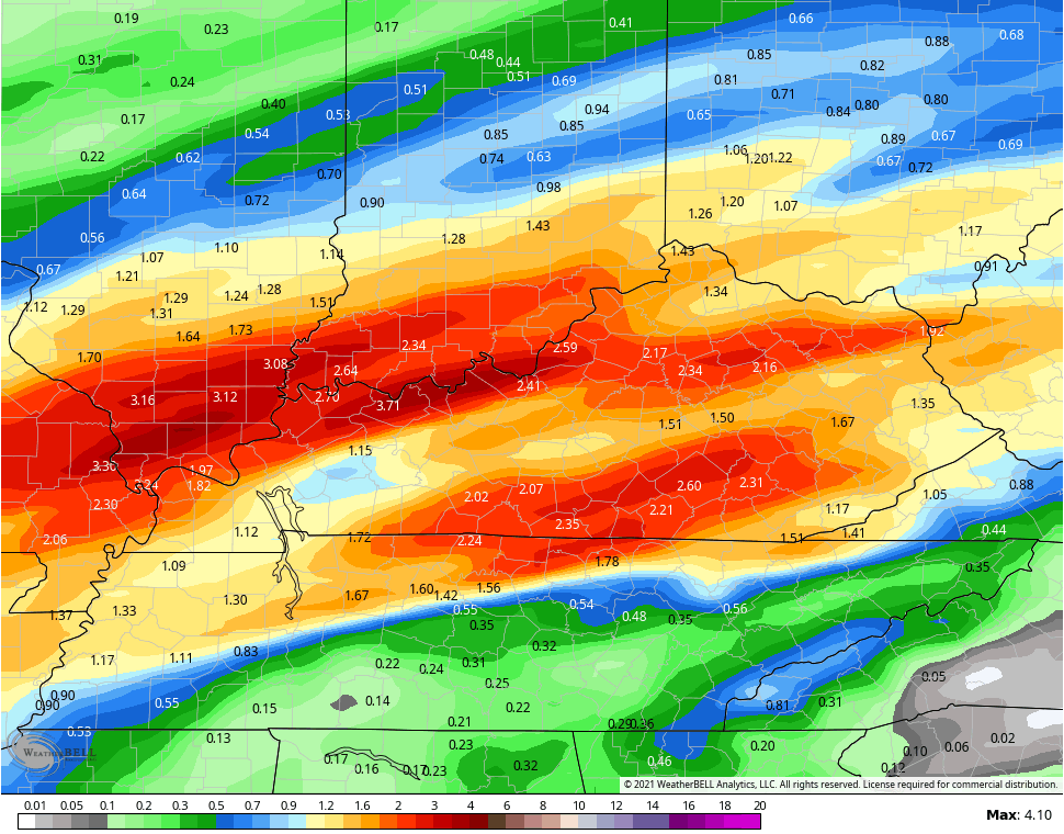
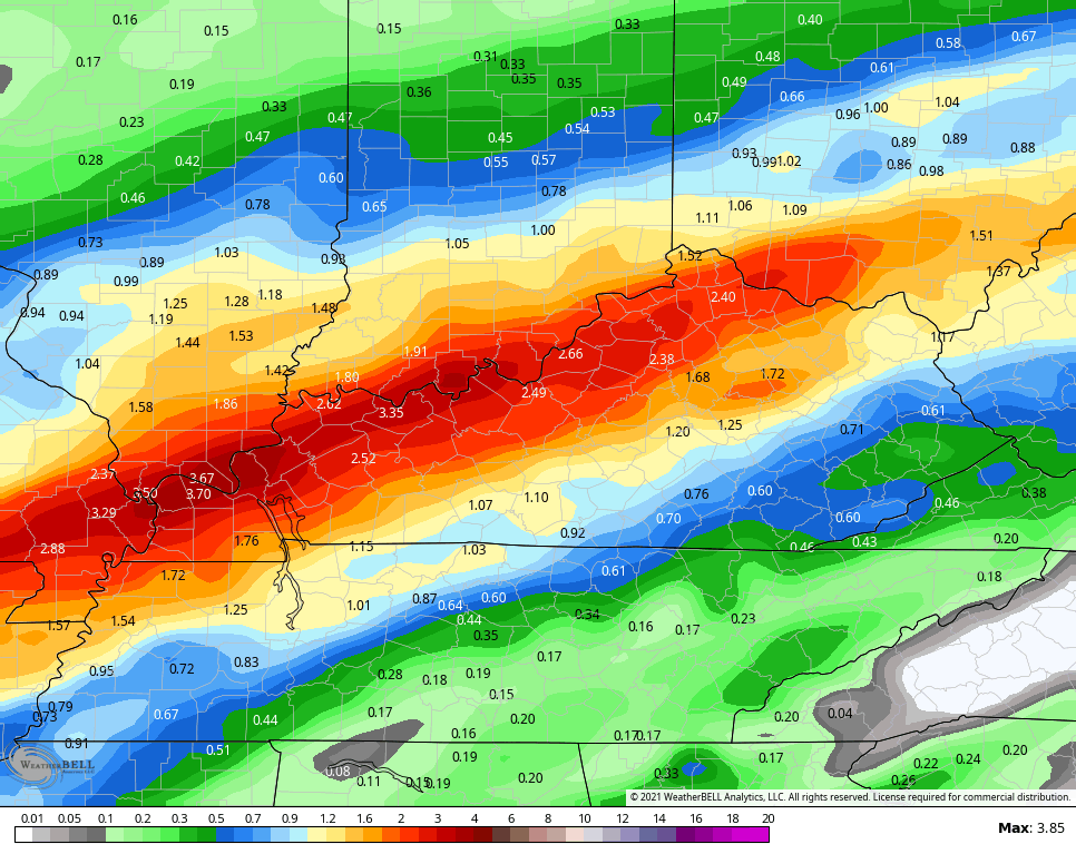
The models continue to spit out a 1″-3″ rainfall with locally higher amounts.
GFS
NAM

Short Range Canadian
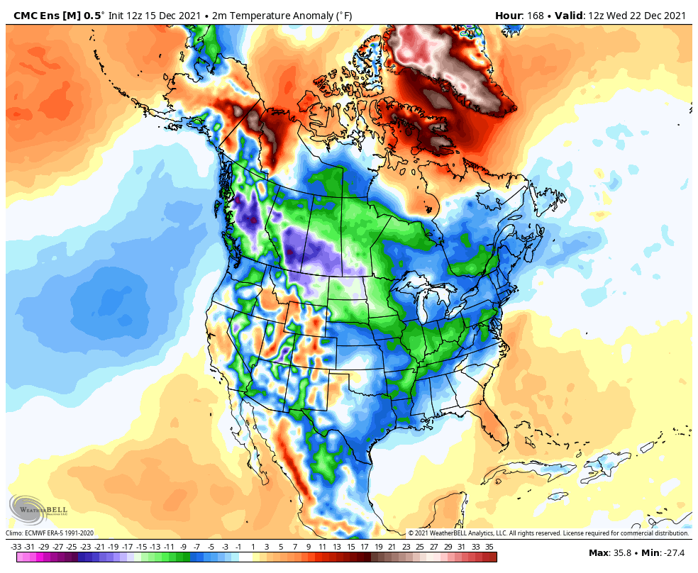
The longer range turns colder next week and you can see the below normal numbers on the GFS…

This matches up with what the Canadian Ensembles are showing…
Enjoy the evening and take care.

Schroeder so glad to hear from today.
Sorry glad to hear from you today