Good Tuesday, folks. We have a weak cold front pushing into the region later today and this will bring a quick shot of cold air for the middle of the week. The next front following that packs more of a punch and that means Santa will have a windy and wet sleigh ride into Kentucky.
Today’s front has no moisture to work with for most of the region, but there’s a slight chance for a few flakes to fly across eastern Kentucky late tonight and early Wednesday. The Hi Res NAM likes our West Virginia neighbors for a better shot of flake action…

This front knocks our numbers back down into the 30s for highs Wednesday. Here are the numbers from 7am Wednesday through 7am Thursday…
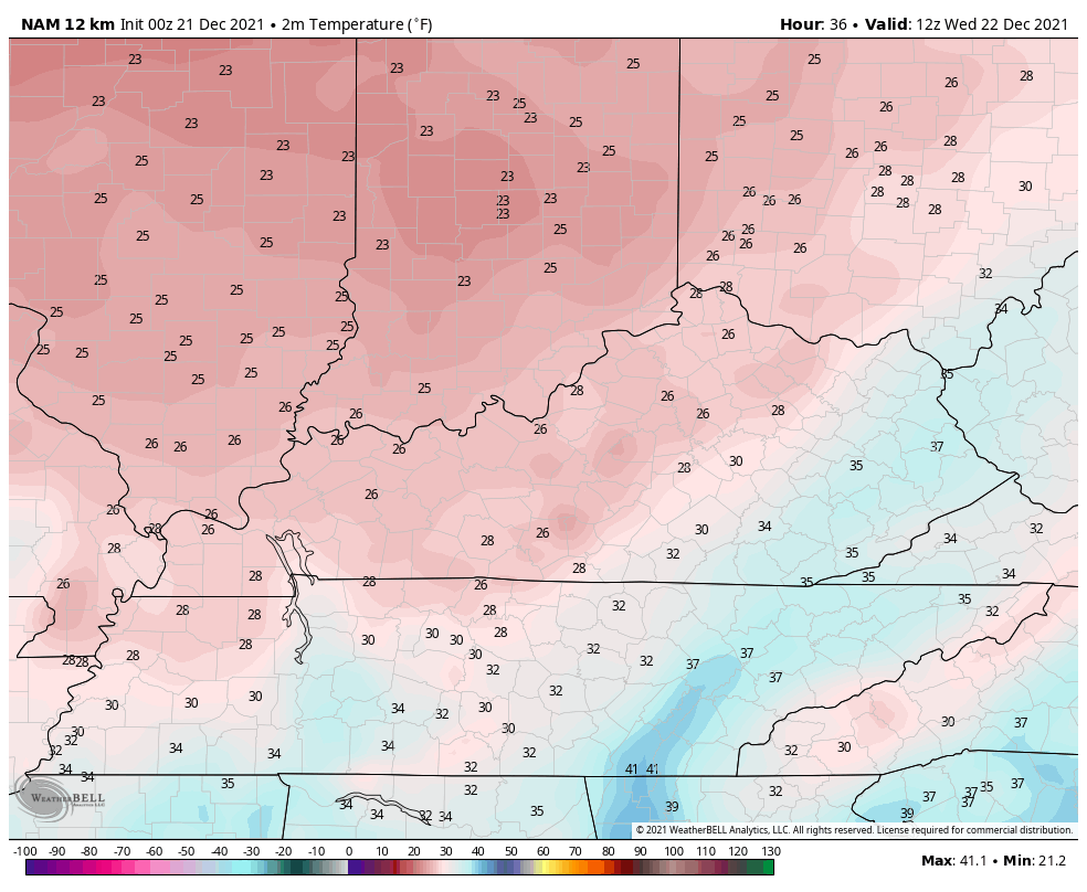
Wind chills during this time are much colder…

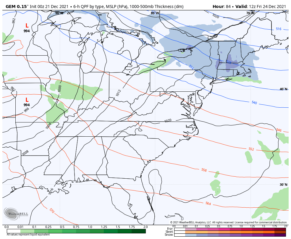
The setup after this is for temps to climb through Christmas Eve as we get ready for a gusty cold front to drop in from the northwest. Gusts of 40mph will be possible to give Santa a little bit of a rocky sleigh ride into town. Some showers will also accompany this system, but there’s now a question on if this front hangs around through the rest of Christmas Weekend.
The new GFS shows showers through Christmas Day as colder air works in from the north and another wave of low pressure Saturday night…

That certainly makes for a much more active Christmas Day and is something to watch for.
The Canadian isn’t buying the slower weekend system…
The EURO looks nothing like either of the above models and changed dramatically from earlier runs. For that reason, I’m not incorporating it into the mix at the moment.
We shall see how that works out in the coming days, but me thinks the GFS might be on to something.
Speaking of the GFS, it’s seeing more cold pressing into early next week as it throws several systems our way…

Again, we need to get winter to show up around here or we will see more rounds of thunderstorms and heavy rains.
The evolution to a very cold pattern continues as we close the door on 2021 and roll into 2022. The new EURO Weeklies confirm this change and show a below normal January f0r much of the country…
The EURO Control for the same time is colder in the east…

The EURO weeklies typically do not a good job in picking up on colder than normal temps, so it should be encouraging to winter fans to see them do so.
I will have another update later today. Have a good one and take care.

positve post!!!! the bengals in first plave and control thier own destiny.
AS a Viking fan, i wish the Bengals best of luck. No white Christmas this year.
That sounds like a real Christmas Miracle Rolo. 🙂
It would be a “Christmas Miracle” if it Snowed on Christmas Eve 2021 in Maple, Kentucky. LOL
The GFS on their extended goes from very warm to very cold and now it’s very cold to very warm. I hope they get it straight as we approach January 2022 ?
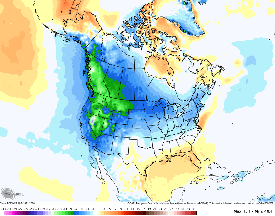
Areas of the Northwest are seeing Snowstorms where they normally don’t see much Snow. What’s normal anymore ?
Just checked …. Seattle will likely have a white Christmas – rain/snow to start, switching to just snow during the day.
And that’s downtown Seattle, which is closer to the water. The suburbs, particularly the further you get away from Puget Sound and Lake Washington, which are higher up, will probably see more snow.
We use to own a small nursery in the coastal range of Oregon. I would imagine that area is really buried in Snow today. I remember one year in the 1990’s the previous owner had a photo where 7 feet of Snow was on the ground !