Good Thursday, folks. Christmas is almost here and things continue to look windy and mild for our part of the world. The mild gets in a big fight with cold air next week, but the cold looks to finally deliver a knockout blow once into the start of the new year.
Temps this morning are deep into the 20s but rebound quickly as the day goes by. Highs range from the middle 40s to middle 50s across the state.
Near record high temps are possible as we head into Christmas as a strong southwest wind gusts up ahead of a system working across the Ohio Valley. This is our payback for last year’s White Christmas snowstorm. 😭
Winds will be gusty and may reach 40mph at times over the weekend. A few showers will also be possible…
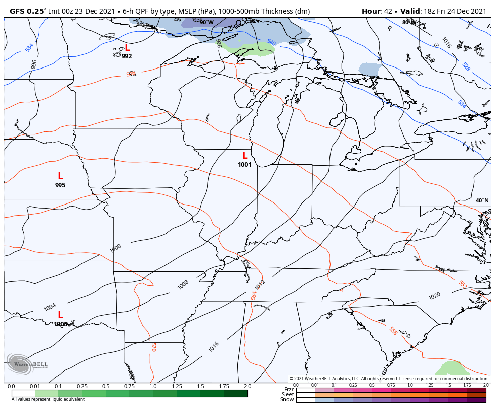
That setup is a big time wind maker for a lot of folks. Check out those wind gusts from the plains through our region and into the northeast…

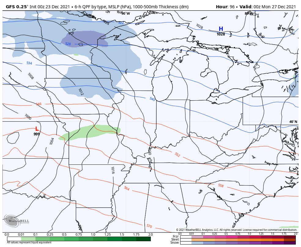
Much colder air comes into the region Christmas night into Sunday.
That sets the stage for a big battle for the closing days of the year. This happens as a MEGA temperature gradient sets up across the country with the northwest seeing brutally cold air with springtime temps across parts of the east and southeast.
This means repeat storm systems rolling across our part of the world through the end of the year. The GFS shows these systems well through the final hour of 2021…
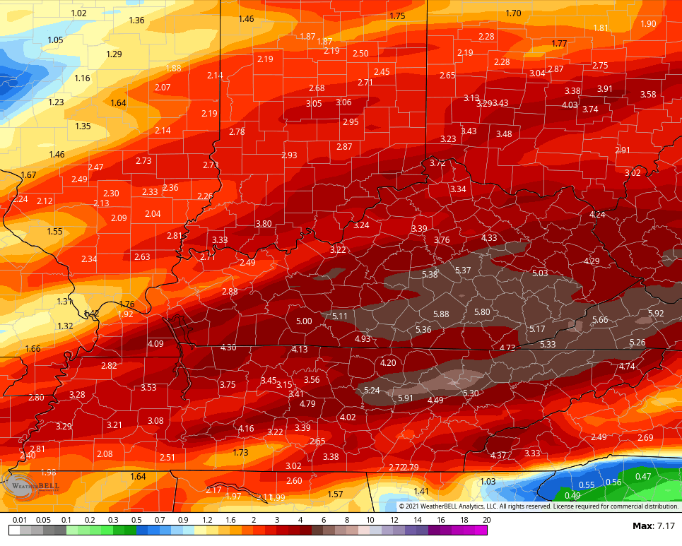
That setup means the potential for some issues to end the year. Strong thunderstorms and heavy rainfall will be possible during the final 5 days of the year. The GFS rainfall numbers through the final day of the year show this…
Much colder than normal temps then crash in at the start of the new year. The GFS is even showing this…
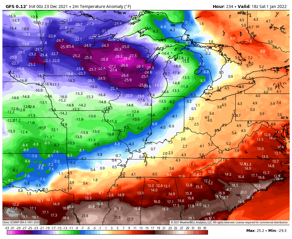
The new EURO is actually a day faster with this change and has the PV rotating into the Great Lakes…

That’s a super cold look pushing into the eastern half of the country.
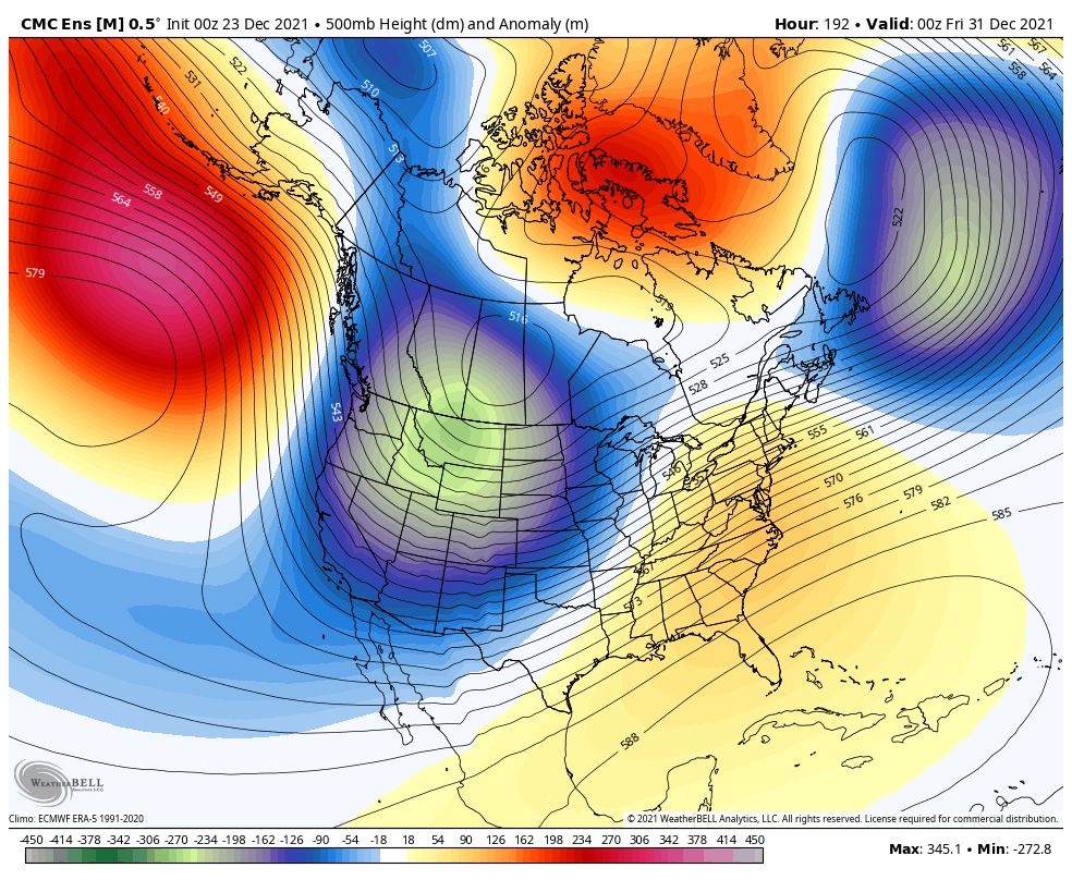
The Canadian Ensembles have been leading this charge and are still doing so…
I will have another update later today. Have a good one and take care.

morning peeps.
Good morning!
Thanks Chris, I’m hoping the Cold finally wins and stays around over the next three months with at least three good Snowstorms to finish off Winter ?
In the meantime, I’ve been tracking the Snow totals out West. They are measuring the Snowfall in yards, and I wish now I still had my place in Oregon. LOL
A strong Southeast Ridge along with La Nina continues to dominate through the 5th of January according to the extended on the Ventusky weather site. Sad for the Southeastern part of the country if you like Snowstorms.
Hoping in the short run we DO NOT receive any severe weather events or break too many high temperature records ?