Good Monday to one and all. It’s ANOTHER windy and mild day out there and this mild pattern continues to signal trouble ahead. We have the potential for flooding and strong storms before a winter weather threat later Sunday.
Temps out there today are back to flirting with record highs again. A scattering of showers and thunderstorms will be noted and your radars are on duty…

More in the way of scattered storms will be noted on Tuesday before this action kicks into a much higher gear Wednesday through early Thursday. This is when low pressure works through the region bringing the potential for heavy rain and strong storms. This may focus of the worst of the weather across the southeastern part of the country. The Storm Prediction Center even has a low-end severe storms risk in the far south…

Local high water issues will be possible during this time. The models are showing the greatest threat across the south and southeast. Here’s how the GFS sees the rain during this time…

The EURO shows a hefty swath…
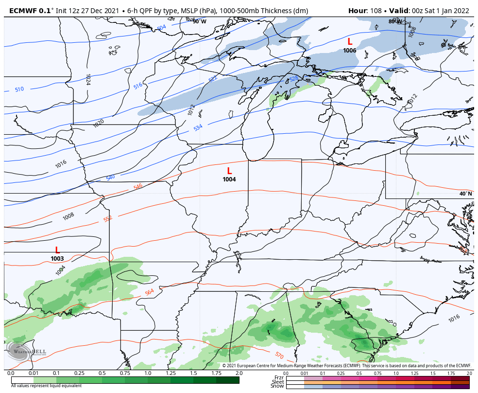
After a bit of a break late Thursday into New Year’s Eve, a much more potent setup takes control for New Year’s Day into Sunday. Low pressure works through here with the increasing potential for strong to severe storms and flooding rains Saturday and Saturday night. This will be followed up by a second low later Sunday that will have much colder air to work with and that means a snow threat.
Here’s the look from the GFS…

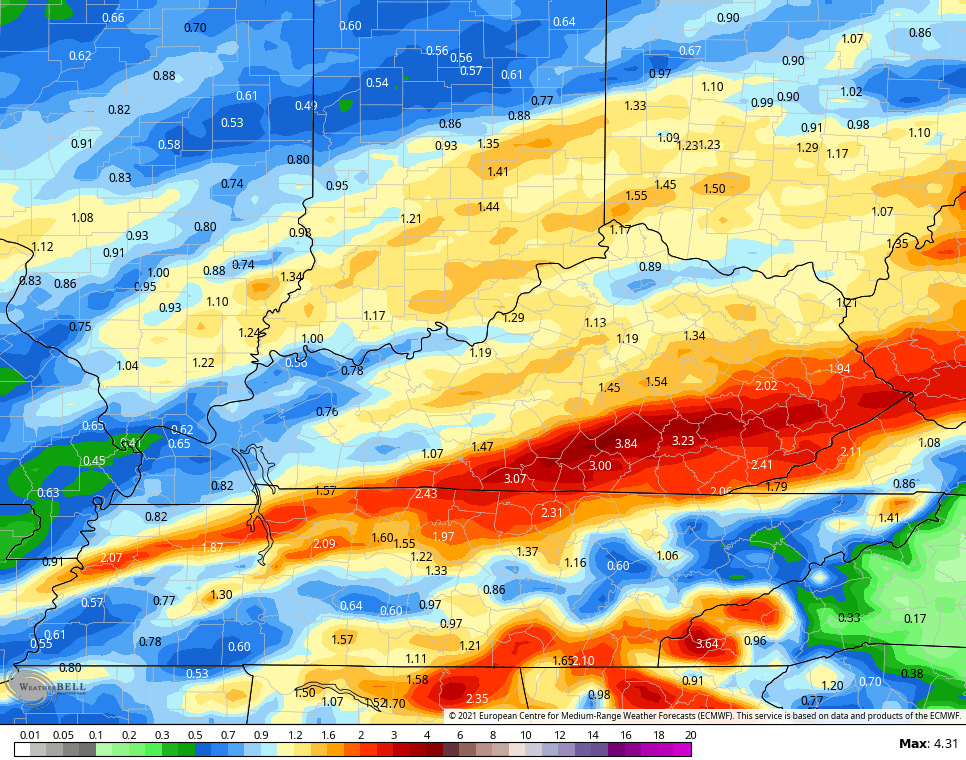
The 7 day rainfall numbers from the GFS are VERY concerning…

The EURO rain numbers are growing…

Folks, both of those maps are ugly and we may easily be dealing with flooding issues.
Here’s the overall look from the EURO…
Notice both models have a nice little snow setup for Sunday and Sunday night. That’s one to watch as it can deliver the first widespread accumulating snow.
That’s also one major temp drop behind the system. Watch the numbers from the EURO from Saturday afternoon through Monday morning…
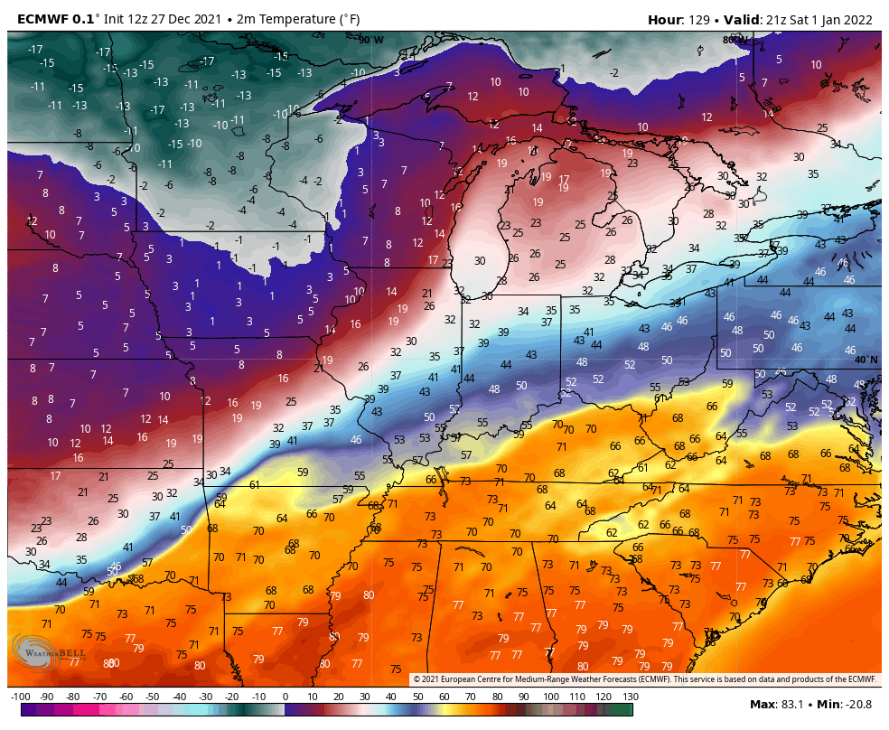
Those wind chills…

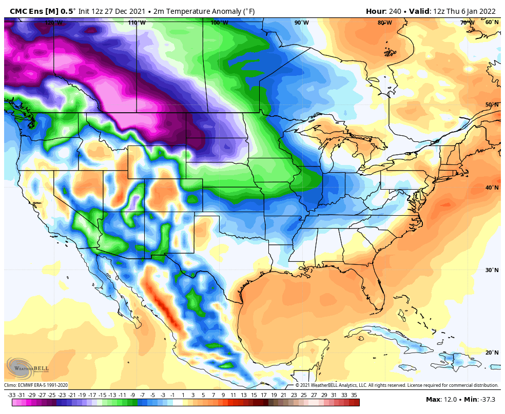
This is likely the opening act to a much colder look taking shape…
Canadian Ensembles
GFS Ensembles

Enjoy the rest of your day and take care.

Schroeder you mention Marcia Hockey she was a gem at her time and I grew up watching her as youngsters myself.
Back then just about everyone watch her nightly weather forecast. I meant her once in my doctors office, but we did not speak very long.
This weather pattern is getting SCARY again. Those Rainfall maps are horrendous, that has the potential to cause a lot of property damage. Now every time severe weather is mentioned in any forecast makes me nervous. As you all can remember an F3 Tornado touchdown just a little over a mile from my home on the morning of December eleventh, 2021.
Check out the accumulated GFS Snowfall forecast early next year:
https://weatherstreet.com/models/gfs-acc-snow-forecast.php