Good Wednesday to one and all. It’s no secret how mild and active our December pattern has been and this rolls on through the closing days of the month and year. This active pattern rolls into the first few days of the New Year as a major storm system moves in.
This system brings the threat for flooding and strong storms for New Year’s Day, with crashing temps and some snow behind it on Sunday. Buckle up on this one.
Let’s begin things with where we are today and roll forward. A front is draped across the region and will have a couple of showers and storms with it early today and will also give us another healthy north-south temp gradient. South of it we are deep into the 60s again.
Showers and storms will develop across the Tennessee Valley and move northeastward late this afternoon and evening. The threat for severe storms is greatest just to the south of Kentucky, but a few of these storms may impact far southern and southeastern Kentucky. This is where the Storm Prediction Center has a low-end risk for severe storms today…

Damaging wind is the main player with any storms that go up across the south. My greater concern is for some flash flooding with a quick 1″-3″ of rain. Here’s the area to watch…

Cooler and drier air moves in for Thursday with just a scattered shower chance.
This takes us into a nasty setup for New Year’s Weekend. Here’s what to expect:
- Temps on the final day of 2021 make a run deep into the 60s with a scattering of showers and storms.
- Heavy rain and storms increase Friday night into early Saturday as low pressure works into the Ohio Valley.
- This sets the stage for the potential for a few strong or severe storms through Saturday afternoon.
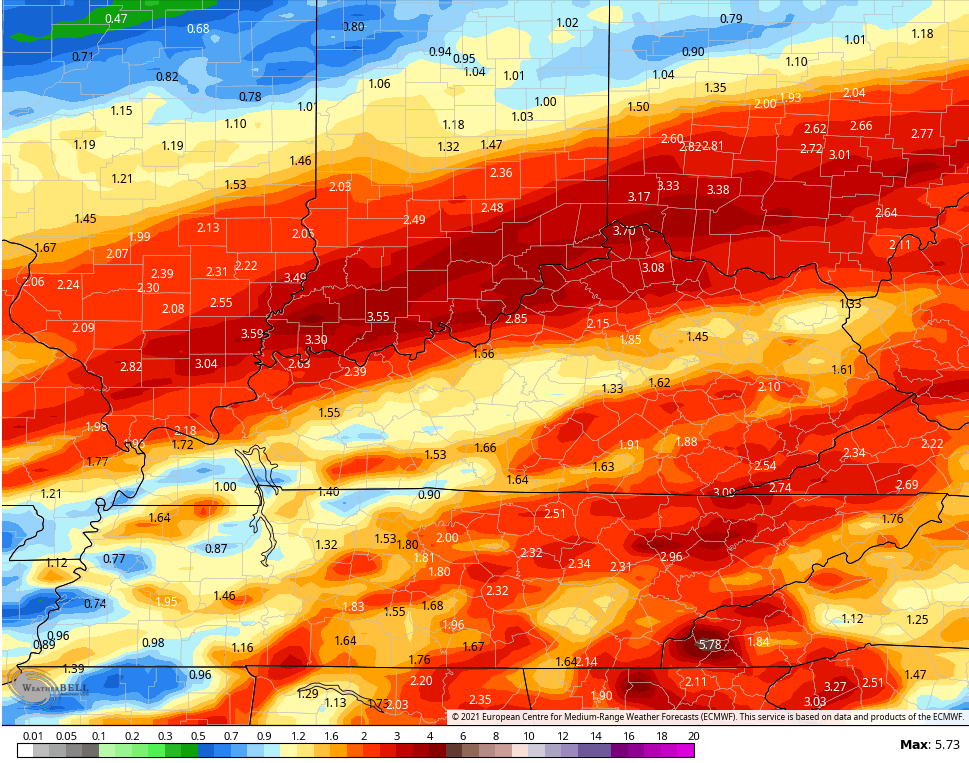
- The heavy rain potential continues to be my main concern with a general 1″-3″ of rain with some streaks of 4″ amounts possible.
- That could lead to flash flooding and flooding, especially across southeastern Kentucky where waters may already be running high after the current rains.
- Near record highs may show up for some on New Year’s Day.
- Temps CRASH from west to east Saturday night and early Sunday. Much of Sunday will feature temps only in the 20s with a wind chill in the teens.
- A period of light snow will be possible Sunday and then we watch for a northwest flow to kick in some snow showers later Sunday and Sunday night across the east.
- Wind chills for Sunday are in the teens and then hit the single digits Sunday night and Monday morning.
Let’s check in on the models and see how they’re handling things.
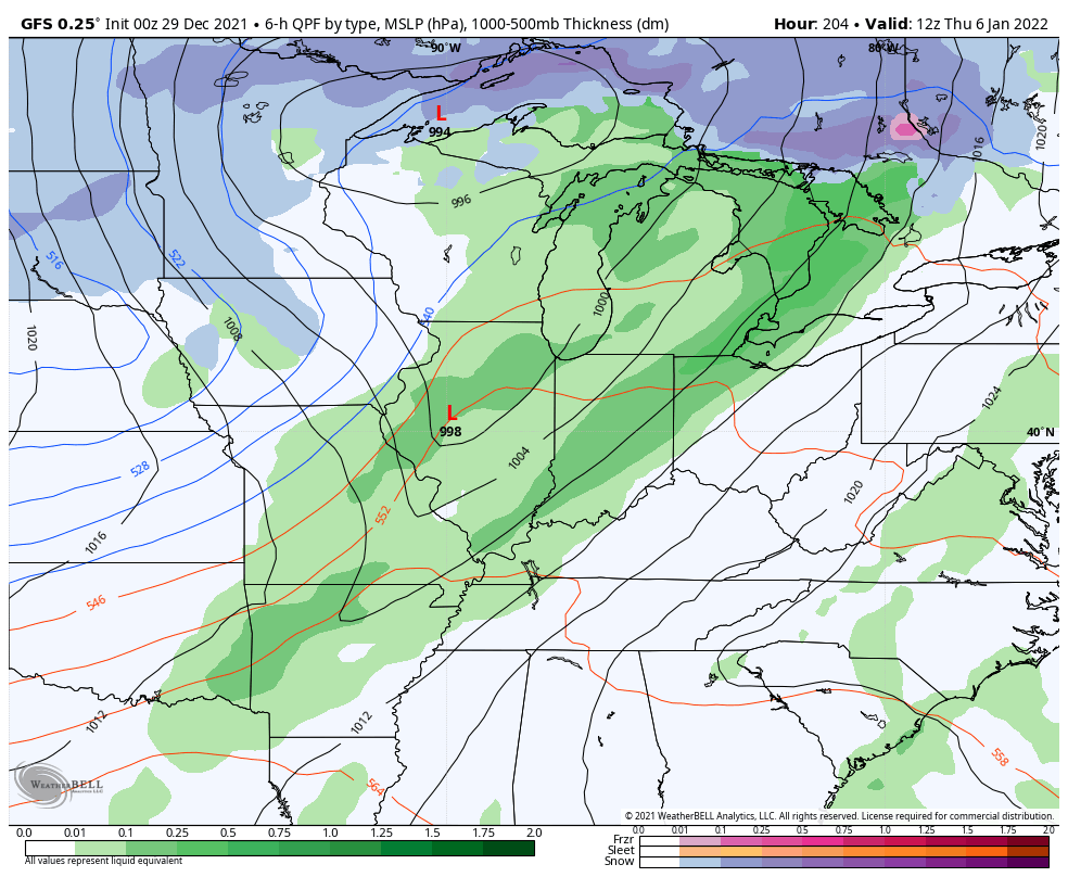
Here’s the GFS…
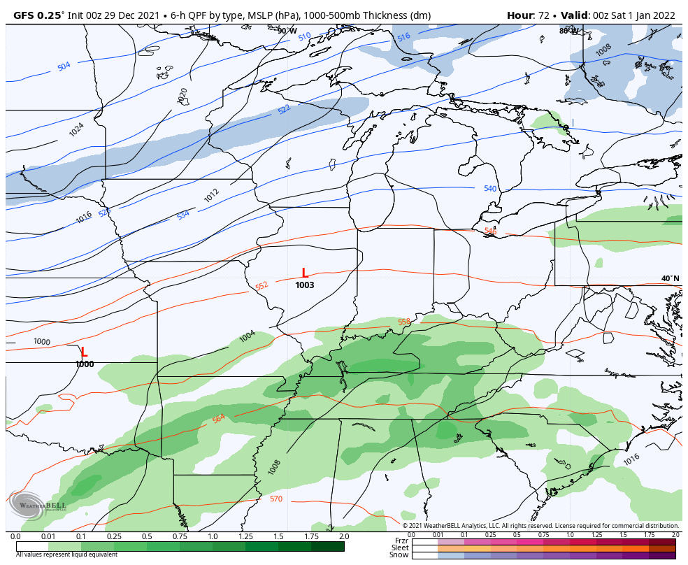
The rain numbers from this run continue to raise eyebrows across the southeast, especially. This is from today through Saturday night…

Here’s the look from the Canadian…

And the rainfall through Saturday night…

The EURO looks like it continues to have feedback issues…

Those issues are very evident with the rainfall forecast that’s MUCH farther north than any other model…
Even the ICON disagrees with the EURO…
![]()
![]()
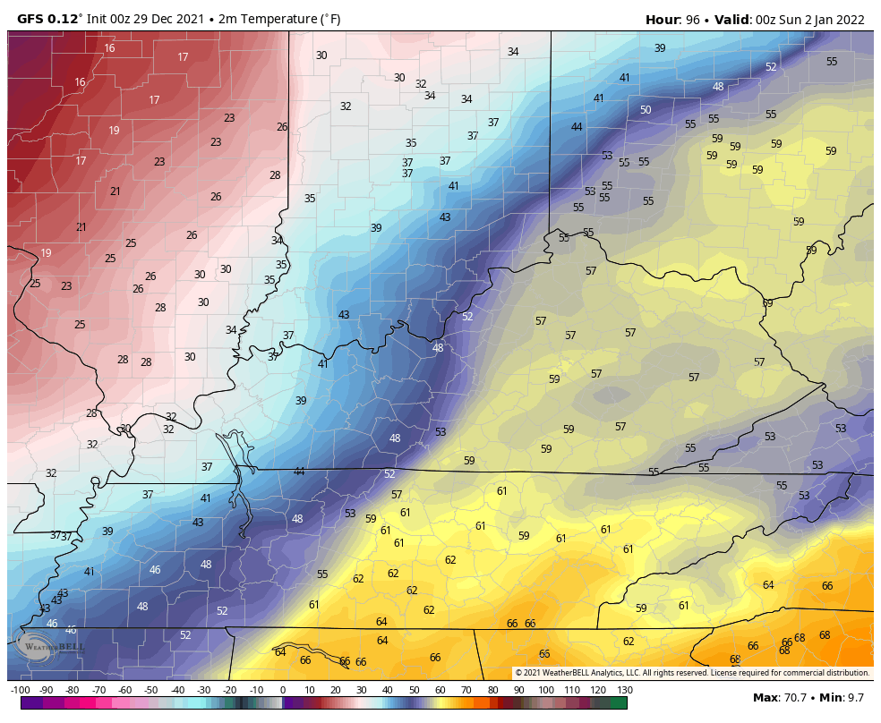
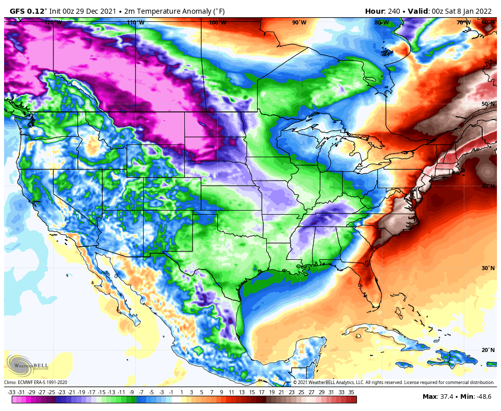
The temp crash behind all this is going to be pretty incredible. Here’s the GFS temp forecast from 7pm Saturday through Monday morning…
The wind chills during the same time…
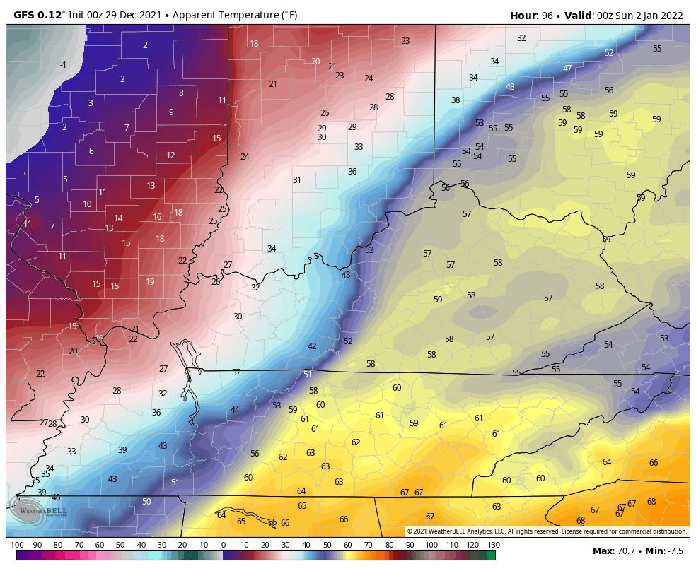
To review, Saturday could reach 65-70 in many areas. Less than 24 hours later, it’s going to feel like the teens. 😲🥶
After a brief moderation in temps the middle of the week, we are likely to see an arctic front crossing the country and into our region late next week…
The operational run of the GFS shows the cold taking control…
So do the GFS Ensembles…

Updates will come your way later today, so check back.
As usual, I have you all set to track the severe weather. Our exclusive interactive radar also features live storm chaser video streams, so be sure to check that out…

Current watches

Possible Watch Areas

Make it a good one and take care.

morning, negative rolo is laying in the weeds. big bust coming.
Thanks Chris, please keep us updated on the severe weather predicted for Friday. Around the 7th and 8th most of Kentucky looks Snowy ?