Good evening, folks. We continue to track a super active setup that looks to bring wild weather in here as we say goodbye to 2021 and hello to 2022. We have the threat for severe storms and high water to be followed by a light snowfall and frigid temps and that’s all packed into the New Year’s Weekend.
Let’s begin with the present weather because things are very active across the Tennessee Valley and some of this action works into southern Kentucky this evening. This is the area I’ve been highlighting for a few days now for some strong storms and local high water issues. That’s still the case into the wee hours of Thursday morning.
Here’s the evening severe threat from the Storm Prediction Center…

I will have your tracking tools in a bit.
We catch a break on Thursday, but New Year’s Weekend features a wild weather ride across our part of the world. We continue to watch the potential for severe storms and flooding rains from New Year’s Eve into New Year’s Day.
The Storm Prediction Center has much of the state in the severe weather risk area for New Year’s Eve…

Here’s the early look at what they’re looking at for New Year’s Day…

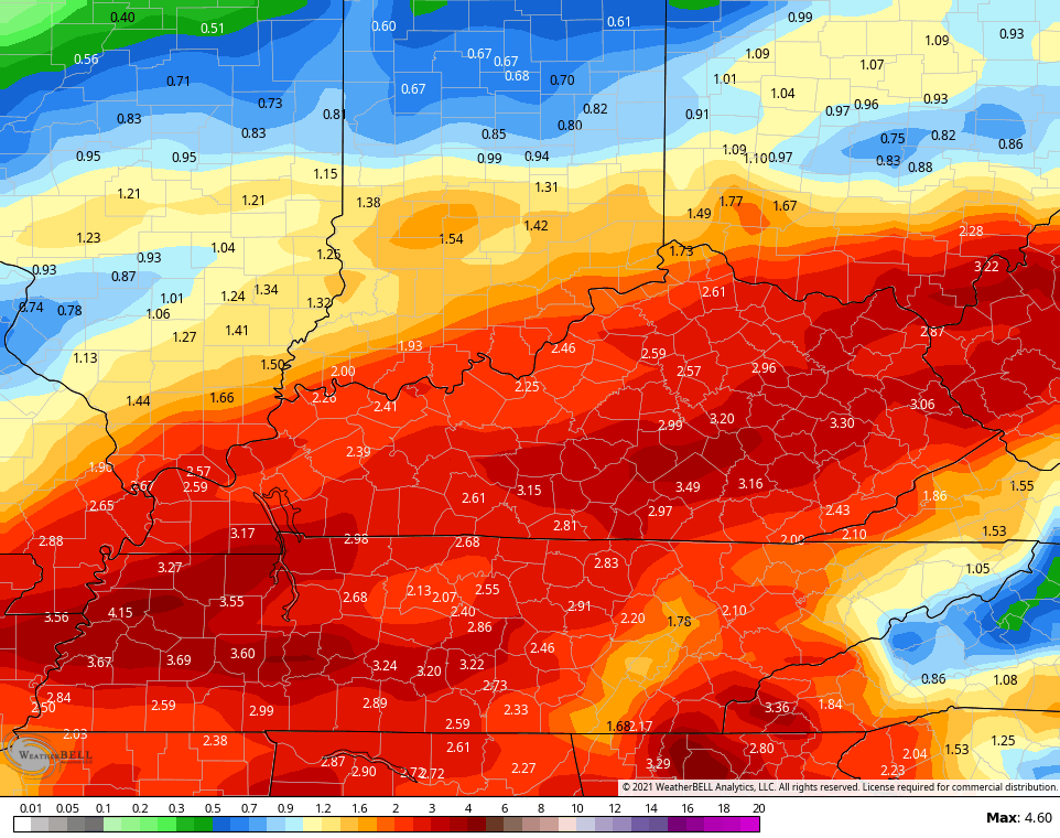
We are also watching for torrential rains that can cause high water issues. Here’s a look at what the models show for rain through Saturday night…
EURO

GFS

CANADIAN
Once the heavy rain ends, the temps crash and we pick up a nice swath of light snow for Sunday with snow showers getting into the mix on a cold northwest flow Sunday evening and Sunday night. Light accumulations are likely.
Here’s how the models see the entire holiday weekend…
GFS

CANADIAN
EURO

Can we get some delays or cancellations for Monday morning? That’s certainly possible
Wind chills on Sunday drop into the teens with single digit wind chills Sunday night and Monday morning.
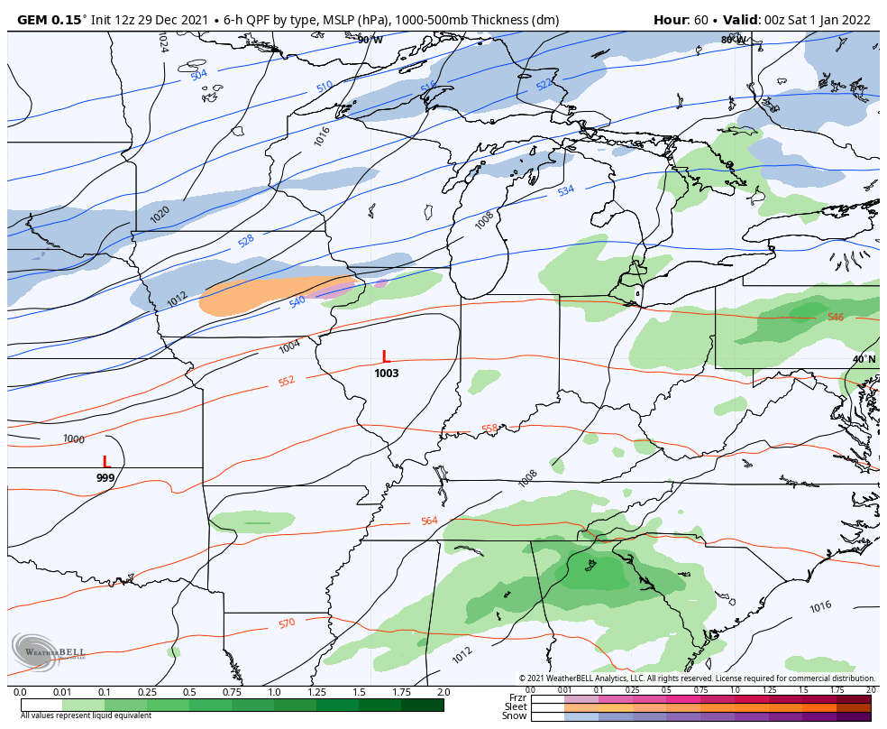
Temps rebound for the middle of the week, but an arctic front arrives late in the week and may have a wave of low pressure along it. Here’s what the GFS is seeing with it…

The model then sees the cold taking control…

So do the GFS Ensembles…
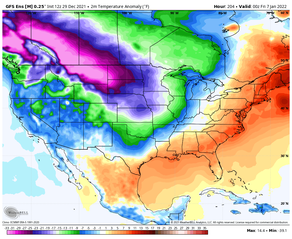
It’s pretty amazing to watch the 1984/85 winter analog playing out almost flawlessly.
I may drop by for a quick update later this evening and will have the latest on WKYT tonight. I leave you with your rain and storm tracking tools…

Current watches

Possible Watch Areas

Enjoy the evening and take care.

Thanks Chris for the update ! Looks as though the rains have move east of my county of Taylor. Hopefully, we will have a restful night. Glad there is a cold front coming through tomorrow to stabilize the atmosphere. I ran the CAPE and found one reading at 600 J/Kg on Saturday in my area. That could be a good Thunderstorm. I don’t get too worried until it reaches a reading over 1000 J/Kg.
Sunday’s Winter weather return will be welcome and some Snow would be a plus. This is one weather type that has been missing for a longtime.