Good afternoon, folks. As you can see, Kentucky Weather Center continues to undergo some work and that’s preventing me from uploading images for a bit. This work is to speed up the viewing process for you guys, so hang tight. I appreciate the patience.😁
In terms of the forecast for our developing winter forecast, I’ve seen nothing to make me change my thought process on how things try to play out.
Here are a few fresh thoughts:
This is NOT a shutdown snowstorm, but it’s one that can bring significant, but manageable snowfall.
TIMING
- The first flakes from this system look to start to fly in western Kentucky late Wednesday night and early Thursday.
- This action will then increase rapidly as it moves east Thursday.
- The prime snow making time for the state appears to be from noon Thursday through 7am Friday.
SETUP
- An arctic front drops in from the northwest late Wednesday.
- Low pressure develops along this boundary just to our south. This low rides west to east across the Tennessee Valley before riding northeast.
- The exact track and intensity of the low determines how much snow falls where you live.
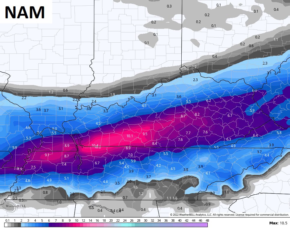
SNOWFALL
- This looks like a system that will put snow down across the entire state.
- Snowfall should range from 1″-6″ across the state, depending on where you live.
- The highest amounts may be across the southeastern part of the state
TRENDS
- The models continue to come into focus with the track of the low and strength of it.
- The current trends are little farther south and east with that track.
TEMPS
- Bitterly cold temps follow the flakes regardless of how much snow falls where you live.
- Single digit lows are possible Friday morning.
- Wind chills may drop below zero Friday morning
I will have the latest on WKYT-TV starting at 4pm and that will includes graphics. 😁 I will drop by KWC for a few more updates and those will hopefully include graphics. 🤷♂️
Have a great afternoon and take care.
