Good afternoon, folks. High water issues continue across many areas of the state as arctic cold surges back in. This will cause icy conditions to develop and that means some slick spots for Monday morning travel. As we look ahead, the overall pattern continues to look rather harsh in the weeks ahead.
Most of the state has picked up 1″-3″ of rain and it’s still coming down in the southeast. This is where additional high water issues will be a problem into the evening. Here are your radarsg…

As temps drop this evening, a few flakes will be possible, but the concern is more about the freeze up. Temps hit the upper teens overnight and that means one thing…
Some slick spots are very likely, and we could be talking about some delays.
Below normal temps are the norm this week as we get ready to head toward a harsh winter pattern for the second half of the month. How we get there is still open for debate as the models have several systems of interest, but vary from run to run on how they play out.
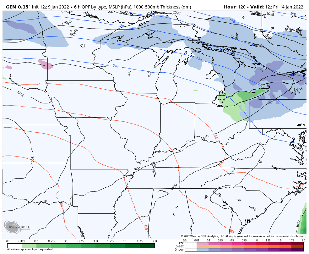
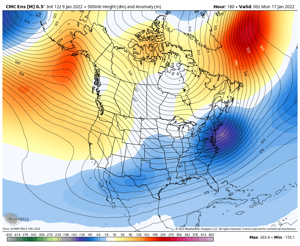
Here’s the latest Canadian for the system next weekend…
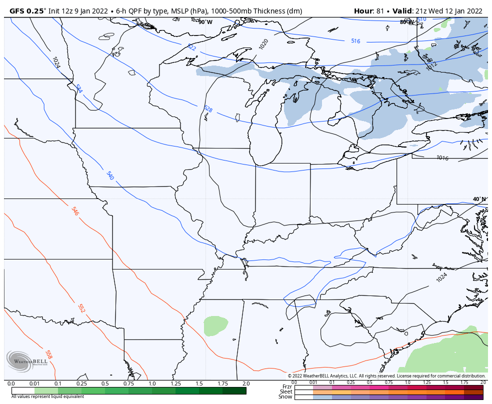
The GFS has a weak system on Wednesday before we get to the weekend system…
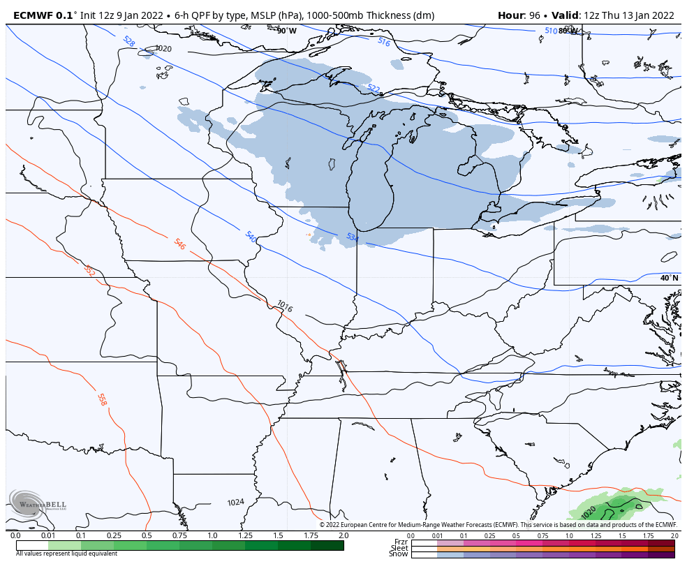
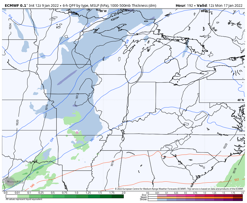
The EURO has a thursday system ahead of the one for the weekend…
The EURO then follows that up with another fast-mover…
Details on individual systems will have to be worked out as we get closer to each.
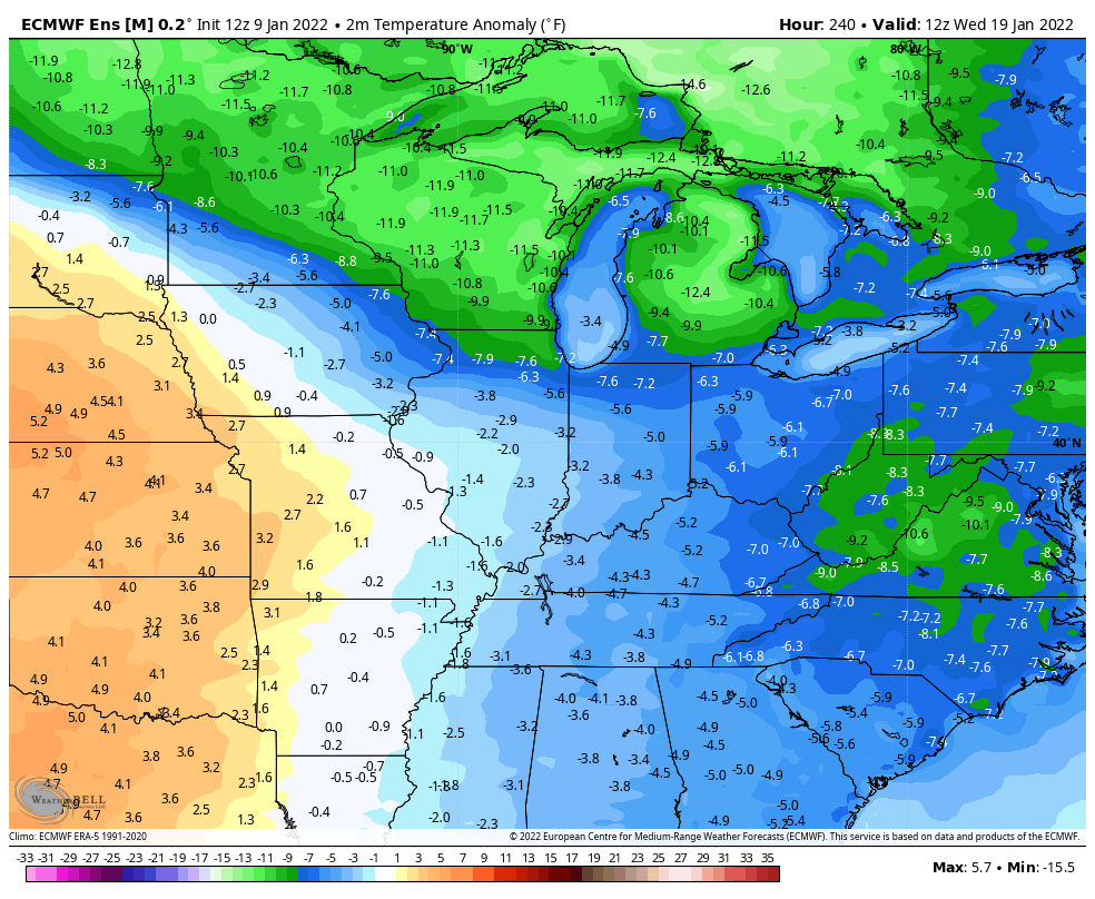
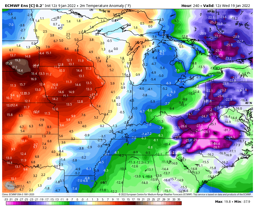
The overall look continues to be one that likely takes much of the country into the tank in terms of winter weather and temps. The ENSEMBLES are dead set on a DEEP tough filled with arctic air engulfing much of the USA.
GFS
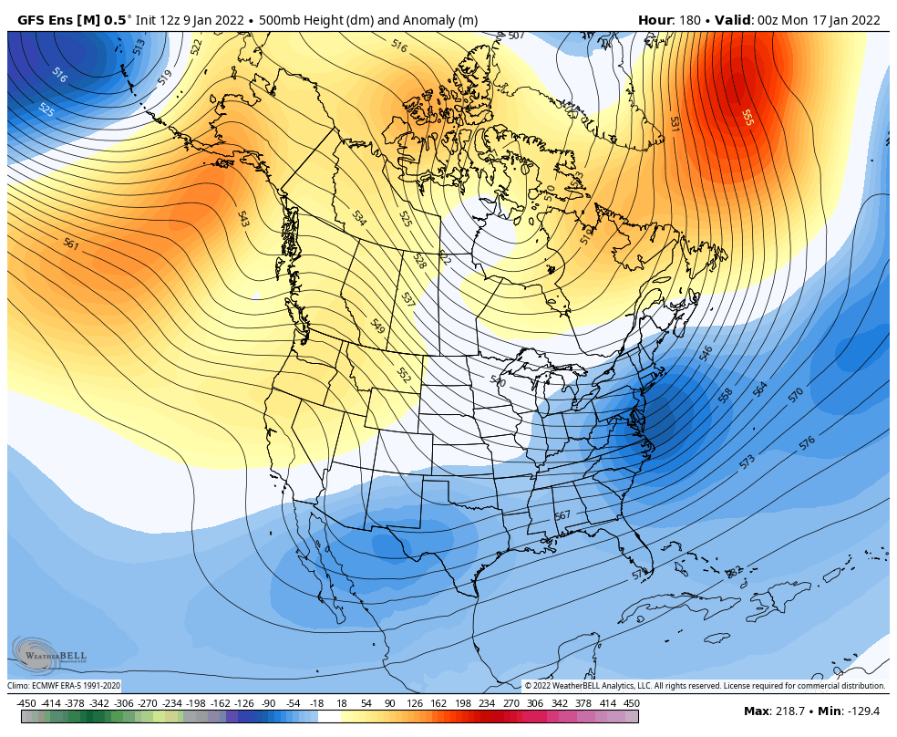
The temp departures are crazy cold from this far out…

The Canadian Ensembles look the same…
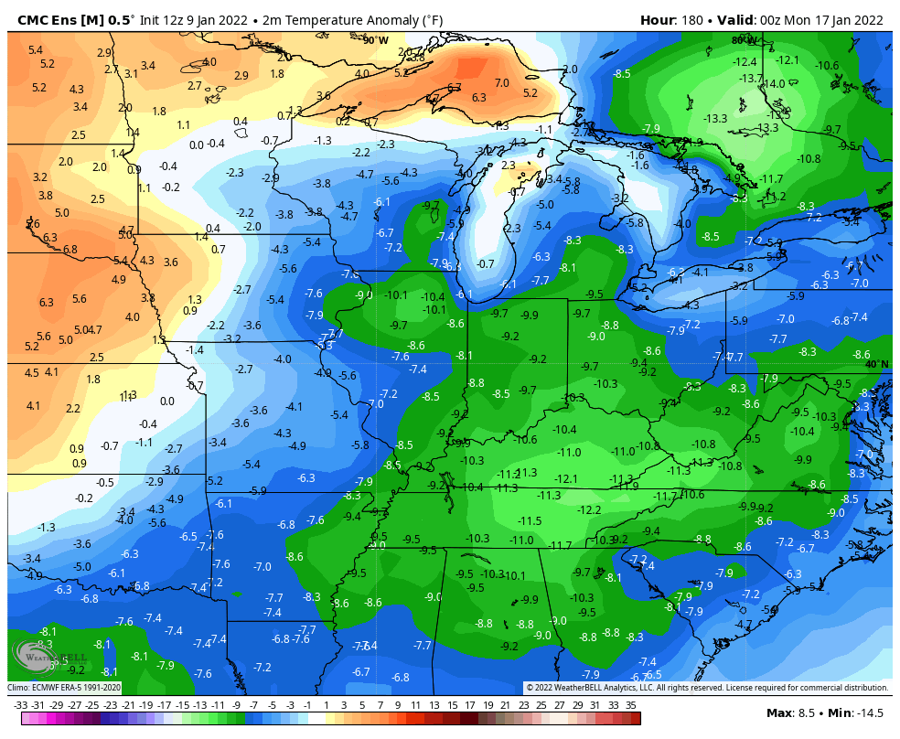
The EURO Ensembles are historically warm biased and they’re even showing the same thing…
The control run is just absurd…
Buckle up, folks.
Enjoy the rest of the day and take care.
