Good afternoon, folks. It’s a sunny, but cold day across the bluegrass state as we continue to focus on the upcoming snow chances. We have a series of systems lined up and these have a good shot at putting some snow on the ground over the next week or so.
Our first chance for some light snow is a small one, but it shows up with a weak system dropping in on Thursday. As of now, this looks fairly week and not very widespread, but I’ll continue to watch it.
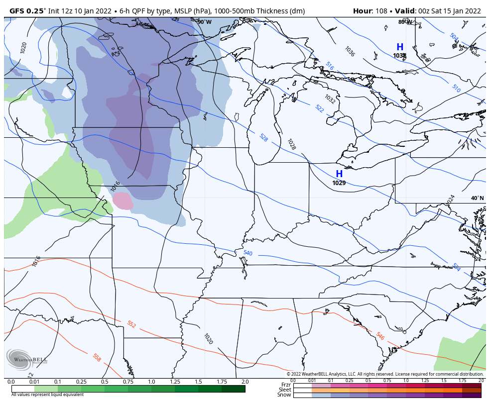
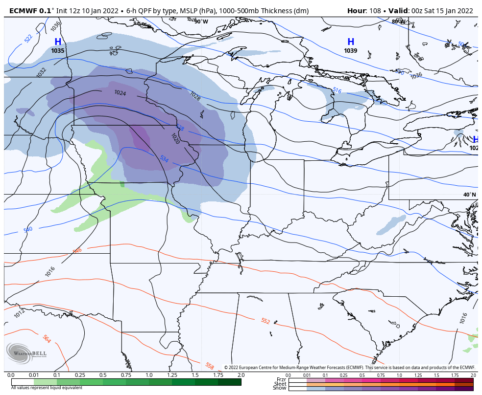
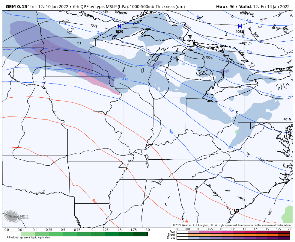
From there, the stage is set for, at least, two clipper looking systems to drop in this weekend and early next week. The individual models continue to handle each of these a little differently, but they all give us the potential to put snow on the ground.
Here’s how the GFS sees both systems…
The EURO…
The Canadian…
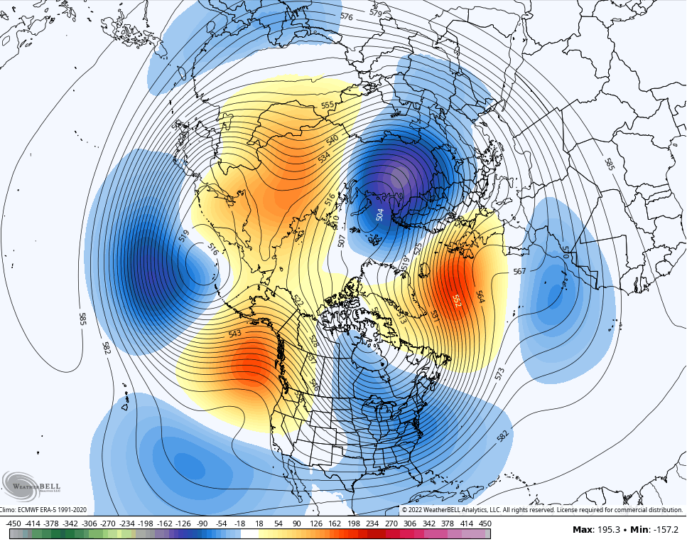
As you know, I’m on board with a prolonged colder than normal pattern settling in and I think we are just at the beginning of it. The operational models are now jumping on board. Here’s the GFS 10 day average 500mb height anomalies from January 15-25…
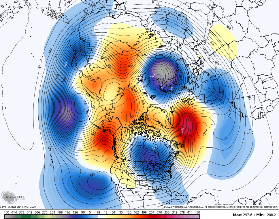
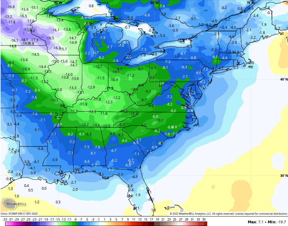
Ridging that connects from Greenland across the North Pole and into the Gulf of Alaska? That can throw some monster arctic shots into the country. The same 10 day temperature deviations from normal…
The Ensembles are also on board for a mega trough during the same 10 day stretch…
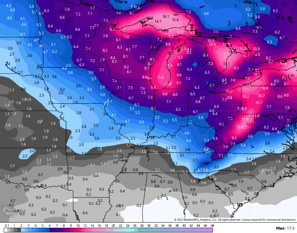
The two week snow signal from the ensembles is pretty darn high…
GFS
CANADIAN
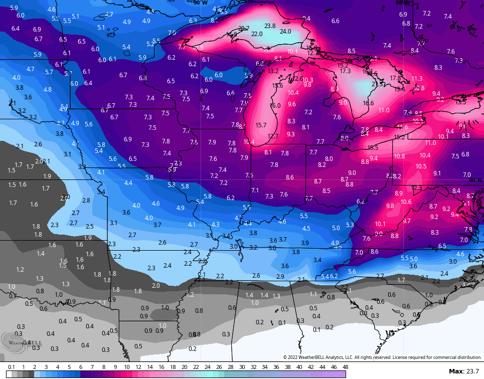
Again, those are averages of 20+ different model runs and aren’t to be taken verbatim. But, those “averages” show the increasing potential for multiple snow systems.
The EURO Ensembles are even more impressive since they’re the average of more than 50 different members…

Enjoy the rest of your day and take care.

Before the maintenance was done – regardless if you had fast internet, the maps/models in motion would load slowly…Then we had those couple of days where the site hit such heavy traffic nothing would load…….now that that’s all over, everything seems to load faster
Thanks Chris, Interesting as all the models are in good agreement for another cold and Snowy weather event.