Good Tuesday, everybody. It’s another calm and cold day out there, but changes are lurking later in the week. That’s when a weak system drops in from the northwest opening the door for much stronger systems starting this weekend and continuing into next week. These may very well put down some snow in our region.
Let’s kick things off with the precious present. Temps out there today are in the teens to start with afternoon highs ranging from the upper 20s to upper 30s across the state. Gusty winds will make it feel colder, but the sun will try to offset that.
Temps rebound to a little above normal on Wednesday as winds switch around to the southwest.
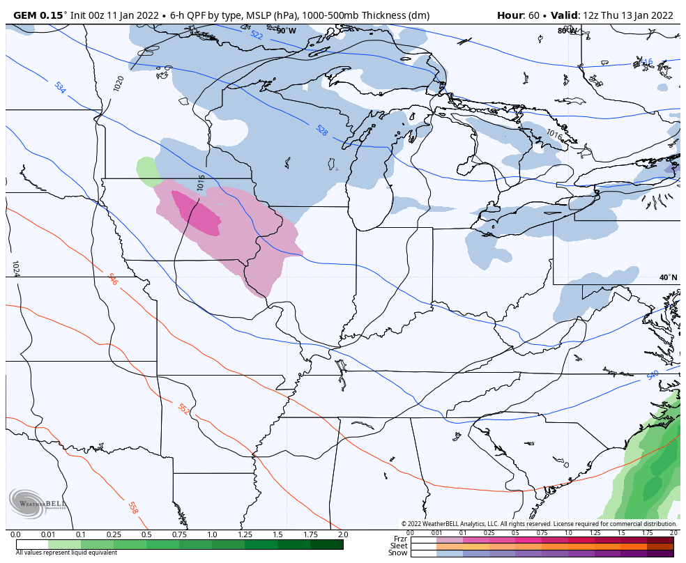
That’s ahead of a weak system dropping into the Ohio Valley on Thursday. That looks pretty weak but it may bring a period of light snow and light rain with it. The NAM is starting to get a little excited with this…

The Canadian is also trying to cook something up…
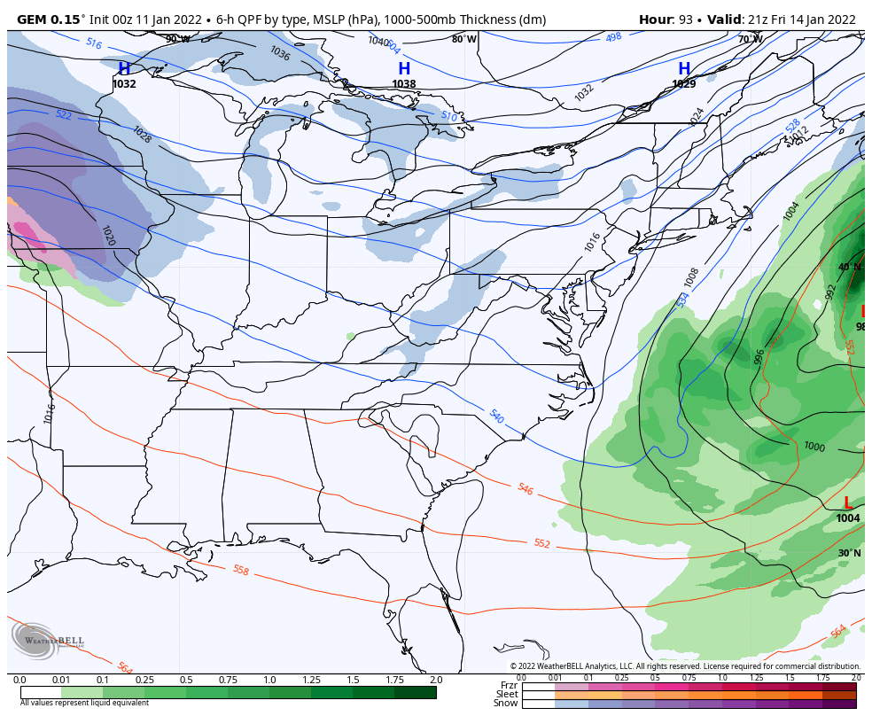
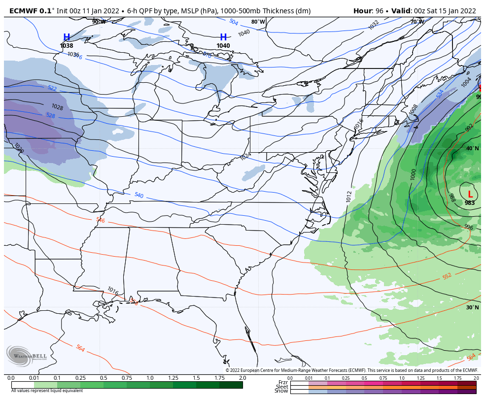
Our next item up for bids is a much stronger system dropping in Friday night and Saturday. This is a potent clipper that will drop into the Mississippi Valley before turning eastward across the Tennessee Valley. There are two important questions that will need to be answered over the next few days.
- What exactly is the track of this low?
- How strong is this system?
Those are essentially the two main questions with any system, but I wanted to spruce it up a bit. 😁
Wherever this low goes, it’s likely to have a decent swath of accumulating snow along and north of the track. Many of the overnight runs are developing this system into a much bigger deal by swinging it to our south then along or just off the east coast.
Let’s take a look at what a few of the models are suggesting with this.
The GFS…

The Canadian…
The EURO…
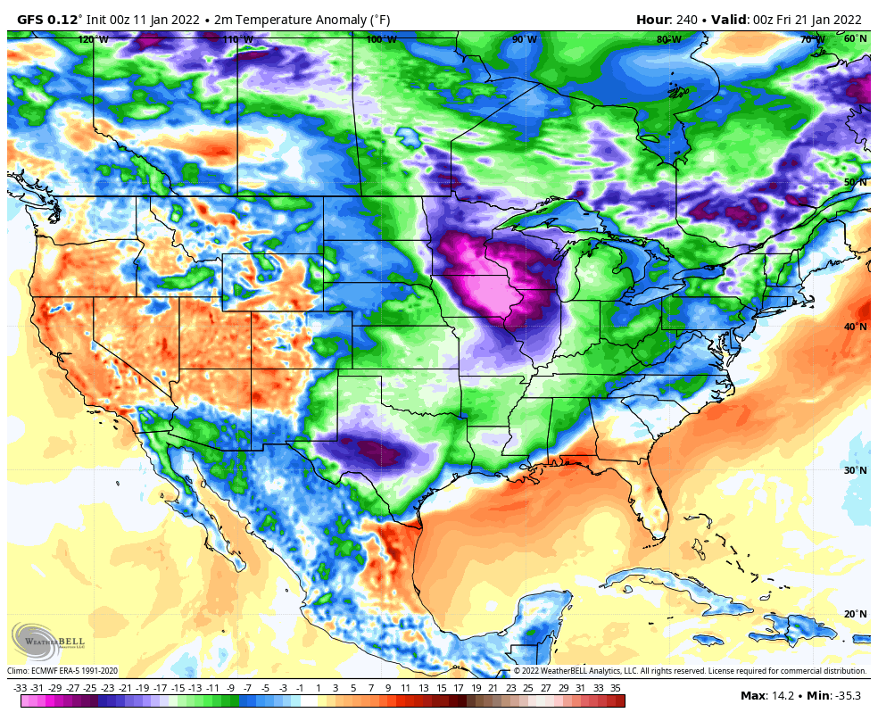
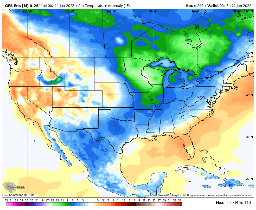
The signals for some brutal cold continue to show up during the second half of the month. I’ve shown the indices I look at and some serious cold would match the 1984/85 analog this winter is closely mirroing.
The latest GFS temp anomalies from January 20-26 are eye opening…
The GFS Ensembles have the same look at the same time…
So do the Candian Ensembles…

That’s about as cold as you can get models in that time range. Brr!🥶
I will have updates later today. Have a great day and take care.

Thanks Chris, looks like there may be some Snow excitement this weekend ?
Yes it does Schroeder
Looks like the GFS is bringing back “The Carolina Crusher” for the weekend..
GFS really adjusted NW this run..Still hits western NC good but oh my Ky gets a whole lotta love..Still showing Thursday I see server problems again..Icon coming aboard also..
Euro is now on board..Doesn’t hit ky but still a big shift west..Quite a big system developing