Good afternoon, everyone. We continue to be focused on a forecast that includes an interesting system for the weekend and one that threatens to send the overall pattern deep into the winter tank. Buckle up time is almost here.
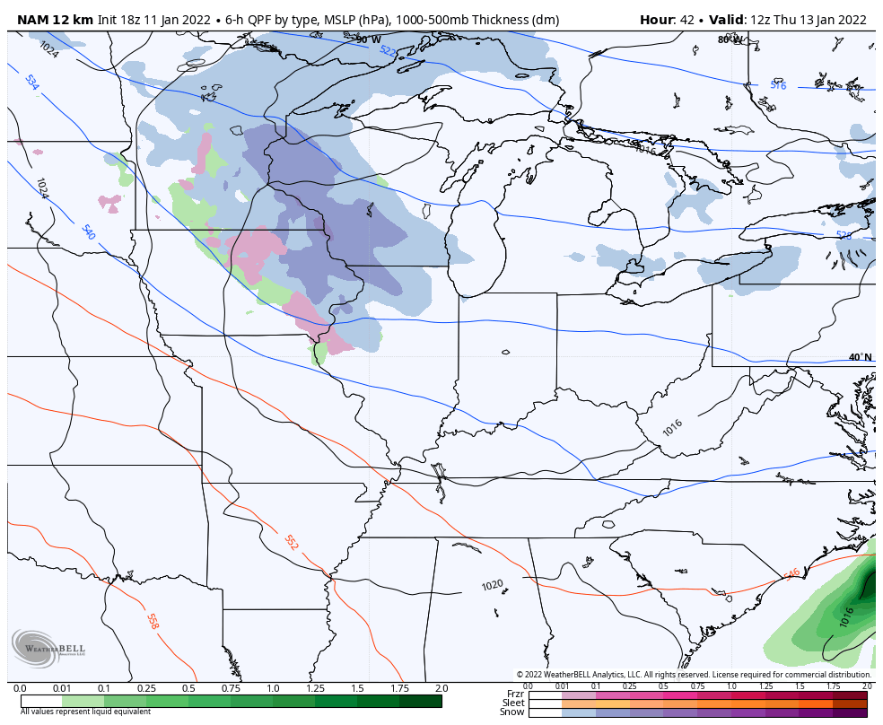
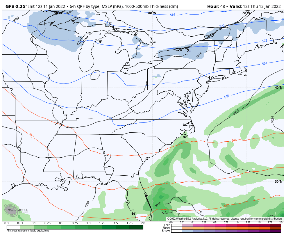
Before we get to the weekend system, there’s a weaker one dropping in from the northwest on Thursday. This will bring a period of light rain and light snow to parts of central and eastern Kentucky through Friday morning.
Here’s how the NAM sees this…
And the GFS…
How strong or weak this system is may end up being the determining factor on the track of the weekend system. Energy will be diving into the Mississippi Valley Friday and Friday night and will be strengthening as it does so. This low will then turn eastward and likely turn into a significant winter storm. Where does this turn happen? That turn will decide on how much snow we get here across Kentucky. If the low rounds the bend too far south, it would keep much of the snow to our south and east.
The models will go back and forth on where this turn happens, so let’s not get too caught up on any one run. This is a setup that may throw big changes all the way up until the day before. This is essentially the two potential tracks…
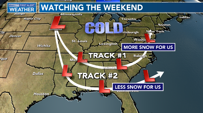
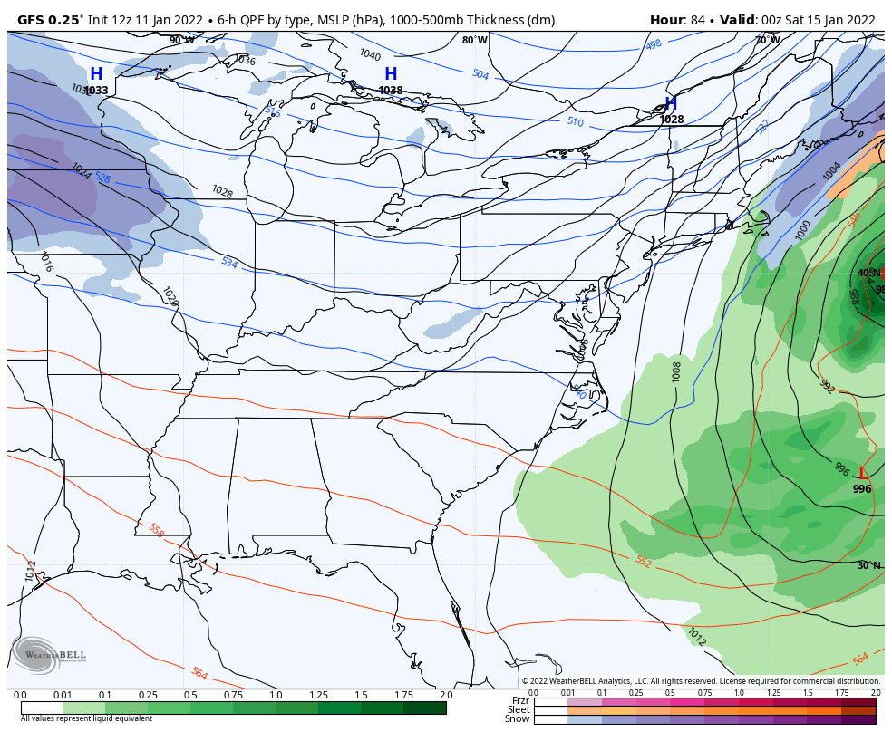
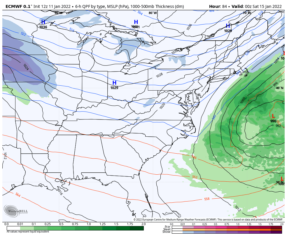
The GFS has a nice storm for us and is closer to track #1…
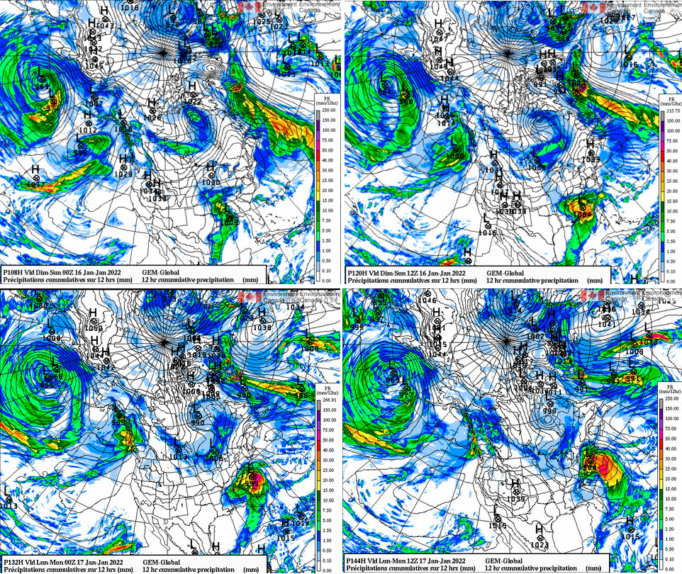
The Canadian didn’t run on some of the normal sites, so I had to use a different site that doesn’t show precipitation type. But, you can see how the Canadian isn’t too far off from Track #1…
That’s a heck of a storm on both models.
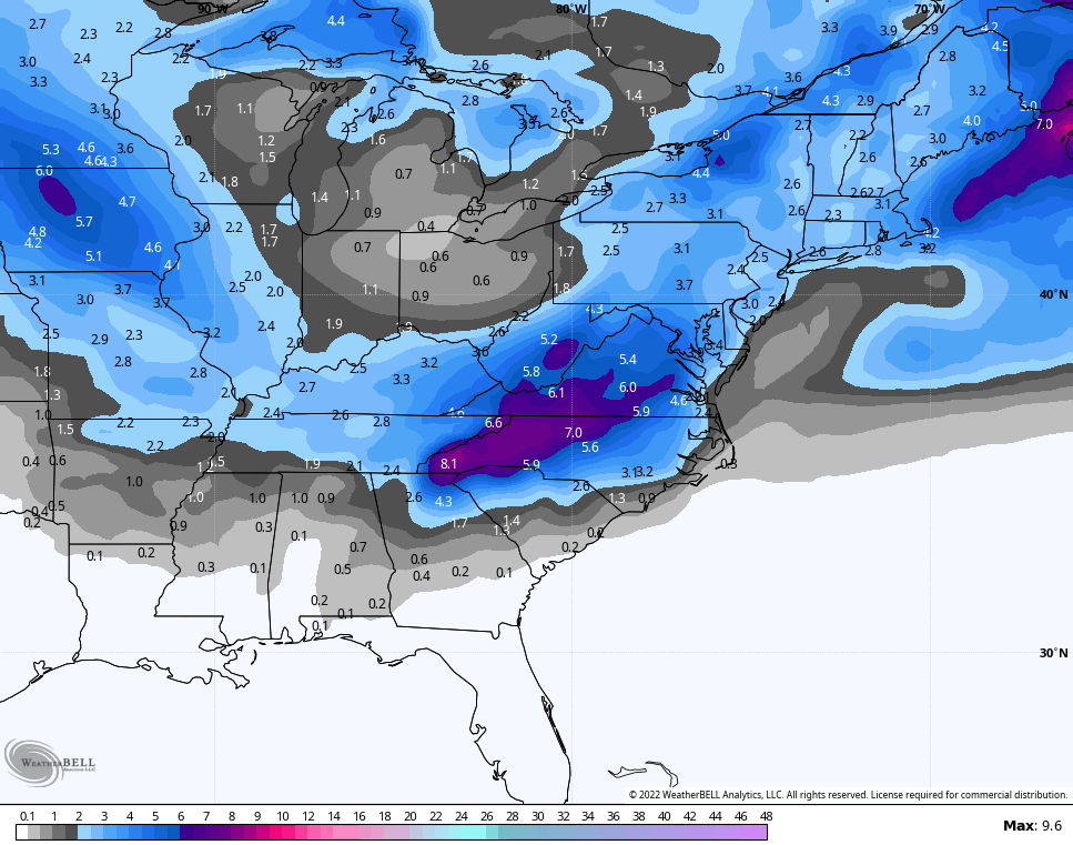
The EURO is all in on Track #2…
If we take a look at the GFS Ensembles, we notice they have the average snowfall follows the Track #1 scenario…
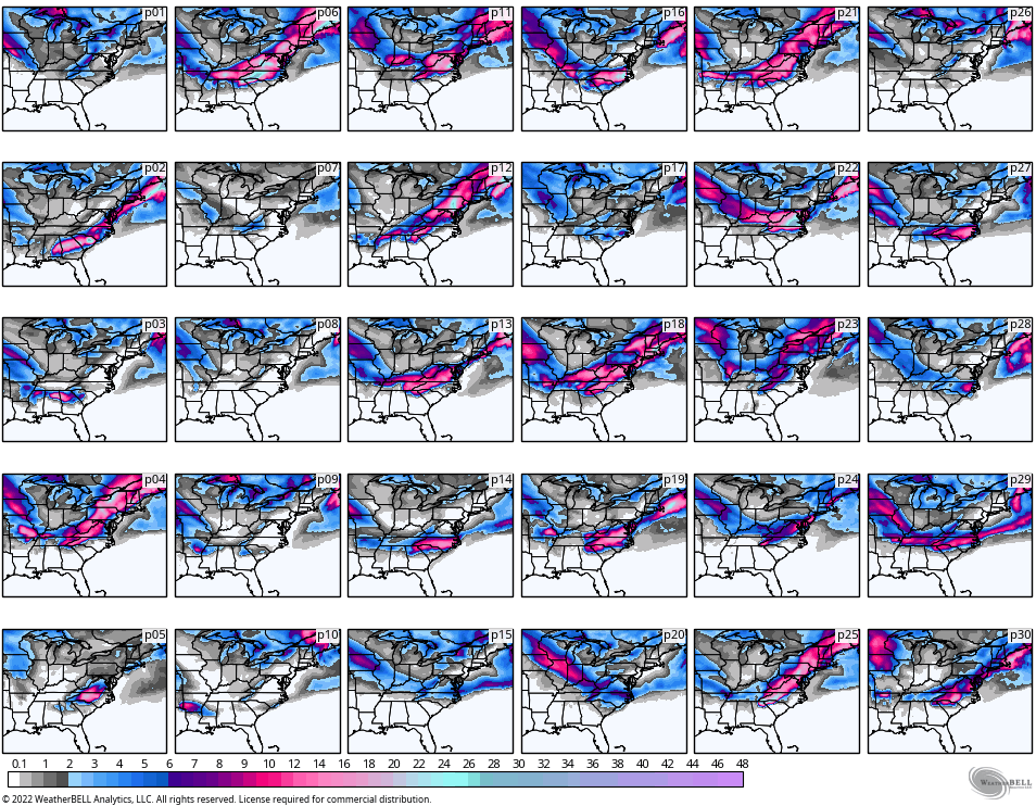
Here are the individual members that go into the above average…
The Canadian Ensembles are also closer to Track #1…

So there ya have it, it’s all about the track of the low and I do expect some wild model swings over the next few days.
I will likely have another quick update later this evening. Have a good one and take care.
