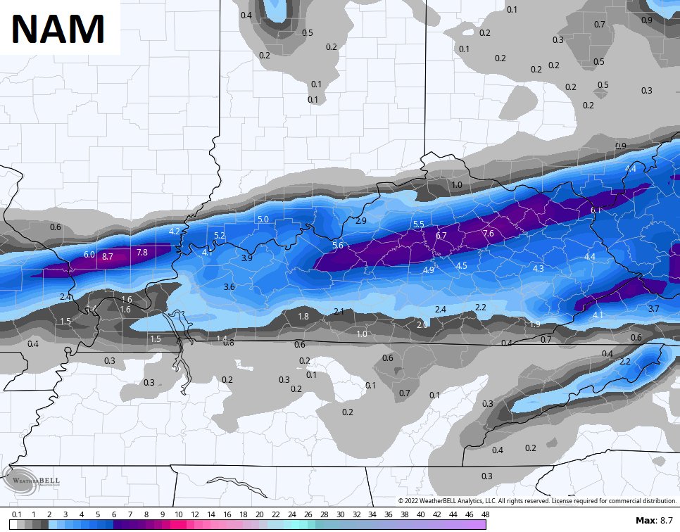
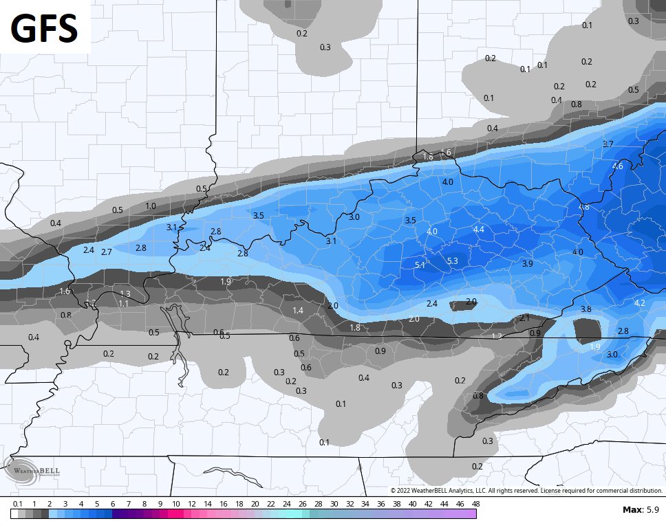
Good evening folks. I’m watching the potential for another snowmaker to impact much of the region as we get into later Wednesday and Thursday. This will be along and just being an arctic cold front surging through here.
In the short term, we are still dealing with some light snow and flurries, but also a touch of freezing drizzle. With temps dropping deep into the low and mid teens, watch for refreezing of roads tonight.
Here are your radars for the evening…
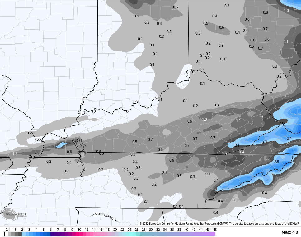
The European Model isn’t as excited…
It’s still too early to talk about specific snows, but I do expect to have a First Call For Snowfall later tonight.
Behind all that comes bitterly cold air with the potential for single digit lows and wind chills going below zero.
I’m also watching the weekend and the potential for a deeper system to eventually show up on the models.
Enjoy the rest of the evening and take care.


Respectfully, I think it time we boycott any weather model that doesn’t bring more snow to Northern Kentucky. I’m getting tired of clearing my drive with a whiskbroom! 🙂
I couldn’t even use a broom to sweep Snow off my Driveway. I’m too old and besides my gravel driveway is about a half of a mile long. LOL
Thanks Chris, I studied lots of weather models and some match up and others don’t, so a lot of uncertainty is out there on the Snowfall for Wednesday night and early Thursday. The weekend looks interesting for a possible Nor’ Easter again ?
The big news will be the frigid Arctic air that will invade the greater Ohio Valley and Dixie through the weekend. Maybe a Snowstorm will follow that, as there are many clipper systems on the move from the Northwest.
As usual, the models place the action north and east of Warren County, and with La Nińa firmly in control, that’s not about to change. La Nińa also has a tendency to influence the timing, geography and intensity of the severe weather season, which leads me to believe that Spring in our neck of the woods could get interesting as early as mid-March.
So, Go #TeamSpring!
Joe, What I currently read, and what I understand NOAA is making a “make shift forecast” that La Nina Winters will become more often or maybe permanent. Is this our CLIMATE CHANGE ???