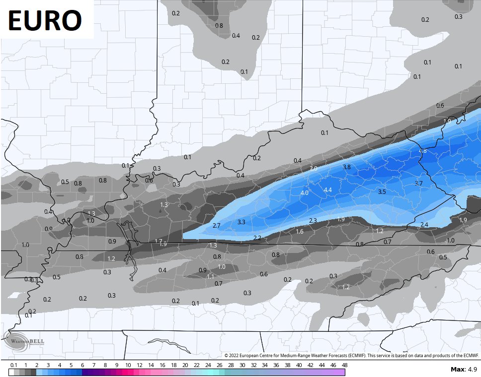
Good afternoon, folks. Our developing storm is bringing an increase in rain with the potential for a few to several inches of snow taking shape this evening through early Thursday as arctic air surges in here.
I wanted to drop by for a very quick update on some of the latest forecast models.
We have some decent agreement among many of them, but the NAM went astray.
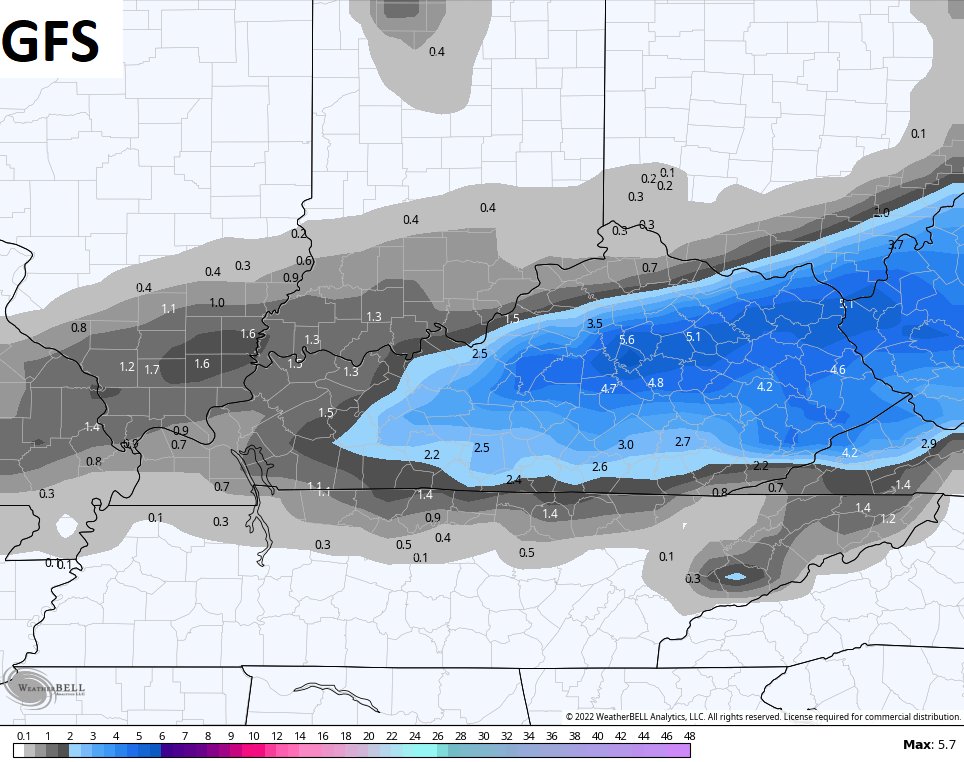
The latest GFS has a pretty good snow hit for much of the area…
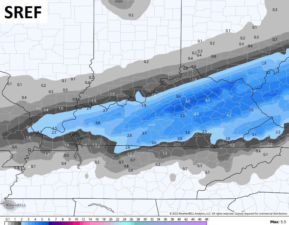
That matches the SREF…
And is similar to the Short Range Canadian…
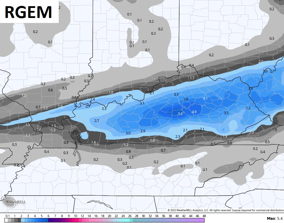
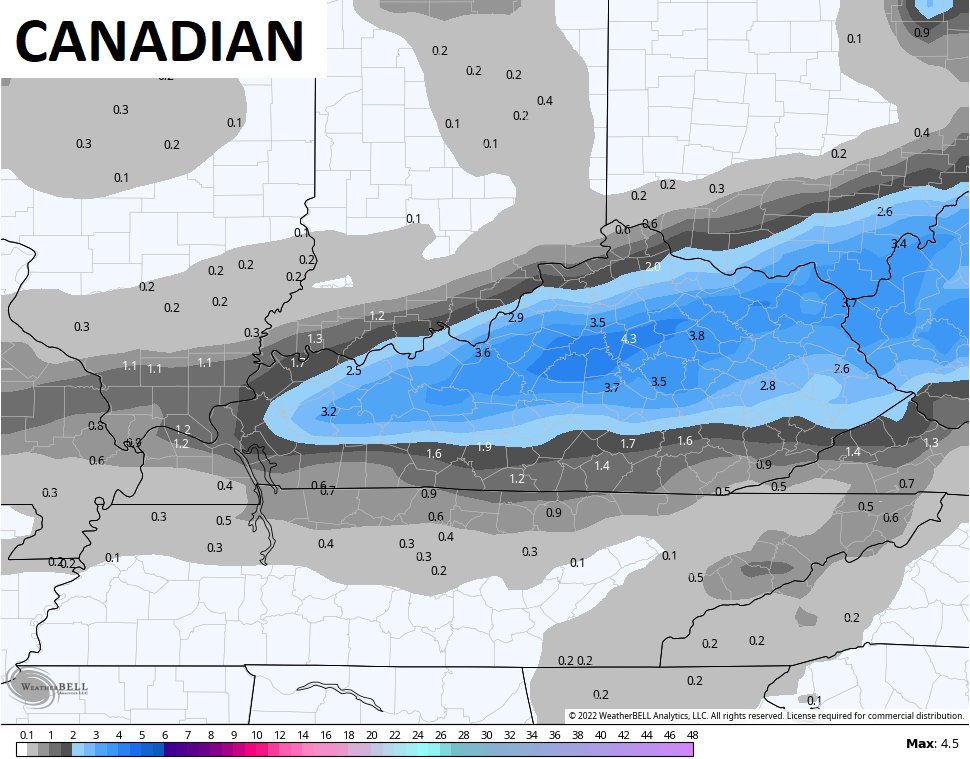
The Canadian is similar…
The Euro has a sharper cutoff, but the trend of the model has been farther north with each run…
Then there’s the NAM that went south…
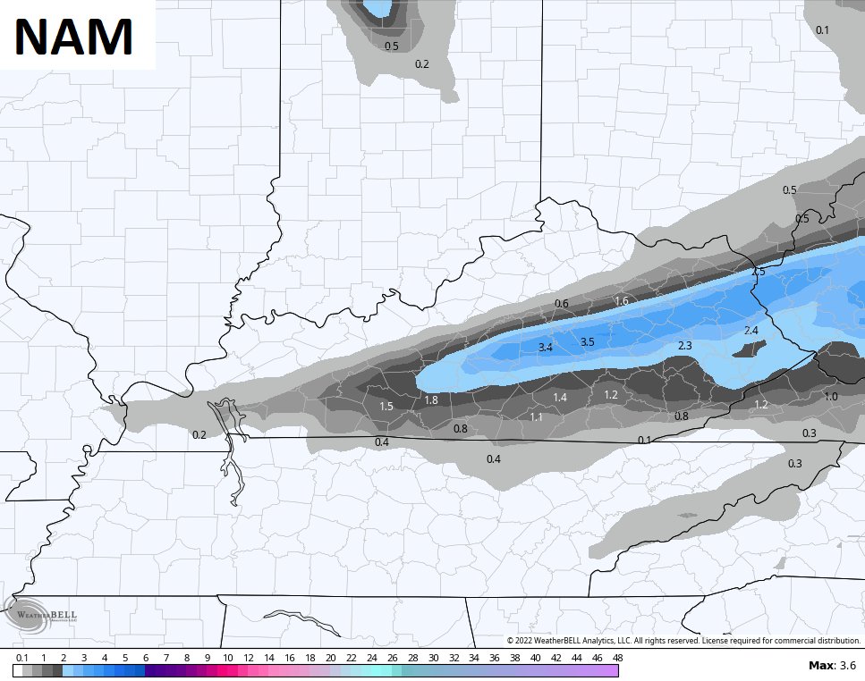
As of now, the NAM has no friends.
I will update things in a bit and will have a New Call For Snowfall. Until then, let’s track some rain…

Make it a good one and take care.

I DONT WANT NOMORE SNOW, DO AWAY WITH IT AND OR ARTIC COLD.
If it knocks out the power I would’t want anymore Snow either Rolo.
It looks like we’re facing a back-loaded Winter that will be colder and longer than in previous years, which is a big exception to the rule for a “normal” La Nińa Winter. I’ve observed that prior years having this type of Winter are frequently followed by a Spring severe weather season that is both earlier by several weeks, and more active than normal. I’m hoping that 2022 will not follow this pattern, especially considering the December/January that we’ve experienced around here.
It’s repeating the same La Nina as last year basically and I would expect February to have more Winter cold outbreaks following Clipper systems. If we should phase into ENSO- neutral that may help us out as far as severe weather goes ?
Years back when I lived in the foothills of Pennsylvania’s Pocono Mountains, we used to say that regardless of Punxsutawney Phil’s prediction, February would always feel like the longest month of the year. I think that’s what we’re facing this year.
As far as an earlier than normal severe weather season, if we see activity in Louisiana, Mississippi and Alabama begin to ramp up in early to mid February, then mid to late March around here could get interesting.
After the second of February, temperatures become very important as to whether we have damage to horticultural crops.
I raised and breed Azaleas in Southwest Indiana for over thirty one years. I let Mother Nature select the ones that were the most resistant to late freezes as far as the Azalea plant is concerned. We would loose the blossoms quite often, but not the Azalea plant and that the ones that were chosen for propagation.
In the last six years we made an observation on Oak tree Species and noted that acorns were very sparse due to unusual late Spring freezes of the blossoms. I feel that this continuing occurrence every Spring could eliminate certain Species of our natural Oak tree Species population.
We need alternation between ENSO cycles like we had several years ago, because when that occurred we had Springs without damage to trees and shrubs.
I agree, we’ve gotten into a La Nińa rut. We planted a 2 year old pin oak sapling about 2 years ago, which seems to be thriving. There are four good sized azalea bushes in front of the house where we’ve lived for over 25 years. Last Spring was the first time that our blooms experienced significant frost damage in all that time, despite the fact that we covered them as best that we could. Unfortunately, a sheet or blanket is useless when the temperature hits 14° for 2 days straight