Good afternoon, folks. We continue to watch a spiraling band of intense snow showers and snow squalls dropping across the state from northwest to southeast. This will cause all kinds of problems through the early this evening, especially in central Kentucky.
My area of greatest concern hasn’t changed…
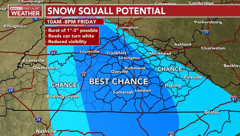
Areas outside of this are also seeing issues, but the worst of the weather is in the Best Chance area.
I have the latest on WKYT-TV starting at 4pm and going through the evening. I may even drop by for another KWC update. In the meantime, I have all the snow tracking tools you need for the rest of the day…

LEXINGTON


LOUISVILLE


COVINGTON AREA


LONDON

CORBIN

SOMERSET

MT. VERNON

PIKEVILLE

Mt. Parkway near Slade

MOREHEAD

JENKINS

PINE MOUNTAIN

FRANKFORT


GEORGETOWN

MAYSVILLE

Make it a great day and take care.

I wouldn’t be surprised if we had over 6+ inches of snow here by morning – a heavy snow band has already dropped 4 or inches. Looks like my hunch about Southeastern Kentucky getting a thumping was correct.