Good evening, folks. We have a major winter storm set to blast the bluegrass state later this week. This will bring a significant threat for flooding and the potential for an ice storm for parts of the state. This setup is ugly, folks.
A Winter Storm Watch has already been issued for areas of central and western Kentucky…
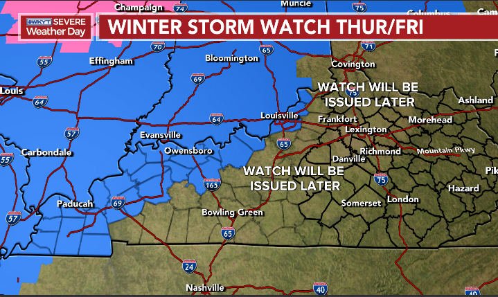
This will be expanded east and I’m highlighting those areas because I don’t want anyone to get a false sense of security. This is not the time for personal biases to come into play for watches to be issued.
Here’s my area of most concern for enough ice to cause issues…

That’s a work in progress and I will zero in on the potential later tonight and Tuesday.
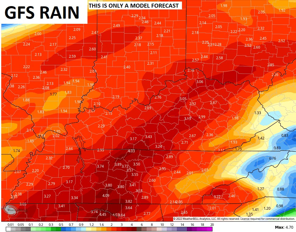
Do NOT sleep on the flooding threat. A general 1″-4″ of rain will show up and this will bring high water issues to the region. We are very likely to have some areas under a Winter Storm Watch and a Flood Watch at the same time.
The latest models trends show the GFS now coming much farther east with the winter weather…

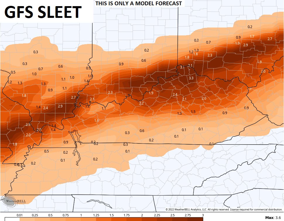

This is what the Canadian has been suggesting for a while now and continues to be in the ballpark…


The EURO has really had some wild swings of late and has done so all winter. Here’s the current run…


I will have updates on WKYT News tonight at 10 on the CW Lexington and 11 on WKYT. Have a good one and take care.

Local forecasts for South Central Kentucky are calling for ¼” to ½” of ice on Thursday evening. It looks like southern Illinois & Indiana will be facing a much worse scenario on the ice/sleet/snow front. In Warren County, the forecasted heavy rainfall coming down on ground that is largely frozen will present a big problem, since water that will not be absorbed will runoff into local waterways and basements.
2022 just won’t let up!
Weird. The only way I could actually get to this post was to turn on my VPN…I saw the Twitter post and yet this post wasn’t showing.
Thanks Chris for your hard work preparing this evenings presentation. The models seem to have good agreement on what to expect when the Storm finally exits sometime on Friday.
I don’t know how one prepares for the kind of weather that we are going to receive from mid week through Saturday.
In the rural areas where I live, the power will likely be out for days if not months. Looks like widespread power outages are more or less likely elsewhere across the State.
If I’m able I will give my damage report on KWC when it’s over. Stay safe everyone.
Chris I agree with you look’s ugly. I would say in the east most will be rain hope no flooding. Looks like ice sleet freezing rain can also be possible. Stay safe everyone.