Good afternoon, everyone. Our active pattern is about to really crank later tonight into Tuesday as we track three different systems. Each of those systems will have a different look, but the main threat continues to come from heavy rain and flooding.
The entire state is now under a Flood Watch through Tuesday…
That’s for a general 1″-3″ of rain, with locally higher amounts. This is from system number 1 rolling through. Storm number 2 arrives Wednesday night and takes us through Friday with heavy rain and some winter weather.
Several inches of rain are likely to fall through Friday and the GFS continues to spit out some ugly numbers…

That would cause flash flooding and general flooding, including on rivers. Please stay alert to this increasing possibility through the week.
There’s also threat low-end risk for severe storms through this evening across the western half of the state. Here’s the latest from the Storm Prediction Center…

That risk expands farther east into Tuesday…

Damaging winds are the main player and the GFS has some gusts of greater than 50mph showing up…

There’s also a small chance for a tornado to spin up.
After a colder break on Wednesday, the next system moves in Wednesday night through Friday. This brings another flood threat and the potential for some winter weather in the north and west…

The GFS shows the different types of precipitation from this…

Again, this is much more of a flood threat in my eyes.
The next system arrives Saturday night and Sunday and tries to take on a straight snow maker look…

I will have the latest on WKYT-TV starting at 4pm. As usual, I have you all set to track the severe weather potential in the west. Our exclusive interactive radar also features live storm chaser video streams, so be sure to check that out…

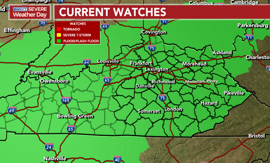
Current watches

Possible Watch Areas

Enjoy the rest of the day and take care.
