Good afternoon, folks. Mild winds are kicking back in across the state today and this leads us into a warm weekend. You better enjoy that warmth because cold changes are lurking next week and things may get pretty darn wintry for the middle of the month.
To bridge the gap between the warmth and the winter will come a stormy setup from Sunday into Monday. I’ll get to that in just a moment. First, let’s talk temps.
Highs today range from the 50s in the north to the 70s in the west and far south. Warm southwest winds kick in and this leads us into a Saturday with highs deep into the 70s. Skies look mainly dry, so let’s get out there and enjoy this one.
Rounds of showers and storms then kick in Sunday as a front moves in here and slows down. That lifts back to the north as low pressure works just to our west on Monday. This brings more widespread showers and storms in here with the potential for a lot of rain.
The GFS is showing the potential for a lot of rain to fall during this time…
Some high water issues will be possible and there’s the chance for a few strong storms during this time.
Cold weather surges in behind this system Monday night and Tuesday with the chance for a few flakes to fly.
Temps are much more typical of March for the middle of next week, but there’s a major dip in the jet stream coming later next week into the following weekend.
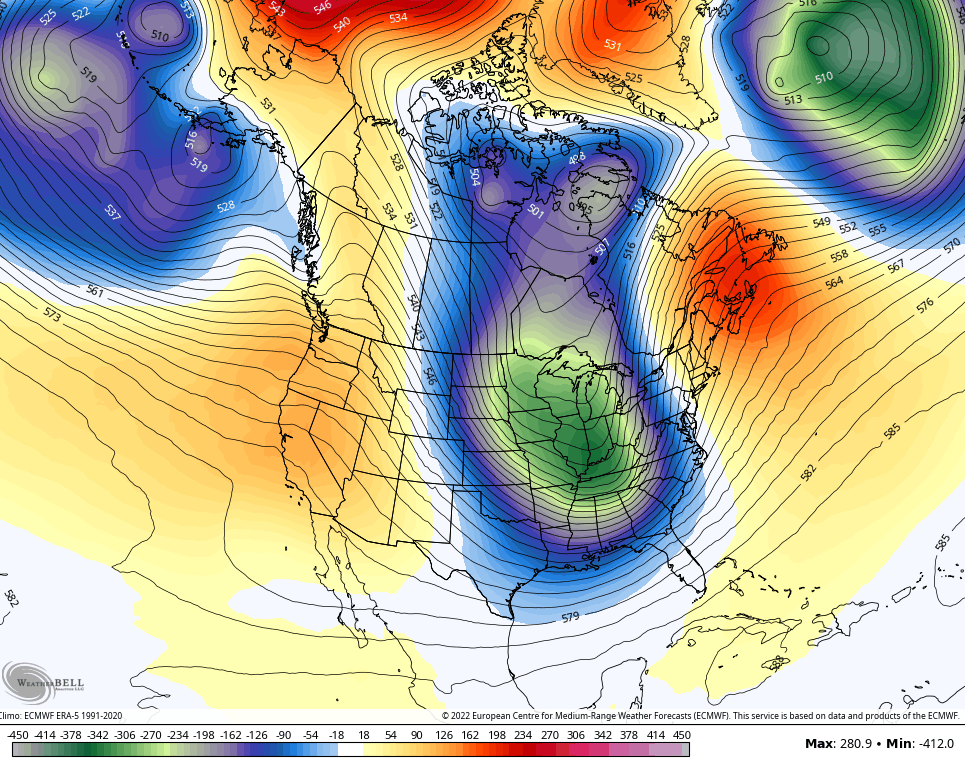
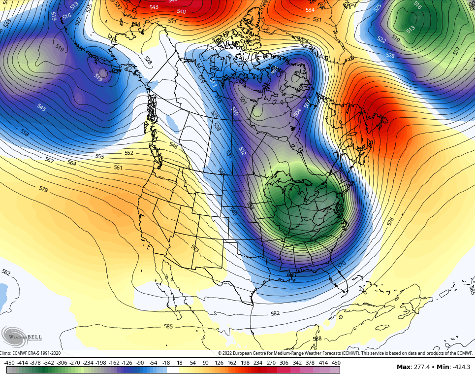
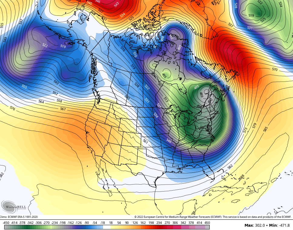
Check out the progression of this trough on the EURO…
That negative tilt suggests the opportunity for a significant storm system. Watch how this thing deepens…
That’s one deep trough and those, especially in March, can lead to major storm systems.
That trough is also accompanied by, for March, bitterly cold numbers that go well below normal. Here’s the EURO temp departures…
The GFS at the same time…
The GFS Ensembles…
Folks, nothing good for #TeamSpring can come from a pattern like that.
I will throw you another update later today. Make it a good one and take care.


TGIF, Thanks Chris, Maybe one of those Big Time March Snowstorms with that Negative tilt ?
Yep spring can be cold here. I’m thinking back to when I went to Keeneland in 1998….that’s the year we had the Feb 98 dusting….Only that spring stayed cold. In fact, it stayed cold up until June of that year. I remember my landlord at the time doing an inspection in early June and he had a coat on. It did finally warm up…but not until about mid-June that year. The following year 1999 was very HOT and dry I think. But being at Keeneland was miserable. Picture overcast, low 40s, drizzle and windy.. I was never so glad to leave but the place was packed