Good Thursday, folks. June is wrapping up with more typical summer weather out there today, but storm chances are set to increase as we flip the calendar to July. Rounds of storms appear likely over the big 4th of July weekend and that trend should carry us into much of next week.
We need the rain, so the storm chances are certainly good news there. However, it is a holiday weekend so we would like to get the fireworks and parades in without any issues. Oh, the quandary!!
We start things off with this last day of June. Temps range from the upper 80s to low 90s as humidity levels pick back up. This will lead to a few showers and storms going up later this afternoon and evening. The best chance will be across the southern half of the state. Your friendly radars are reporting for duty…

The threat for scattered showers and storms will increase Friday and continue through the holiday weekend. Here’s the EURO view from Friday through the 4th…

Notice how we keep the threat for some waves of storms going through the rest of next week…

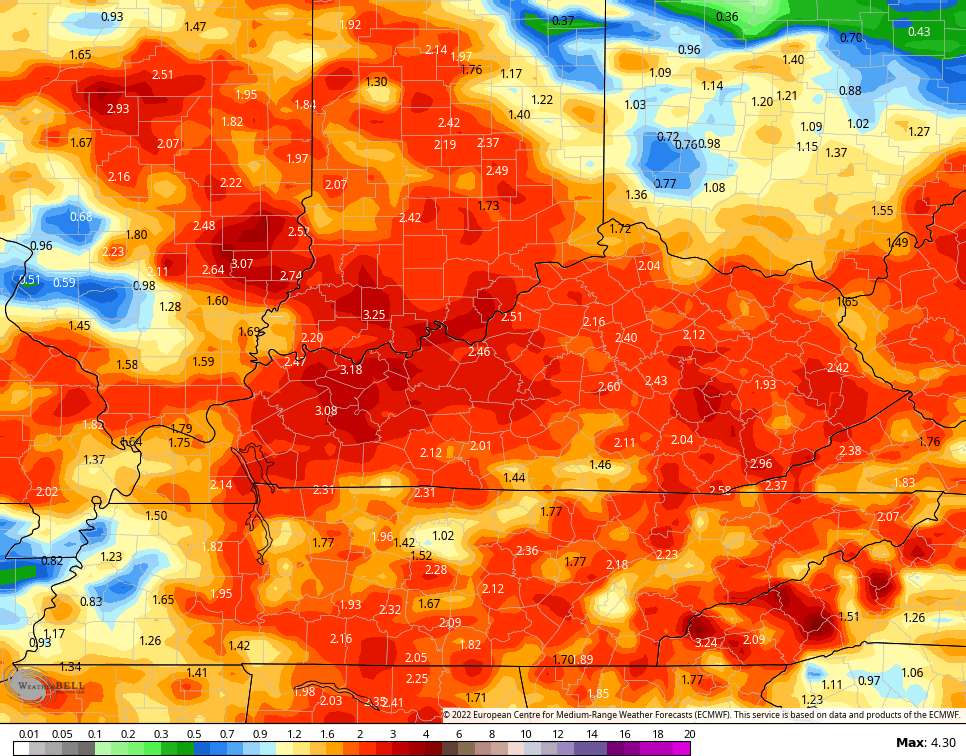
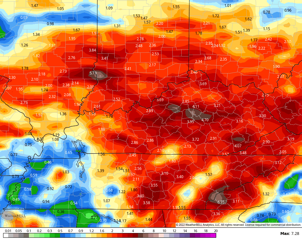
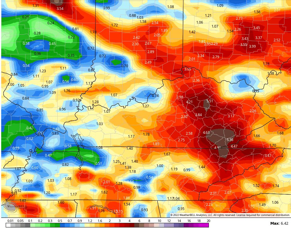
Check out the rainfall numbers from now through next week…
EURO
GFS
CANADIAN
We will take the rain, because we need it. I’m going to throw this out as something to watch for… We are entering flash flood season here in Kentucky and this pattern certainly looks the part next week.
The tropics keep on keepin’ on with several systems of interest…

The one off the Texas coast has the chance to develop right before coming ashore…

Have a terrific Thursday and take care.

My personal weather station in central Warren County recorded a record-tying low temperature of 53° this morning. Under cloudless skies it quickly rose to high of 92°, a nearly 40° climb. No good news on the lack of rain, quite the opposite. The last rainfall we had occurred on June 6th and for 26 days straight we have had nothing. Last weekend a potent system rolled out of Eastern Missouri and looked very promising, but as it neares the western edge of Warren County, it seemed to evaporate. Hoping that a tropical system could throw some moisture our way seems like a long shot, but it’s all we have right now.
We hope so Joe, but that stubborn High Pressure Ridge is going to have to break down before that happens.
We have rain chances for the next 8 to 9 days ranging from 30 to 60%, you have to think that the odds are in your favorite that one of those days the rain will fall.
If the Bermuda High is keeping us from getting rain the past weeks…how are Florida, Georgia and the Carolinas getting storms?? Wouldn’t it block that? Where is it actually located?
That is actually a good question Mark. The Bermuda High moves east to west and vice versa. The extreme Southeast may not be affected due to it’s geographical location ?
Thanks Chris, This morning low was 58 degrees here in Maple. Yesterday was very Sunny with a low dew point and humidity. Any rain / showers is not too promising, about a 10 % chance in my local forecast.
A Burn Ban is in effect for my area so that means No Fireworks for the Fourth of July. In town they may have the Pubic Display though ?
Every Fourth of July since I’ve lived here in Maple I haven’t heard or seen any Fireworks. I know that’s due to the Vast Forest surrounding my home. Duh……