Good Friday and welcome to July. The month is starting off on a steamy and stormy note and this looks to hang around through the big holiday weekend that’s also kicking off. As a matter of fact, the first 10 days of the new month will likely feature more of the same.
That’s certainly good news because we need the rain.
Temps today are back into the upper 80s to middle 90s depending on where you are and where any storm goes up. Humidity levels will also climb so it’s gonna feel pretty darn sticky.
Showers and storms will be scattered about the region during this time and your radars are here to catch it all…

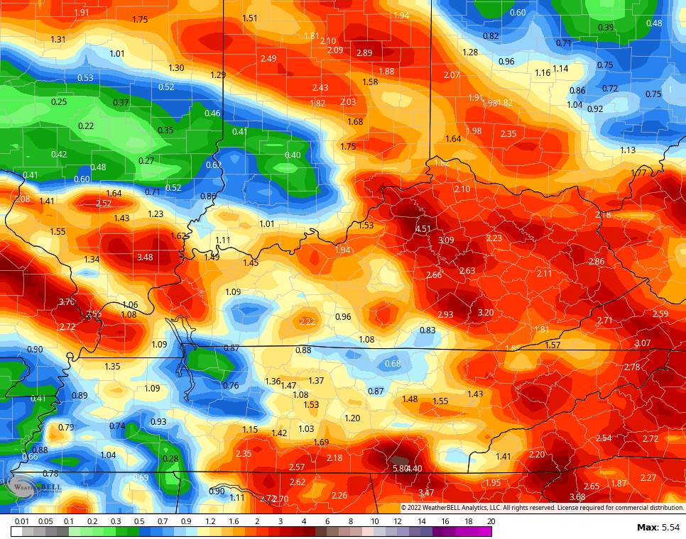
The threat for a few showers and storms will linger through the 4th of July holiday weekend, but this is not a washout by any means. Check out the EURO animation from today through the 4th…

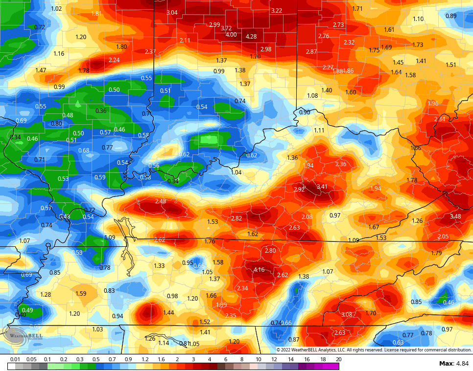
The threat for storms may actually ramp up a bit following the 4th. You can see this well on the the EURO for the rest of next week into early the following weekend…

Again, we are entering flash flood season and that’s something we will have to watch for as we roll forward.
The rainfall numbers from the EURO look like this…

The Canadian…
And the GFS…
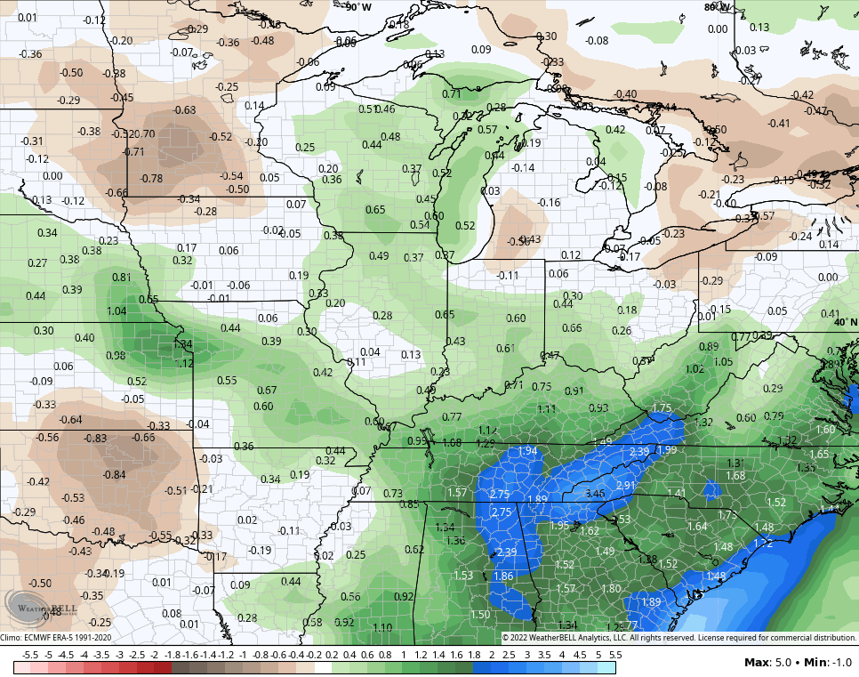
The GFS Ensembles show above normal rainfall numbers over the next two weeks…
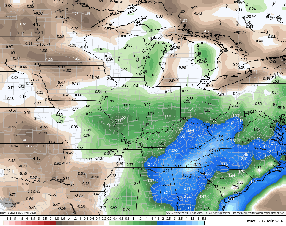
The extended GFS Ensembles from now through August 2nd are pretty enthusiastic about above normal rainfall numbers…
Woot!
Have a fantastic Friday and take care.

Thanks Chris, the chances for scattered showers and thunderstorms have increase in my local forecast, but not a lot of precipitation is expected. We will take what we can get though.
The system in the Gulf of Mexico doesn’t appear to be of any consequence at this time.
Hot and Steamy weather is to be expected due to the sinking air and dry soil. Autumn weather can’t come too soon for the Ohio Valley, but not after some substantial rains.
Very concerned about the Corn and Soybean crops and also the potential for Wildfires anywhere in the State and surrounding States. Be careful with those Fireworks, but have fun we need it.
We’ve had one little cell work across SE Lexington this morning and I’ve recorded .40 so far. My garden (and I) are happy.
LOL I saw that on radar…what an odd time for that to happen…..with no heating of the day or anything…Just some random small shower pops up at dawn.
Glad your area finally received that much needed Rain Dottie. I don’t garden anymore, but I am concerned about the Farmers in my area and the ones that are dealing with the Drought. Major Crops in my area are really stressed. We were well below normal on Rainfall for June. Not good going into July and August. Hopefully, this drought will end before we have major damage to Crops and Gardens ?
Adding to the above, the average temperature for June in Taylor County was at 74 degrees and only recorded 2.77 inches of rain.
June Summary from NWS out of Louisville, Kentucky : https://www.weather.gov/lmk/june22_summary