Good Sunday, folks. Our 4th of July weekend rolls on with a scattering of storms and steamy temps. As the old saying goes, you ain’t seen nothin’ yet! A significant heat wave is on the way for the week ahead and it’s likely to be accompanied by some big time storm clusters.
The weather out there today generally features temps from 85-90 in most areas with a mix of sun and clouds. A few showers and storms go up, especially in the south. Here are your holiday weekend radars to follow along…

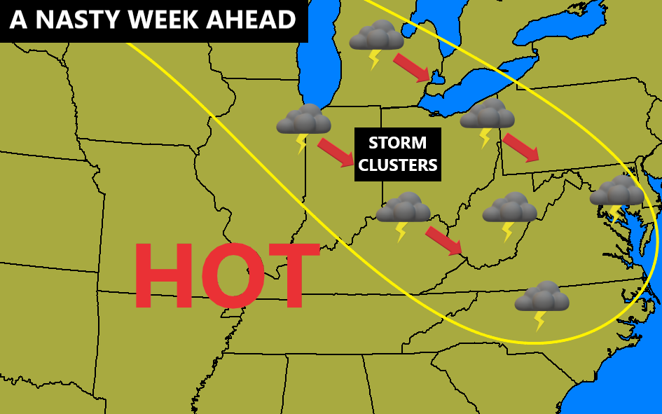
The 4th on Monday features a small chance for storms going up with temps ranging from the upper 80s to middle 90s across the state. It’s just after this that things turn ugly in terms of heat, humidity and storms. Here’s the setup for next week…
Let’s start with the temps that can reach 100 degrees on any day where storm clusters don’t show up. This is a look straight out of the same time in 2012 and that produced our last widespread 100-degree weather around here. Check out the highs from the GFS…

Here’s a closer look…
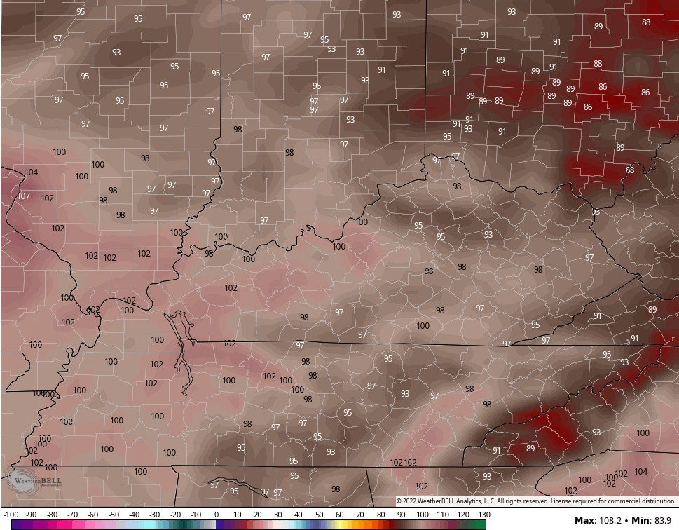
The GFS has been much closer to reality with temps than the wretched Euro has been, so we have to put some respect on what it’s showing here. With high humidity, heat index numbers around 105-110 will be possible.
Thunderstorm clusters and complexes tend to roll around the outer periphery of such heat waves. The one from 2012 produced a massive derecho. I’m not saying this will do the same, but such a setup can produce some big wind makers.
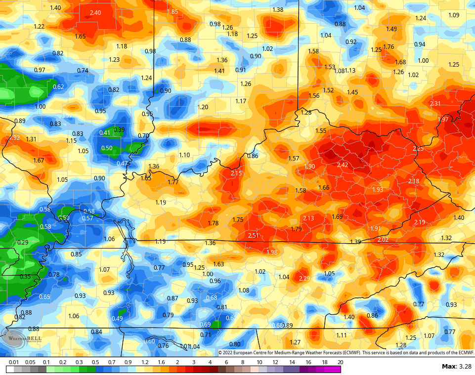
These storms can also put down some heavy rain amounts as we enter flash flood season in the bluegrass state. The models, as expected, vary on placement and totals…
GFS

CANADIAN

EURO
Have a wonderful 4th of July Eve and take care.

Oh My My! So much for cooler than normal temps. that was forecasted on the long range models. Maybe the tropics will begin to become active in a few weeks. Maybe that will be a game changer and change the weather pattern.
Thanks Chris, yesterday afternoon we got lucky and received 0.48 inches of much needed rain / showers. This will help, but we need more, a lot more.
We need a Tropical Storm in the Western Gulf of Mexico to come up the Mississippi River into the lower Ohio Valley with widespread rain. Instead we have post Tropical Storm Colin heading out into the Atlantic. Maybe later in the Hurricane Season but, hopefully, we won’t have any Major/ destructive events this season ?
More of the high pressure ridge with descending air, not looking forward to that hot and humid scenario.
we’ve been really lucky the past years not having too hot of summers….most years are above normal precip…it was only a matter of time before we dried out and got endless dry days with heat..Last night around 2 to 3 am it poured rain…for maybe 20 min’s…just what we needed….right now it’s mostly overcast…glorious clouds blocking that hot sun.
Here is the link for the June Climate Review for the Chicago area, which featured above normal temps at 72.2 degrees and below normal precipitation at 2.66 inches. https://weather.gov/lot/June2022
Here in Maple, Kentucky for June we had an average temperature of 74 degrees and only 2.77 inches of rain recorded on the Kentucky Mesonet. This morning we were under a pocket of some very warm rising air which resulted in a very short lived rain shower.
https://www.weather.gov/lmk/june22_summary